Montopolis in Austin in Travis County, Texas — The American South (West South Central)
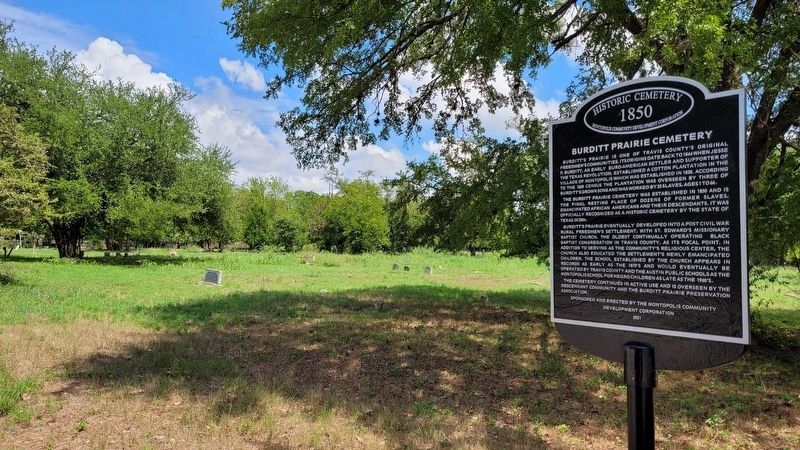
Burditt Prairie Cemetery
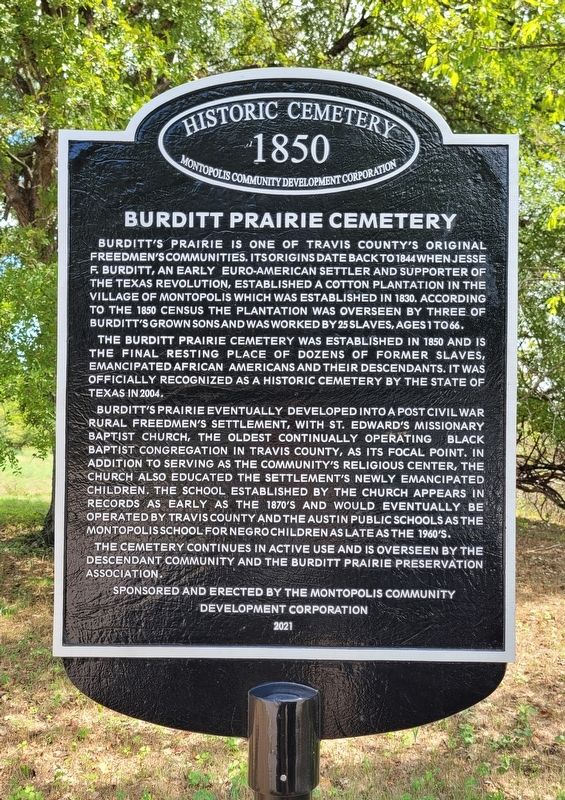
Historic Cemetery
— 1850 —
Burditt's Prairie is one of Travis County's original Freedmen's communities. Its origins date back to 1844 when Jesse F. Burditt, an early Euro-American settler and supporter of the Texas Revolution, established a cotton plantation in the village of Montopolis which was established in 1830. According to the 1850 census the plantation was overseen by three of Burditt's grown sons and was worked by 25 slaves, ages 1 to 66.
The Burditt Prairie Cemetery was established in 1850 and is the final resting place of dozens of former slaves, emancipated African Americans and their descendants. It was officially recognized as a historic cemetery by the State of Texas in 2004.
Burditt's Prairie eventually developed into a post Civil War rural Freedmen's settlement, with St. Edward's Missionary Baptist Church, the oldest continually operating black Baptist congregation in Travis County, as its focal point. In addition to serving as the community's religious center, the church also educated the settlement's newly emancipated children. The school established by the church appears in records as early as the 1870's and would eventually be operated by Travis County and the Austin Public Schools as the Montopolis School for Negro Children as late as the 1960's.
The cemetery continues in active use and is overseen by the descendant community and the Burditt Prairie Preservation Association.
Erected 2021 by Montopolis Community Development Corporation.
Topics. This historical marker is listed in these topic lists: African Americans • Cemeteries & Burial Sites • Education • Settlements & Settlers. A significant historical year for this entry is 1850.
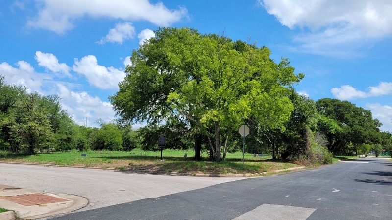
Location. 30° 14.012′ N, 97° 41.566′ W. Marker is in Austin, Texas, in Travis County. It is in Montopolis. Marker is at the intersection of Valdez Street and Felix Avenue, on the right when traveling north on Valdez Street. The marker is located at the corner of the intersection with the cemetery. Touch for map. Marker is at or near this postal address: 6700 Felix Avenue, Austin TX 78741, United States of America. Touch for directions.
Other nearby markers. At least 8 other markers are within 3 miles of this marker, measured as the crow flies. The Original Townsite of Montopolis (approx. 1.8 miles away); Richard Overton Healing Garden (approx. 1.9 miles away); Parque Zaragoza (approx. 2.2 miles away); Del Valle Army Air Base (approx. 2.3 miles away); Zavala Elementary School (approx. 2.4 miles away); Ward Memorial United Methodist Church (approx. 2˝ miles away); The Sing Family in Austin (approx. 2.6 miles away); L.C. Anderson High School and Integration of Austin’s Public Schools (approx. 2.7 miles away). Touch for a list and map of all markers in Austin.
Also see . . .
1. Montopolis, Austin, Texas. Wikipedia
The founder of the Republic of Texas era townsite of Montopolis was Jesse Cornelius Tannehill (1797-1863). A recent though often repeated misconception is that Tannehill's Montopolis was founded in 1830; Tannehill's time in Texas is well documented showing this is not so. Tannehill and family came to Texas in 1828 first settling near Caney in Matagorda County. As a member of Stephen F. Austin’s “Little Colony,” they soon moved to Bastrop. In 1836 during the Texas war for independence, when Mexican forces threatened settlements along the Colorado, the Tannehills and other families fled Bastrop in wagons eastward towards Nacogdoches along the Old San Antonio Road. This evacuation was referred to as the Runaway Scrape. Following the war, the Tannehills lived in Huntsville and later in La Grange.(Submitted on September 6, 2022, by James Hulse of Medina, Texas.)
2. Montopolis, Texas at The Handbook of Texas. Travis County has had two locations named Montopolis that differ in their formation and location, sometimes causing confusion when the two are conflated as has happened on this marker. The Burditt Prairie Cemetery marker is not an official State Historical Marker; it was not erected by the Texas Historical Commission. See Handbook of
Texas entry for Montopolis for clarification. (Submitted on December 16, 2022.)
3. Montopolis: The Old and New, Travis County Historical Commission. Travis County Historical Commission article explaining confusion between the current neighborhood of Montopolis (south bank of Colorado River) and the Republic of Texas townsite (north bank). (Submitted on December 16, 2022.)
4. Montopolis. State Historical Marker, Texas Historical Commission. (Submitted on December 16, 2022.)
5. Burditt Prairie Cemetery, Find a Grave. The application for Texas historic cemetery designation states the number of burials from circa 1850 was unknown and that an inventory of burials from that period had not been done in 2003 when the application was submitted. Of the 500 plus burials recorded in Find a Grave all date to the 20th and 21st century. (Submitted on December 24, 2022.)
Credits. This page was last revised on February 1, 2023. It was originally submitted on September 5, 2022, by James Hulse of Medina, Texas. This page has been viewed 518 times since then and 96 times this year. Last updated on December 27, 2022, by Richard Denney of Austin, Texas. Photos: 1, 2, 3. submitted on September 6, 2022, by James Hulse of Medina, Texas. • J. Makali Bruton was the editor who published this page.


