Shakopee in Scott County, Minnesota — The American Midwest (Upper Plains)
The Ox Cart Trail to Shakopee
Pathways of Shakopee History
| — | A self-guided tour on the development of the City of Shakopee | — |
Photographed by Cosmos Mariner, September 2, 2022
1. The Ox Cart Trail to Shakopee Marker
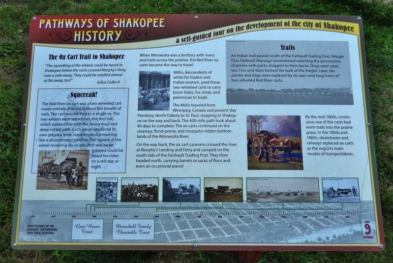
”The squeaking of the wheels could be heard in Shakopee before the carts crossed Murphy's Ferry over a mile away. They could be smelled almost as far away, too!"
—Julius Coller II
When Minnesota was a territory with rivers and trails across the prairies, the Red River ox carts became the way to travel.
Métis, descendants of white fur traders and Indian women, used these two-wheeled carts to carry bison hides, fur, meat, and pemmican to trade.
The Métis traveled from Winnipeg, Canada and present-day Pembina, North Dakota to St. Paul, stopping in Shakopee on the way and back. The 400-mile path took about 40 days to complete. The ox carts continued on the swampy, flood-prone, and mosquito-ridden bottomlands of the Minnesota River.
On the way back, the ox cart caravans crossed the river at Murphy's Landing and Ferry and camped on the south side of the Faribault Trading Post. They then headed north, carrying barrels or sacks of flour and even an occasional piano!
By the mid-1800s, continuous use of the carts had worn trails into the prairie grass. In the 1850s and 1860s, steamboats and railways replaced ox carts as the region's
this page online
Squeeeak!
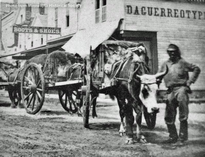
The Red River ox cart was a two-wheeled cart made entirely of wood without the benefit of nails. The cart was hitched to a single ox. The two wheels were sometimes five feet tall, which worked fine with the heavy mud and deep-rutted path. Each wheel produced its own peculiar tone, moaning and screaming like a discontented panther. The squeak of the wheel revolving on an axle that was never greased could be heard for miles on a still day or night.
Trails
An Indian trail passed south of the Faribault Trading Post. Pelagie Eliza Faribault Manaige remembered watching the processions of ponies with packs strapped to their backs. Dogs were used, too. Furs and skins formed the bulk of the freight. Later, the ponies and dogs were replaced by six oxen and long trains of two-wheeled Red River carts.
Erected by Pathways of Shakopee History. (Marker Number 9.)
Topics. This historical marker is listed in these topic lists: Industry & Commerce • Roads & Vehicles • Settlements & Settlers.
Location. 44° 48.05′ N, 93° 30.269′ W. Marker is in Shakopee,
Minnesota Historical Society
2. Marker detail: Ox Cart

Regionally, this marker is in the Minnesota River Valley and in the Twin Cities Metropolitan Area. It is also in the American Midwest and in the Corn Belt. Globally, it is in North America, the Western Hemisphere, the Western World, and the Anglosphere. Historically, it finds itself in what was once Rupert’s Land, the territory of the Mississippian Culture, and the Louisiana Purchase.
Other nearby markers. At least 8 other markers are within walking distance of this marker: Who Else Was Here (a few steps from this marker); The Railroad to Shakopee 1865 (a few steps from this marker); The Springs (within shouting distance of this marker); Pond Mission
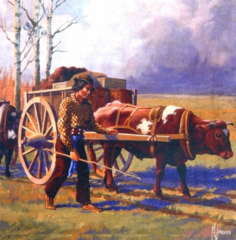
3. Marker detail: Ox Cart
Related markers. Click here for a list of markers that are related to this marker. Pathways of Shakopee History Trail
Also see . . . Red River Ox Cart Trail.
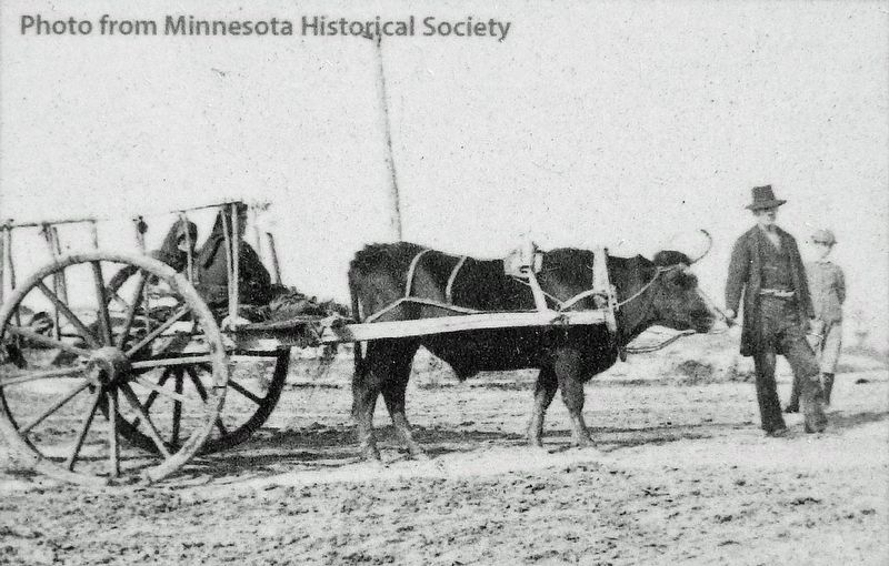
This segment was part of a large network of ox cart trails centered on what is now Pembina, North Dakota, near the where the borders of North Dakota, Minnesota and Canada come together. The trails extended north to what is now Winnipeg, west into the plains and 420 miles southeast of Pembina to the riverboat landings in St. Paul. It took an ox cart caravan averaging about 15 miles a day about four weeks to travel between Pembina and St. Paul. Métis carters brought buffalo hides and other furs, pemmican, tallow, moccasins and other handmade items to St. Paul. They returned with groceries, tobacco,(Submitted on December 31, 2022, by Cosmos Mariner of Cape Canaveral, Florida.)liquor and manufactured goods. Their carts were made entirely of wood and rawhide — without metal parts — so that worn or broken parts could be replaced on the trail. Usually each cart was pulled by one ox and could carry 800 to 1,000 pounds of cargo.Minnesota Historical Society4. Marker detail: Ox Cart, circa 1890
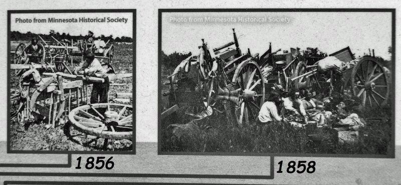
5. Marker detail: Timeline Photos
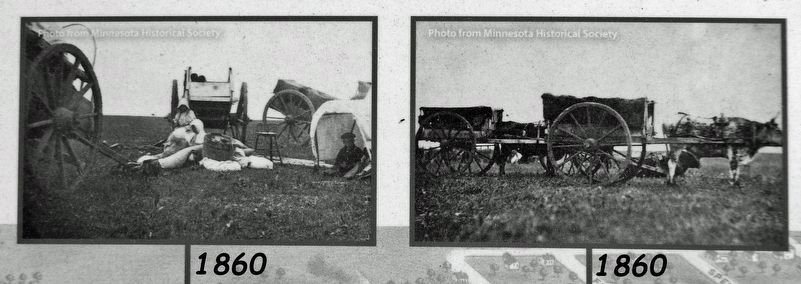
6. Marker detail: Timeline Photos
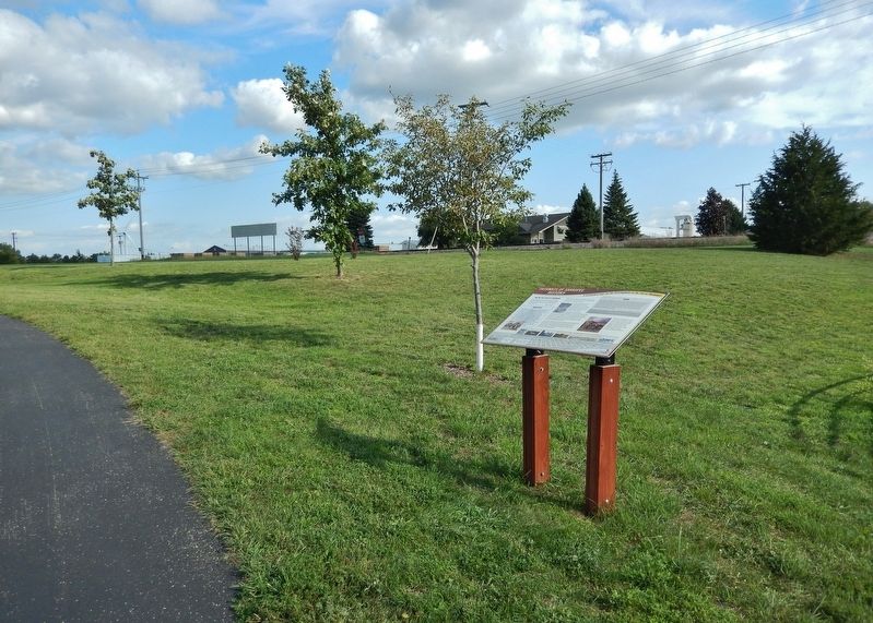
Photographed by Cosmos Mariner, September 2, 2022
7. The Ox Cart Trail to Shakopee Marker
Credits. This page was last revised on December 31, 2022. It was originally submitted on December 30, 2022, by Cosmos Mariner of Cape Canaveral, Florida. This page has been viewed 1,431 times since then and 498 times this year. Photos: 1. submitted on December 30, 2022, by Cosmos Mariner of Cape Canaveral, Florida. 2, 3, 4, 5, 6. submitted on December 31, 2022, by Cosmos Mariner of Cape Canaveral, Florida. 7. submitted on December 30, 2022, by Cosmos Mariner of Cape Canaveral, Florida.
