Greilickville in Leelanau County, Michigan — The American Midwest (Great Lakes)
For the Love of this Place: DeYoung Natural Area Farmstead
A project of the Leelanau Conservancy
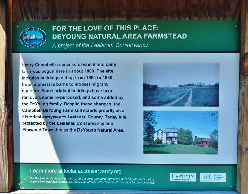
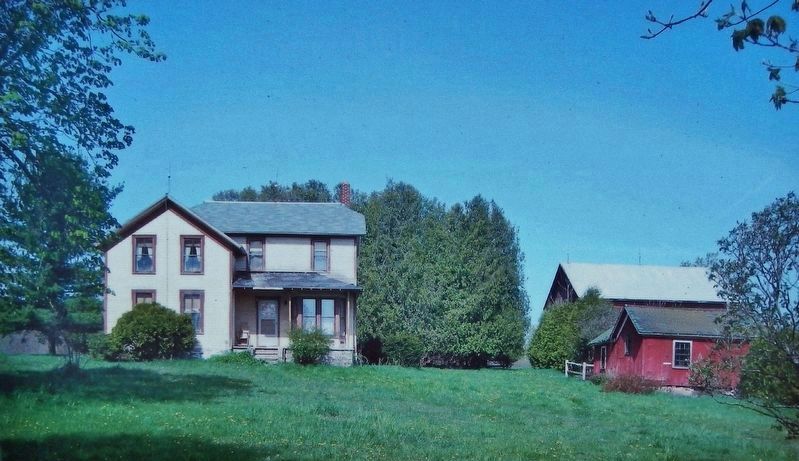
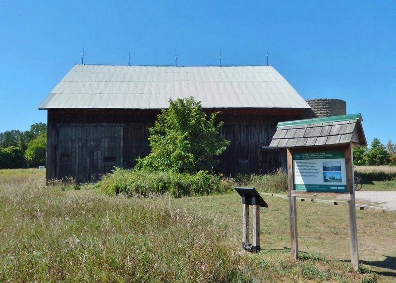
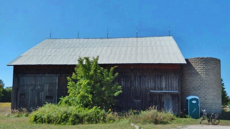
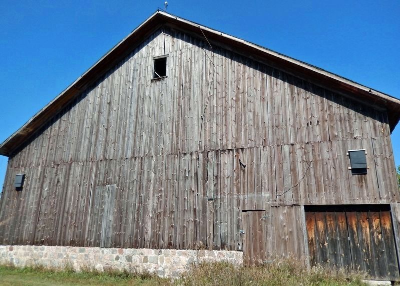
Henry Campbell's successful wheat and dairy farm was begun here in about 1860. The site includes buildings dating from 1860 to 1960 from impressive barns to modest migrant quarters. Some original buildings have been removed, some re-purposed, and some added by the DeYoung family. Despite these changes, the Campbell-DeYoung Farm still stands proudly as a historical entryway to Leelanau County. Today it is protected by the Leelanau Conservancy and Elmwood Township as the DeYoung Natural Area.
Erected by Leelanau Conservancy; Eastern Michigan University; and Michigan Humanities Council.
Topics. This historical marker is listed in these topic lists: Agriculture • Parks & Recreational Areas • Settlements & Settlers. A significant historical year for this entry is 1860.
Location. 44° 48.567′ N, 85° 39.204′ W. Marker is in Greilickville, Michigan, in Leelanau County. Marker can be reached from East Cherry Bend Road (County Road 633) 0.3 miles north of East Breithaupt Road, on the right when traveling north. Marker and kiosk are located on the east side of the DeYoung Natural Area farmstead, beside the Leelanau Trail. Touch for map. Marker is at or near this postal address: 9509 East Cherry Bend Road, Traverse City MI 49684, United States of America. Touch for directions.
Other nearby markers. At least 8 other markers are within 4 miles of this marker, measured as the crow flies. For the Love of this Place: DeYoung Natural Area on Cedar Lake (within shouting distance of this marker); Greilickville (approx. 1.7 miles away); The J.E. Greilick Factory (approx. 3 miles away); Second Industrial Revolution (approx. 3 miles away); Korean War Memorial (approx. 3.1 miles away); Friends Meetinghouse (approx. 3.4 miles away); Hannah and Lay Mercantile Building (approx. 3.4 miles away); City Opera House (approx. 3˝ miles away).
Related markers. Click here for a list of markers that are related to this marker. DeYoung Natural Area
Also see . . . DeYoung Natural Area Farmstead.
The farmstead dates back to 1855 and serves as a gateway to the county’s agricultural corridor. Recreation opportunities abound at this natural area, named for Louis DeYoung, an innovative farmer who died at 104 and dreamed of protecting his land. The farm has a rich agricultural history. The aging mustard colored farmhouse along Cherrybend Road is where Louis and his wife, Esther, raised two children and, early on, tended a dairy cattle herd. After morning milking, Louis herded the cows to pasture, sometimes leading them over railroad tracks to graze on the shores of Cedar Lake. Louis drove his milk into Maxbauer’s Creamery on Traverse City’s West Front in a one-seat Ford pickup. The DeYoungs weathered the Depression, nearly losing their farm. Louis was the first in the area to bring electricity into their home. He rigged up a car generator and a couple of 6-volt light bulbs and hooked it all up to a water wheel on a stream that ran beneath his workshop.(Submitted on January 2, 2023, by Cosmos Mariner of Cape Canaveral, Florida.)
Credits. This page was last revised on January 2, 2023. It was originally submitted on January 2, 2023, by Cosmos Mariner of Cape Canaveral, Florida. This page has been viewed 89 times since then and 9 times this year. Photos: 1, 2, 3, 4, 5. submitted on January 2, 2023, by Cosmos Mariner of Cape Canaveral, Florida.
