Sulphur Springs in DeKalb County, Alabama — The American South (East South Central)
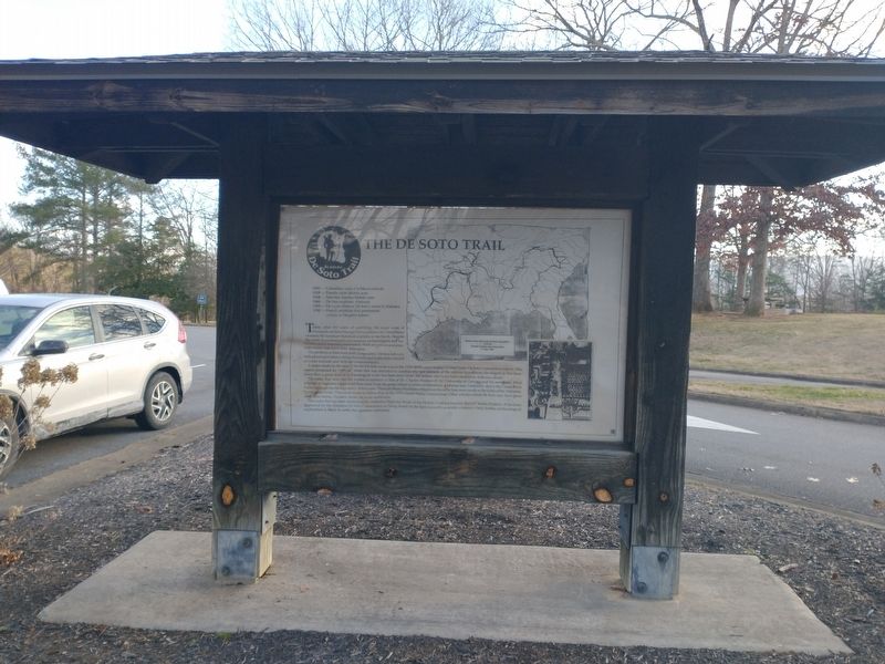
The De Soto Trail
1492 - Columbus visits Caribbean islands
1519 - Pineda visits Mobile area
1528 - Narváez reaches Mobile area
1540 - De Soto explores Alabama
1559 - De Luna retraces De Soto's route in Alabama
1702 - French establish first permanent colony at Dauphin Island
Today after 450 of searching, the exact route of Hernando de Soto through the southeastern United States remains the foremost historical mystery of the South. Despite the work of professional and amateur archaeologists and historians, and a national commission, there are still several alternate routes that have their defenders.
The problem is that even with a large army, De Soto left very little physical evidence along the route and neglected to record accurate latitude and mileage measurements.
A major study in the search for the De Soto route was in the 1939 (400th anniversary) United States De Soto Commission report. This report presented an "official” route that was intended to combine the best features of the various hypotheses developed at that time. Since then a great deal of archaeological work has been done (over 300 Indian sites have been studied in Alábama alone).
The route that now has the widest acceptance is that of Dr. Charles Hudson of the University of Georgia and his associates. Most scholars in Alabama agree with that route from the point where it enters northeastern Alabama near Piedmont, down the Coosa River Valley and into the Montgomery-Selma area. There are those who believe that from there De Soto went south to the forks of the Alabama-Tombigbee rivers. This route tends to follow that of the 1939 United States Commission. Other scholars think De Soto may have gone west from Selma. Hudson thinks he went northwest.
The route that has been marked as the Alabama Highway Route of the De Soto Trail is primarily that of Charles Hudson. It has been approved by the Alabama De Soto Commission as being based on the best currently available evidence. Only further archaeological exploration is likely to settle this question definitely.
Topics. This historical marker is listed in these topic lists: Colonial Era • Exploration. A significant historical year for this entry is 1492.
Location. 34° 42.474′ N, 85° 33.587′ W. Marker is in Sulphur Springs, Alabama, in DeKalb County. Marker can be reached from Interstate 59, one mile north of County Road 140, on the right when traveling south. Touch for map. Marker is in this post office area: Valley Head AL 35989, United States of America. Touch for directions.
Other nearby markers. At least 8 other markers are within 9 miles of this marker, measured as the crow flies. A different marker also named The De Soto Trail (here, next to this marker); Wills Town (within shouting distance of this marker); POW-MIA Memorial (within shouting distance of this marker); Veterans Memorial (within shouting distance of this marker); Nisbet Plantation (approx. 2.2 miles away in Georgia); The Road to Chickamauga (approx. 6.3 miles away); Cureton Plantation (approx. 6.4 miles away in Georgia); Flat Rock High School (approx. 8.8 miles away). Touch for a list and map of all markers in Sulphur Springs.
Credits. This page was last revised on January 4, 2023. It was originally submitted on January 3, 2023, by Craig Doda of Napoleon, Ohio. This page has been viewed 135 times since then and 27 times this year. Photos: 1, 2. submitted on January 3, 2023, by Craig Doda of Napoleon, Ohio. • Devry Becker Jones was the editor who published this page.

