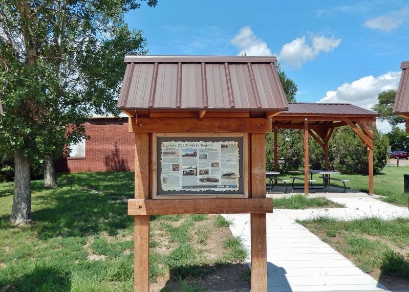
Lamar in Prowers County, Colorado — The American Mountains (Southwest)
Explore Big Timbers Region
John Martin Reservoir
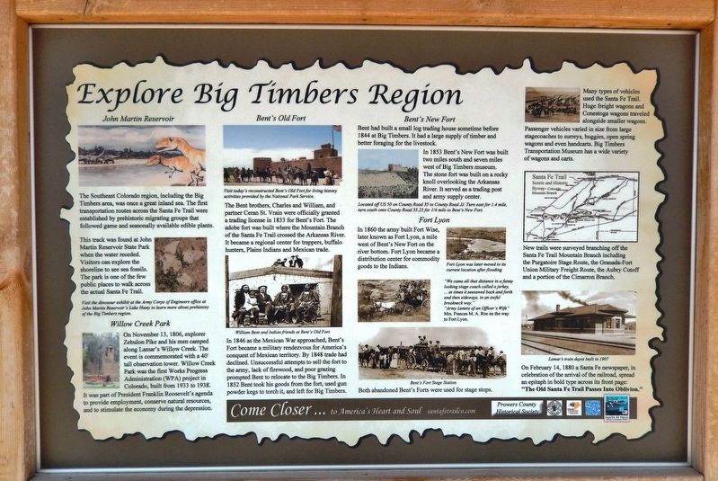
The Southeast Colorado region, including the Big Timbers area, was once a great inland sea. The first transportation routes across the Santa Fe Trail were established by prehistoric migrating groups that followed game and seasonally available edible plants.
This track was found at John Martin Reservoir State Park when the water receded. Visitors can explore the shoreline to see sea fossils. The park is one of the few public places to walk across the actual Santa Fe Trail.
Willow Creek Park
On November 13, 1806, explorer Zebulon Pike and his men camped along Lamar's Willow Creek. The event is commemorated with a 40' tall observation tower. Willow Creek Park was the first Works Progress Administration (WPA) project in Colorado, built from 1933 to 1938. It was part of President Franklin Roosevelt's agenda to provide employment, conserve natural resources, and to stimulate the economy during the depression.
Bent’s Old Fort
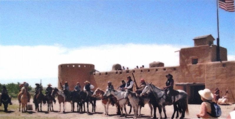
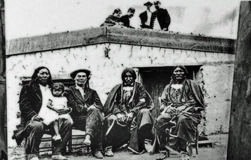
The Bent brothers, Charles and William, and partner Ceran St. Vrain were officially granted a trading license in 1833 for Bent's Fort. The adobe fort was built where the Mountain Branch of the Santa Fe Trail crossed the Arkansas River. It became a regional center for trappers, buffalo hunters, Plains Indians and Mexican trade.
In 1846 as the Mexican War approached, Bent's Fort became a military rendezvous for America's conquest of Mexican territory. By 1848 trade had declined. Unsuccessful attempts to sell the fort to the army, lack of firewood, and poor grazing prompted Bent to relocate to the Big Timbers. In 1852 Bent took his goods from the fort, used gun powder kegs to torch it, and left for Big Timbers.
Bent's New Fort
Bent had built a small log trading house sometime before 1844 at Big Timbers. It had a large supply of timber and better foraging for the livestock. In 1853 Bent's New Fort was built two miles south and seven miles west of Big Timbers museum. The stone fort was built on a rocky knoll overlooking the Arkansas River. It served as a trading post and army supply center.
Fort Lyon
In 1860 the army built Fort Wise, later known as Fort Lyon, a mile west of Bent's New Fort on the river bottom. Fort Lyon became a distribution center for commodity goods to the Indians.
"We came all that distance in a funny looking stage coach called a jerkey, … at times it seesawed back and forth and then sideways, in an awful breakneck way"
"Army Letters of an Officer's Wife"
Mrs. Frances M. A. Roe on the way to Fort Lyon.
Both abandoned Bent's Forts were used for stage
stops. Many types of vehicles used the Santa Fe Trail. Huge freight wagons and Conestoga wagons traveled alongside smaller wagons. Passenger vehicles varied in size from large stagecoaches to surreys, buggies, open spring wagons and even handcarts. Big Timbers Transportation Museum has a wide variety of wagons and carts.
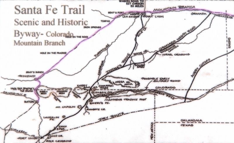
New trails were surveyed branching off the Santa Fe Trail Mountain Branch including the Purgatoire Stage Route, the Granada-Fort Union Military Freight Route, the Army Cutoff and a portion of the Cimarron Branch.
On February 14, 1880 a Santa Fe newspaper, in celebration of the arrival of the railroad, spread an epitaph in bold type across its front page:
[photo captions]
• Visit the dinosaur exhibit at the Army Corps of Engineers office at John Martin Reservoir's Lake Hasty to learn more about prehistory of the Big Timbers region
• Visit today's reconstructed Bent's Old Fort for living history activities provided by the National Park Service.
• William Bent and Indian friends at Bent's Old Fort
• Located off US 50 on County Road 35 to County Road JJ. Turn east for 1.4 mile, turn south onto County Road 35.25 for ¼ mile to Bent's New Fort.
• Fort Lyon was later moved to its current location after flooding
• Bent's Fort Stage Station
• Santa Fe Trail Scenic and Historic Byway — Colorado Mountain Branch
• Lamar’s train depot built in 1907
Erected by Prowers County Historical Society.
Topics and series. This historical marker is listed in these topic lists: Forts and Castles • Industry & Commerce • Roads & Vehicles • Settlements & Settlers. In addition, it is included in the Santa Fe Trail, and the Works Progress Administration (WPA) projects series lists. A significant historical date for this entry is November 13, 1806.
Location. 38° 6.926′ N, 102° 37.136′ W. Marker is in Lamar, Colorado, in Prowers County. Marker is at the intersection of Scenic U.S. 50/287 and State Highway 196, on the right when traveling west on U.S. 50/287Scenic . Marker kiosk is located at the Big Timbers Museum Interpretive Park, on the south side of the museum. Touch for map. Marker is at or near this postal address: 7515 US-50 Scenic Highway, Lamar CO 81052, United States of America. Touch for directions.
Other nearby markers. At least 8 other markers are within 2 miles of this marker, measured as the crow flies. Big Timbers Museum Collection (here, next to this marker); Santa Fe Trail Scenic and Historic Byway (here, next to this marker); Santa Fe Trail, 1821-1880 (here, next to this marker); a different marker also named Santa Fe Trail (here, next to this marker); Iraqi Freedom Memorial (a few steps from this marker); Big Timbers (within shouting distance of this marker); Madonna of the Trail (within shouting distance of this marker); Lamar Railroad Depot (approx. 1.8 miles away). Touch for a list and map of all markers in Lamar.
Also see . . .
1. Willow Creek Park.
The park is associated with several Great Depression era federal relief programs. Constructed between 1933 and 1938 under the Civil Works Administration (CWA), the Federal Emergency Relief Administration (FERA) and the Works Progress Administration (WPA), creation of the park provided a source of employment in Lamar during much of the Depression. Willow Creek Park was Colorado’s first CWA project and the first planned park in Lamar, providing a location for active and passive recreation activities.(Submitted on January 10, 2023, by Cosmos Mariner of Cape Canaveral, Florida.)
2. Bent's Old Fort National Historic Site.
Reconstructed 1840s adobe fur trading post on the mountain branch of the Santa Fe Trail where traders, trappers, travelers, and the Cheyenne and Arapaho tribes came together in peaceful terms for trade. Today, living historians recreate the sights, sounds, and smells of the past with guided tours, demonstrations and special events.(Submitted on January 10, 2023, by Cosmos Mariner of Cape Canaveral, Florida.)
3. Bent's New Fort Exhibits.
Why did William Bent leave his trading post located near La Junta, Colorado in 1849? Why did he pick this new location just 40 miles east? What happened once he relocated to Big Timbers in 1853? How did this little-known site on the Santa Fe Trail become preserved? You can find the answers here!(Submitted on January 10, 2023, by Cosmos Mariner of Cape Canaveral, Florida.)
4. Fort Lyon.
In July 1860, the Army rented Bent's New Fort and used it for storage of annuity goods for the Cheyenne and Arapaho. At the same time the Army constructed a new fort about one-half mile west of Bent's New Fort adjacent to the Arkansas river, naming it Fort Wise for Henry A. Wise, the governor of Virginia. After the start of the American Civil War and Virginia's succession from the Union, it was renamed Fort Lyon in 1862 for Brigadier General Nathaniel Lyon, who had been the first Union general killed in the Civil War.(Submitted on January 10, 2023, by Cosmos Mariner of Cape Canaveral, Florida.)
Credits. This page was last revised on January 10, 2023. It was originally submitted on January 8, 2023, by Cosmos Mariner of Cape Canaveral, Florida. This page has been viewed 159 times since then and 34 times this year. Photos: 1, 2, 3, 4, 5, 6. submitted on January 10, 2023, by Cosmos Mariner of Cape Canaveral, Florida.
