Innere Stadt in Wien, Austria — Central Europe (Eastern Alps)
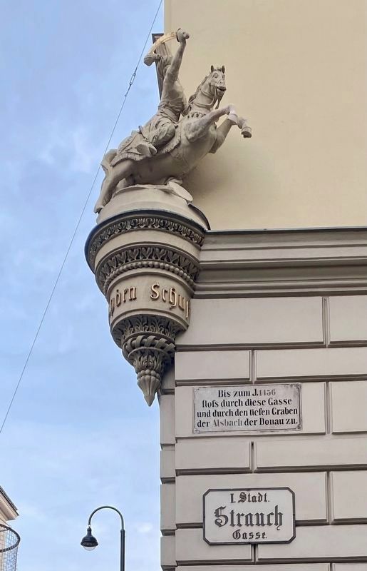
Former streambed of the Alsbach
Bis zum J. 1456 floss durch diese Gasse und durch den tiefen Graben der Alsbach der Donau zu.
Until the year 1456 the Alsbach flowed through this lane and the tiefen Graben (“deep ditch/moat”, now a street) into the Danube River.
Topics. This historical marker is listed in these topic lists: Environment • Waterways & Vessels. A significant historical year for this entry is 1456.
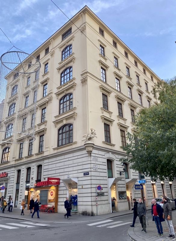
Location. 48° 12.666′ N, 16° 21.983′ E. Marker is in Wien. It is in Innere Stadt. Marker is at the intersection of Strauchgasse and Heidenschuss, on the right when traveling north on Strauchgasse. Touch for map. Marker is at or near this postal address: Heidenschuß 3, Wien 1010, Austria. Touch for directions.
Other nearby markers. At least 8 other markers are within walking distance of this marker. Pope Innocent XII (Antonio Pignatelli) (about 90 meters away, measured in a direct line); Der Wiener Feuerwehr / The Vienna Fire Department (about 120 meters away); Henry Dunant and the Red Cross (about 120 meters away); Beethoven’s Residence (about 120 meters away); Hans Christian Andersen (about 150 meters away); Türkenkugel / The Turkish Ball (about 150 meters away); Roman Ruins (about 210 meters away); Memorial Plaque of the Archdiocese Vienna at Judenplatz (about 240 meters away). Touch for a list and map of all markers in Wien.
Also see . . . Als (Fluss) (Wikipedia, in German).
Overview (in translation): The Als, also known as the Alsbach or Alserbach, is a 10.55-kilometer-long river in Vienna, which today largely flows run as a channelized stream.(Submitted on January 16, 2023.)
How stream diversion created a new channel: After the Ottakringer Stream was diverted for the construction of the Minorite monastery, around 1200 an arm of the Als was branched off to the city of Vienna. The water was channeled west of the Schottentor via the Stadtgraben via Sensengasse and Währinger Straße into the city and then followed Schottengasse and Herrengasse to the original bed of the Ottakringer Stream. The new arm of the ALS finally reached the Danube Canal through Strauchgasse and Tiefen Graben. Between 1430 and 1440, the newly formed arm of the Als in the inner city was probably finally filled in and only watered the city moat and the mill in it.
Credits. This page was last revised on January 16, 2023. It was originally submitted on January 16, 2023, by Andrew Ruppenstein of Lamorinda, California. This page has been viewed 53 times since then and 12 times this year. Photos: 1, 2. submitted on January 16, 2023, by Andrew Ruppenstein of Lamorinda, California.

