Kingsessing in Philadelphia in Philadelphia County, Pennsylvania — The American Northeast (Mid-Atlantic)
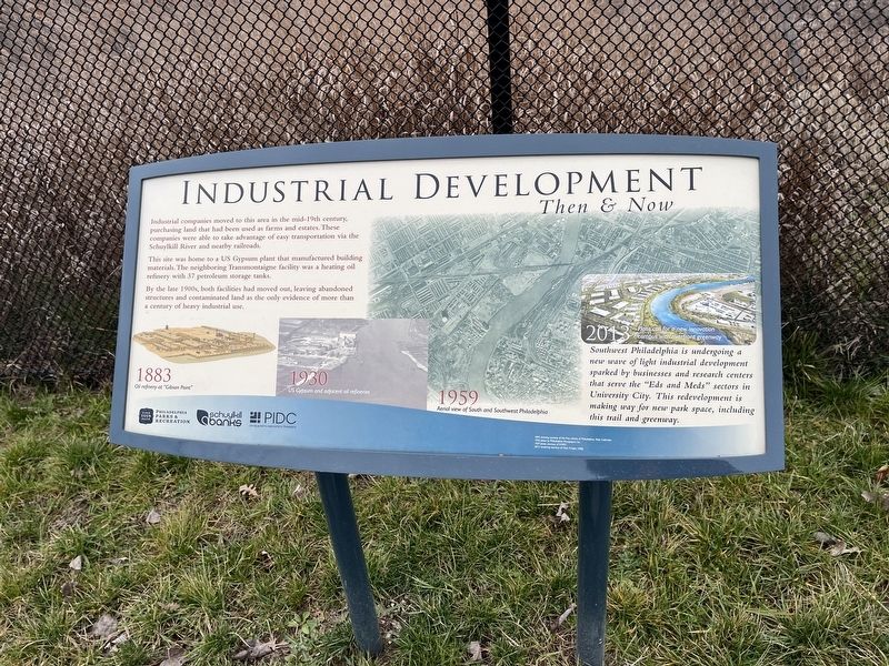
Industrial Development
Then & Now
Industrial companies moved to this area in the mid-19th century, purchasing land that had been used as farms and estates. These companies were able to take advantage of easy transportation via the Schuylkill River and nearby railroads.
This site was home to a US Gypsum plant that manufactured building materials. The neighboring Transmontaigne facility was a heating oil refinery with 37 petroleum storage tanks.
By the late 1900s, both facilities had moved out, leaving abandoned structures and contaminated land as the only evidence of more than a century of heavy industrial use.
[Captions:]
1883
Oil refinery at "Gibson Point"
1930
US Gypsum and adjacent oil refineries.
1959
Aerial view of South and Southwest Philadelphia
2013
Plans call for a new innovation campus with riverfront greenway
Southwest Philadelphia is undergoing a new wave of light industrial development sparked by businesses and research centers that serve the "Eds and Meds" sectors in University City. This redevelopment is making way for new park space, including this trail and greenway.
Erected by Philadelphia Parks & Recreation; Schuylkill BAnks; PIDC.
Topics. This historical marker is listed in these topic lists: Industry & Commerce • Natural Resources • Parks & Recreational Areas • Waterways & Vessels. A significant historical year for this entry is 1883.
Location. 39° 55.692′ N, 75° 12.761′ W. Marker is in Philadelphia, Pennsylvania, in Philadelphia County. It is in Kingsessing. Marker can be reached from South 56th Street east of Eastwick Avenue, on the right when traveling east. Touch for map. Marker is at or near this postal address: 3000 S 56th St, Philadelphia PA 19143, United States of America. Touch for directions.
Other nearby markers. At least 8 other markers are within walking distance of this marker. An Orchard in the City (approx. 0.2 miles away); Arbor (approx. 0.3 miles away); Yellowwood (approx. 0.3 miles away); Ginkgo (approx. 0.3 miles away); Bartram's Boxes (approx. 0.3 miles away); John Bartram (1699 - 1777) (approx. 0.3 miles away); Bartram's Garden (approx. 0.3 miles away); Dialogue with Nature: The Bartram Contribution (approx. 0.3 miles away). Touch for a list and map of all markers in Philadelphia.
Credits. This page was last revised on February 2, 2023. It was originally submitted on January 16, 2023, by Devry Becker Jones of Washington, District of Columbia. This page has been viewed 50 times since then and 9 times this year. Photos: 1, 2. submitted on January 16, 2023, by Devry Becker Jones of Washington, District of Columbia.

