Sault Ste. Marie in Chippewa County, Michigan — The American Midwest (Great Lakes)
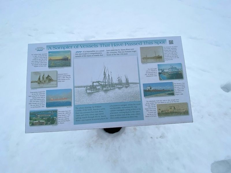
A Sampler of Vessels That Have Passed This Spot
Inscription.
It is impossible on a panel this size to give a comprehensive sample of the types of vessels that have plied the St. Marys River over the centuries. This one features larger boats of the last 150 years.
The Wilfred Sykes, launched in 1949, was the first lake freighter to burn fuel oil instead of coal. She could carry almost 22.000 tons of ore at full draft, about twice the capacity of the average freighter of those days.
Schooner Emma L Nielson passing Brady Park in 1908. Note the sailor halfway up the center mast.
Ocean-going vessels from all over the world have been using the St. Lawrence Seaway since 1959 to reach Lake Superior ports. Here, the Federal Welland slides through sea-smoke in the river above the locks in mid-December, 2003.
This photo from 2011 shows the 1,000-foot- long Stewart J. Cort about to enter the Poe Lock, greeting the 630-foot Robert S. Pierson.
The above drawing, by William Gerrish of the Sault, depicts a scene that was common between about 1860 and 1890, when tugs towed sailing vessels through the St. Marys River-too narrow in several places for schooners to navigate unless the wind was favorable. Sometimes the tug captain managed a string of five or six schooners, towing them to the open lakes at either end of the river, where they could continue on their way.
The Cormorant was one of many lumber steamboats bringing Upper Peninsula white pine to lower lake ports. In the 1880 season. she made 12 round trips and paid the third highest amount of tolls of any ship using the locks.
The fully-loaded John G. Munson is downbound here in 1976, all decked out in Bicentennial colors.
The Stewart J. Cort downbound below the locks, is taking on supplies from the supply boat Ojibway in August 2008.
The sidewheeler North Star, built 1854, brought many of the workers here from Detroit to work on the first lock. The ship, 260 feet long, was the fastest boat on the lakes when built. It could make the trip up from Detroit in 24 hours.
Topics. This historical marker is listed in this topic list: Waterways & Vessels. A significant historical month for this entry is August 2008.
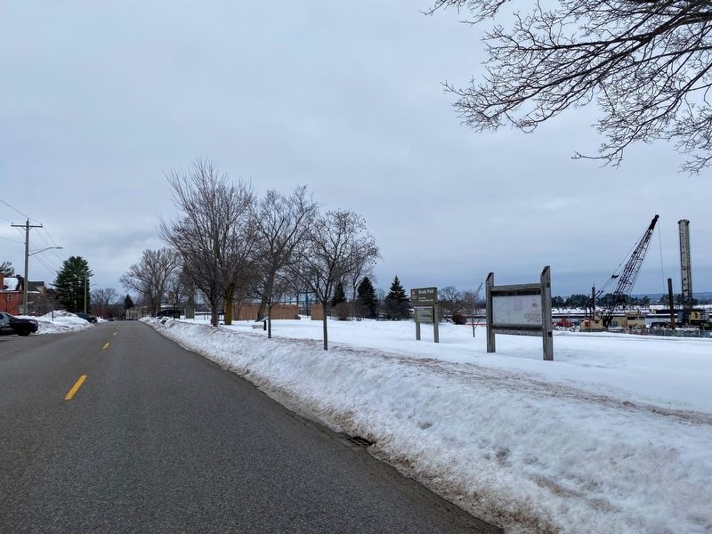
Location. 46° 30.011′ N, 84° 20.497′ W. Marker is in Sault Ste. Marie, Michigan, in Chippewa County. Marker is at the intersection of East Water Street and Brady Street, on the right when traveling west on East Water Street. Touch for map. Marker is at or near this postal address: 298 East Water Street, Sault Sainte Marie MI 49783, United States of America. Touch for directions.
Other nearby markers. At least 8 other markers are within walking distance of this marker. Fort Brady (within shouting distance of this marker); a different marker also named Fort Brady (within shouting distance of this
marker); Statue of St. Mary (within shouting distance of this marker); Fort Brady 1850 (within shouting distance of this marker); St. Mary's Church (within shouting distance of this marker); The King's Grant (within shouting distance of this marker); Fort Chevalier DeRepentigny (about 300 feet away, measured in a direct line); Ancient Anishinaabek Burial Ground (about 300 feet away). Touch for a list and map of all markers in Sault Ste. Marie.
Credits. This page was last revised on January 19, 2023. It was originally submitted on January 16, 2023, by J.T. Lambrou of New Boston, Michigan. This page has been viewed 54 times since then and 6 times this year. Photos: 1, 2. submitted on January 19, 2023, by J.T. Lambrou of New Boston, Michigan. • J. Makali Bruton was the editor who published this page.

