Manassas, Virginia — The American South (Mid-Atlantic)
The Brown School
1869 - 1954
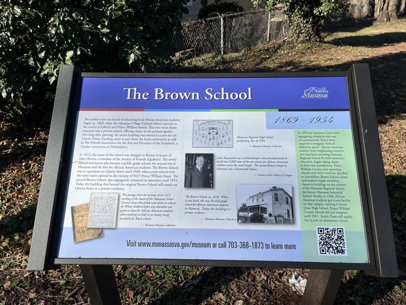
The earliest story on record of educating local African American students began ca. 1869, when the Manassas Village Colored School opened on the corner of Liberty and Prince William Streets. This two-room frame structure was a private school, offering classes in the primary grades. Not long after opening, the entire building was moved to a new lot on Liberty Street. Funding came in part from the local community as well as The Friends Association for the Aid and Elevation of the Freedmen, a Quaker institution in Philadelphia.
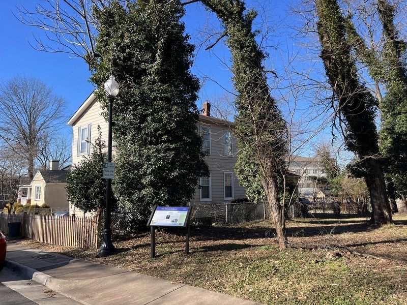
In 1872, the name of the school was changed to Brown in honor of Mary Brown, a member of the Society of Friends (Quakers). The newly named institution also became a public grade school, the second one in Manassas and the first for African American students. The Brown School was in operation on Liberty Street until 1928, when a new school with the same name opened in the vicinity of 9415 Prince William Street. The second Brown School, also segregated, remained in operation until 1954. Today the building that housed the original Brown School still stands on Liberty Street as a private residence.
[Sidebar:]
In 1954 the Supreme Court ruled segregating schools by race was unconstitutional. Towns were required to integrate "with all deliberate speed." African American children from neighboring counties who had been attending Manassas Regional School for their secondary education, began taking classes in their own jurisdictions. Prince William County, now operating schools with fewer students, decided to consolidate. Brown School closed and students began attending classes in buildings on the campus of the Manassas Regional School, the former Manassas Industrial School. Finally, in 1960, African American students got a new facility on that campus, naming it Jennie Dean High School. Prince William County schools did not integrate until 1965. Jennie Dean still stands, but is now an elementary school.
[Captions:]
This passage from the minutes of an 1872 meeting of the board of the Manassas School District shows that funds were spent on schools for White children before any attention was given to those for African American students, often resulting in no money being available for Black schools.
Manassas Regional High School graduating class of 1956.
Julius Rosenwald was a philanthropist who provided funds to build over 5,000 state-of-the-art schools for African American children across the rural South. The second Brown School in Manassas was a Rosenwald School.
,br> The Brown School, ca. 1950. When it was built, this was the only grade school for African American students in Manassas. Today, this building is
Erected by City of Manassas.
Topics and series. This historical marker is listed in these topic lists: African Americans • Civil Rights • Education. In addition, it is included in the Quakerism, and the Rosenwald Schools series lists. A significant historical year for this entry is 1869.
Location. 38° 44.921′ N, 77° 28.401′ W. Marker is in Manassas, Virginia. Marker is on Liberty Street north of Grant Avenue (Virginia Route 234), on the right when traveling north. Touch for map. Marker is at or near this postal address: 9504 Liberty St, Manassas VA 20110, United States of America. Touch for directions.
Other nearby markers. At least 8 other markers are within walking distance of this marker. Liberty Street (within shouting distance of this marker); Occupation or Liberation (about 400 feet away, measured in a direct line); War on the Landscape (about 500 feet away); Manassas (about 500 feet away); Wartime Manassas (about 500 feet away); a different marker also named Wartime Manassas (about 600 feet away); a different marker also named Wartime Manassas (about 600 feet away); Route of the "Old 97" (about 600 feet away). Touch for a list and map of all markers in Manassas.
Credits. This page was last revised on January 17, 2023. It was originally submitted on January 17, 2023, by Devry Becker Jones of Washington, District of Columbia. This page has been viewed 214 times since then and 65 times this year. Photos: 1, 2. submitted on January 17, 2023, by Devry Becker Jones of Washington, District of Columbia.

