Manassas in Prince William County, Virginia — The American South (Mid-Atlantic)
Answering the Call to Service
1917 - 1918
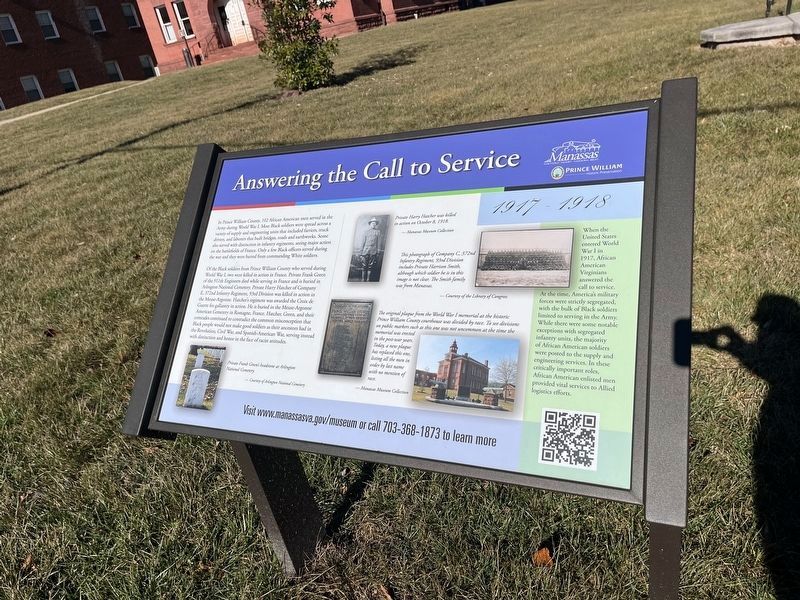
In Prince William County, 102 African American men served in the Army during World War I. Most Black soldiers were spread across a variety of supply and engineering units that included farriers, truck drivers, and laborers that built bridges, roads and earthworks. Some also served with distinction in infantry regiments, seeing major action on the battlefields of France. Only a few Black officers served during the war and they were barred from commanding White officers.
Of the Black soldiers from Prince William County who served during World War I, two were killed in action in France. Private Frank Green of the 511th Engineers died while serving in France and is buried in Arlington National Cemetery. Private Harry Hatcher of Company E, 372nd Infantry Regiment, 93rd Division was killed in action in the Meuse-Argonne. Hatcher's regiment was awarded the Croix de Guerre for gallantry in action. He is buried in the Meuse-Argonne American Cemetery in Romagne, France. Hatcher, Green, and their comrades continued to contradict the common misconception that Black people would not make good soldiers as their ancestors had in
this page online
[Sidebar:]
When the United States entered World War I in 1917, African American Virginians answered the call to service. At the time, America's military forces were strictly segregated, with the bulk of Black soldiers limited to serving in the Army. While these were some notable exceptions with segregated infantry units, the majority of African American soldiers were posted to the supply and engineering services. In these critically important roles, African American enlisted men provided vital services to Allied logistics efforts.
[Captions:]
Private Frank Green's headstone at Arlington National Cemetery.
Private Harry Hatcher was killed in action on October 8, 1918.
This photograph of Company C, 372nd Infantry Regiment, 93rd Division includes Private Harrison Smith, although which soldier he is in this image is not clear. The Smith family was from Manassas.
The original plaque from the World War I memorial at the historic Prince William County courthouse was divided by race. to see divisions on public markers such as this one was not uncommon at the time the memorial was erected in the post-war years. Today, a new plaque has replaced this one, listing all the men in order by last name with no mention of race.
Erected by City
Topics. This historical marker is listed in these topic lists: African Americans • Civil Rights • War, World I. A significant historical date for this entry is October 8, 1918.
Location. This marker has been replaced by another marker nearby. It was located near 38° 45.131′ N, 77° 28.542′ W. Marker was in Manassas, Virginia, in Prince William County. It was on Lee Avenue west of Grant Avenue (Virginia Route 234), on the right when traveling west. Touch for map. Marker was at or near this postal address: 9251 Lee Ave, Manassas VA 20110, United States of America. Touch for directions.

Regionally, this marker was in the Washington Metropolitan Area, in Northern Virginia, and in the Piedmont. It was also in the American South, specifically in the Upper South, in the Mid-Atlantic, and on the Eastern Seaboard. Globally, it was in the North Atlantic Region, North America, the Western Hemisphere, the Western World, and the Anglosphere. Historically, it found itself in what was once the territory of the Mississippian Culture, one of the original Thirteen Colonies, one of the Confederate States of America, and the Antebellum South.
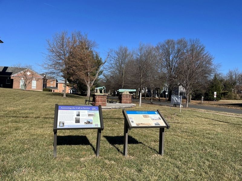
Other nearby markers. At least 8 other markers are within walking distance of this location: A different marker also named Answering the Call to Service (here, next to this marker); a different marker also named Peace Jubilee (here, next to this marker); In Commemoration of the Manassas National Jubilee of Peace (a few steps from this marker); Fifth Prince William County Courthouse (within shouting distance of this marker); Prince William County World War I Memorial (within shouting distance of this marker); First Baptist Church (about 600 feet away, measured in a direct line); African American Entrepreneurs (about 700 feet away); Old Bennett School (about 700 feet away). Touch for a list and map of all markers in Manassas.
Another marker is no longer nearby. Peace Jubilee (was here, next to this marker but has been replaced with another marker now near it).
Related marker. Click here for another marker that is related to this marker. This marker has been replaced with the linked marker. There are slight differences in the inscriptions.
Additional commentary.
1. Location of the marker
This marker stands at the Old Prince William Courthouse in the City of Manassas. The political geography in the Commonwealth of Virginia is that all cities are independent of any counties, even when they serve as the seats of the counties that surround them.
The old courthouse stands on ground that is a legal exclave of Prince William County within the City of Manassas. Note that the nearby City of Manassas Park is also an independent city. Also, much of the unorganized area of Prince William County near Manassas also has a postal place name of Manassas, Virginia, even though it is not actually a part of the City of Manassas.
The U.S. Postal Service determines postal place names. The Commonwealth of Virginia determines municipal boundaries within Virginia. The Census Bureau, U.S. Department of Commerce determines boundaries of Census Designated Places.
— Submitted January 18, 2023, by Devry Becker Jones of Washington, District of Columbia.
Credits. This page was last revised on July 12, 2026. It was originally submitted on January 18, 2023, by Devry Becker Jones of Washington, District of Columbia. This page has been viewed 215 times since then and 26 times this year. Photos: 1, 2. submitted on January 18, 2023, by Devry Becker Jones of Washington, District of Columbia.
