Many in Sabine Parish, Louisiana — The American South (West South Central)
St. John the Baptist Catholic Church
Photographed by Dave W, May 13, 2022
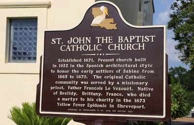
1. St. John the Baptist Catholic Church Marker
Established 1871. Present church built in 1922 in the Spanish architectural style to honor the early settlers of Sabine from 1865 to 1870. The original Catholic community was served by a missionary priest, Father Francois Le Vezouet. Native of Brelidy, Brittany, France, who died a martyr to his charity in the 1873 Yellow Fever Epidemic in Shreveport.
Erected 2021 by Parishioners of St. John the Baptist.
Topics. This historical marker is listed in these topic lists: Architecture • Immigration • Religion & Religious Structures • Settlements & Settlers. A significant historical year for this entry is 1871.
Location. 31° 34.123′ N, 93° 28.785′ W. Marker is in Many, Louisiana, in Sabine Parish. It is at the intersection of San Antonio Avenue (Louisiana Route 6) and Church Street when traveling north on San Antonio Avenue. Touch for map. Marker is at or near this postal address: 1090 San Antonio Ave, Many LA 71449, United States of America. Touch for directions.

Regionally, this marker is in Central Louisiana. It is also in the American South, specifically in the Deep South, and in the Piney Woods.
this page online
Other nearby markers. At least 8 other markers are within 6 miles of this marker, measured as the crow flies: The Sabine Index (approx. 0.2 miles away); Baldwin's Store (approx. 0.2 miles away); Duty • Honor • Country (approx. 0.2 miles away); First Lieutenant Floyd J. Giblin (approx. 0.3 miles away); Sabine High School (approx. 0.4 miles away); Kansas City Southern Railway Depot (approx. 0.4 miles away); Village of Fisher (approx. 5.2 miles away); Fort Jesup (approx. 5½ miles away). Touch for a list and map of all markers in Many.

Photographed by Dave W, May 13, 2022
2. St. John the Baptist Catholic Church
Marker is just to the left of this picture off screen at the front of the church.
Photographed by Jimmy Emerson, Feb 2025
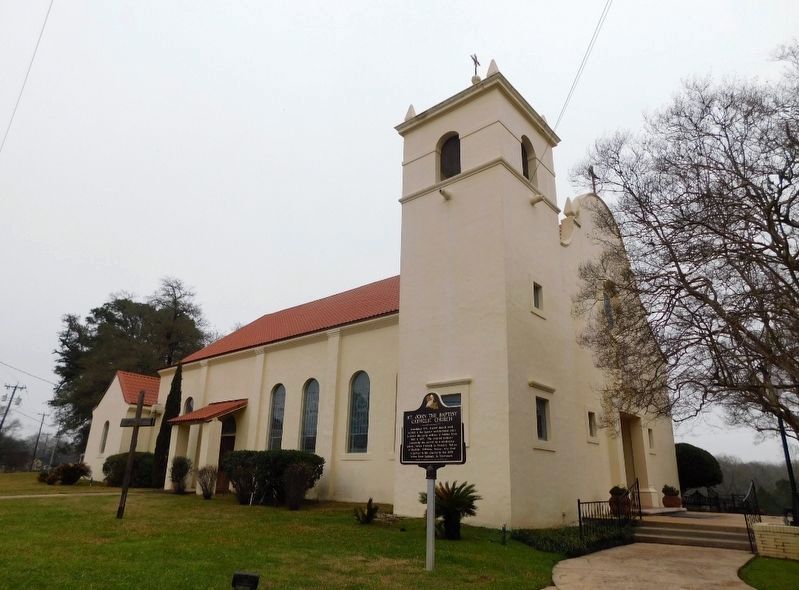
3. St. John the Baptist Catholic Church and Marker
Credits. This page was last revised on May 31, 2026. It was originally submitted on January 19, 2023, by Dave W of Co, Colorado. This page has been viewed 676 times since then and 70 times this year. Photos: 1, 2. submitted on January 19, 2023, by Dave W of Co, Colorado. 3. submitted on May 3, 2026, by Jimmy Emerson of Dalton, Georgia. • Devry Becker Jones was the editor who published this page.
