Green Valley in Arlington in Arlington County, Virginia — The American South (Mid-Atlantic)
FREED, 2021
Walter Hood
| — | Laser cut aluminum panel and metallic gold urethane topcoat. | — |
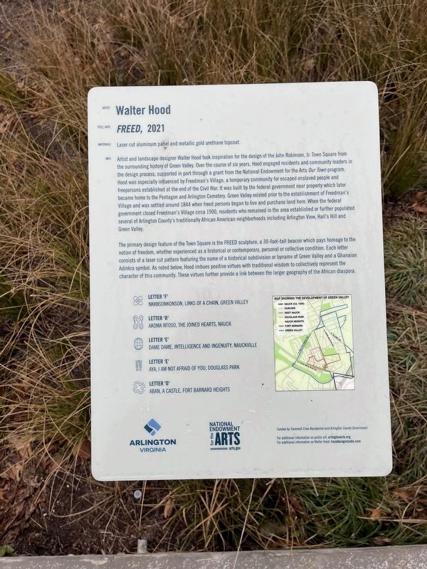
Artist and landscape designer Walter Hood took inspiration for the design of the John Robinson, Jr. Town Square from the surrounding history of Green Valley. Over the course of six years, Hood engaged residents and community leaders in the design process, supported in part through a grant from the National Endowment of the Arts Our Town program. Hood was especially influenced by Freedman's Village, a temporary community for escaped enslaved people and freepersons established at the end of the Civil War. It was built by the federal government near property which later became home to the Pentagon and Arlington Cemetery. Green Valley existed to the establishment of Freedmen's Village and was settled around 1844 when freed persons began to live and purchase land here. When the federal government closed Freedman's Village circa 1900, residents who remained in the area established or further populated several of Arlington County's traditionally African American neighborhoods including Arlington View, Hall's Hill and Green Valley.
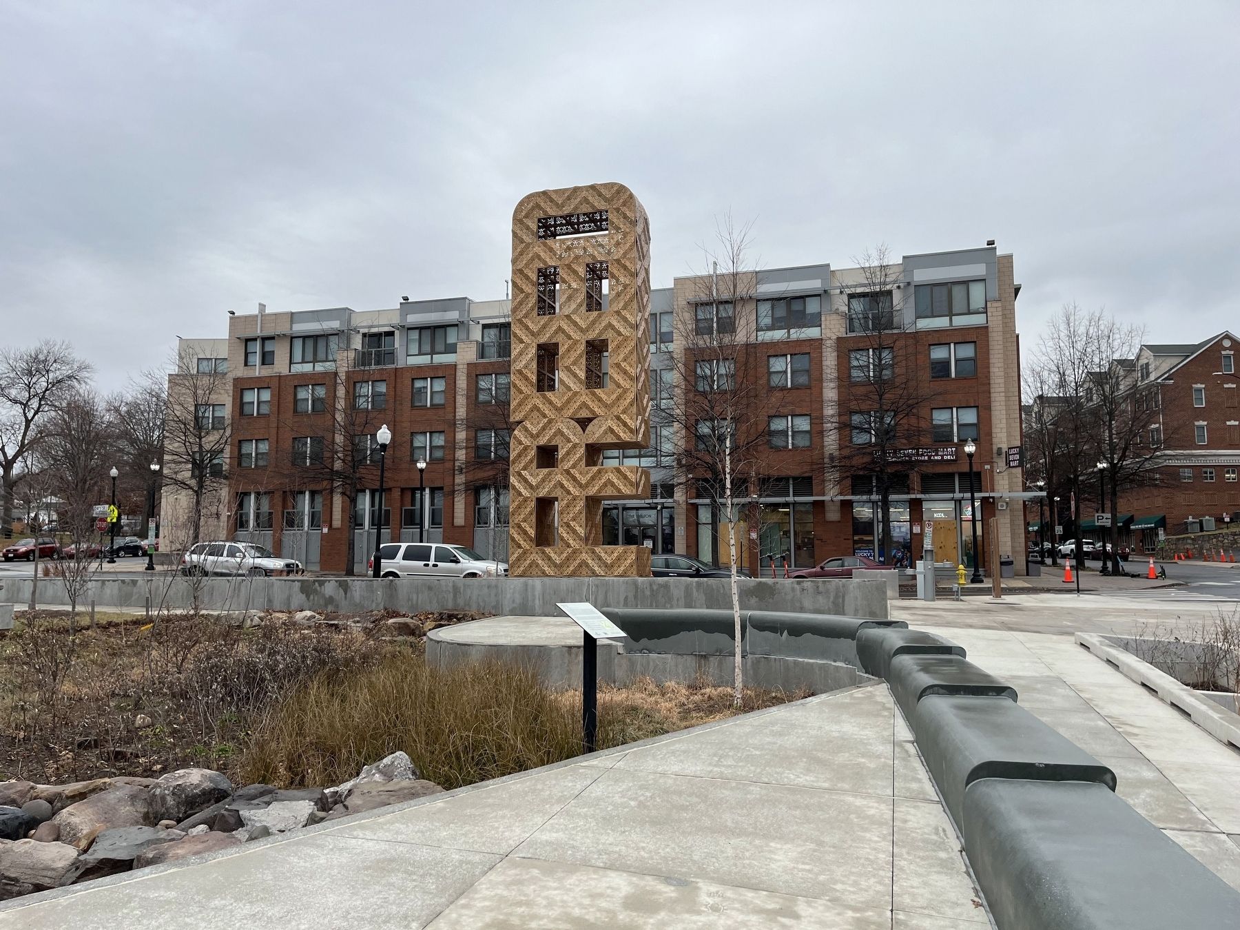
The primary design feature of the Town Square is the FREED sculpture, a 30-foot-tall beacon
this page online
Letter 'F'
Nkknsonkonson, links of a chain, Green Valley
Letter 'R'
Akoma Ntoso, the joined hearts, Nauck
Letter 'E'
Dame Dame, intelligence and ingenuity, Nauckville
Letter 'E'
Aya, I am not afraid of you, Douglass Park
Letter 'D'
Aban, a castle, Fort Barnard Heights
Erected 2021 by Arlington County, Virginia; National Endowment for the Arts.
Topics. This historical marker is listed in these topic lists: African Americans • Arts, Letters, Music • Parks & Recreational Areas • Settlements & Settlers • War, US Civil. A significant historical year for this entry is 1844.
Location. 38° 50.899′ N, 77° 5.052′ W.
Photographed by Devry Becker Jones (CC0), January 22, 2023
2. FREED with the marker visible in the foreground

Regionally, this marker is in the Washington Metropolitan Area and in Northern Virginia. It is also in the American South, specifically in the Upper South, in the Mid-Atlantic, and on the Eastern Seaboard. Globally, it is in the North Atlantic Region, North America, the Western Hemisphere, the Western World, and the Anglosphere. Historically, it finds itself in what was once the territory of the Mississippian Culture, one of the original Thirteen Colonies, one of the Confederate States of America, and the Antebellum South.
Other nearby markers. At least 8 other markers are within walking distance of this marker: Green Valley Pharmacy (within shouting distance of this marker); Drew School (about 400 feet away, measured in a direct line); Origins of Green Valley (about 400 feet away); Community Businesses (about 500 feet away); Arlington Lodge 58 (about 500 feet away); Places of Worship (about 500 feet away); Recreation (about 500 feet away); Veterans Memorial Y.M.C.A. (about 500 feet away). Touch for a list and map of all markers in Arlington.
Another marker is no longer nearby. Origins (was a few steps from this marker but has been replaced with another marker now near it).
Additional keywords. FREED, 2021
Credits. This page was last revised on February 1, 2023. It was originally submitted on January 22, 2023, by Devry Becker Jones of Washington, District of Columbia. This page has been viewed 166 times since then and 20 times this year. Photos: 1, 2. submitted on January 22, 2023, by Devry Becker Jones of Washington, District of Columbia.
