Doylestown in Bucks County, Pennsylvania — The American Northeast (Mid-Atlantic)
Doylestown Agricultural Works
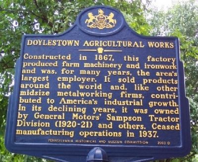
Photographed by William Fischer, Jr., July 2, 2009
1. Doylestown Agricultural Works Marker
Erected 2003 by Pennsylvania Historical and Museum Commission.
Topics and series. This historical marker is listed in these topic lists: Agriculture • Industry & Commerce. In addition, it is included in the Pennsylvania Historical and Museum Commission (PHMC) series list. A significant historical year for this entry is 1867.
Location. 40° 18.446′ N, 75° 7.804′ W. Marker is in Doylestown, Pennsylvania, in Bucks County. It is at the intersection of Ashland Street and Hamilton Street, on the left when traveling west on Ashland Street. Touch for map. Marker is in this post office area: Doylestown PA 18901, United States of America. Touch for directions.

Regionally, this marker is in Southeast Pennsylvania and in Greater Philadelphia.
this page online
Other nearby markers. At least 8 other markers are within walking distance of this marker: Thinking Green (about 700 feet away, measured in a direct line); The Mercer Museum (approx. 0.2 miles away); The Lenape Crossroads (approx. 0.2 miles away); 1748 Fountain House (approx. 0.2 miles away); The Site (approx. 0.2 miles away); The Museum (approx. 0.2 miles away); The Expansion (approx. 0.2 miles away); Corporate Business Partner Entrance Courtyard and W.B.U.X. Sculpture Garden (approx. 0.2 miles away). Touch for a list and map of all markers in Doylestown.
Also see . . .
1. Explore Pennsylvania History website. Includes a brief history of Doylestown Agricultural Works. (Submitted on August 11, 2009, by William Fischer, Jr. of Reynoldsburg, Ohio.)
2. MarkerQuest - Doylestown Agricultural Works.
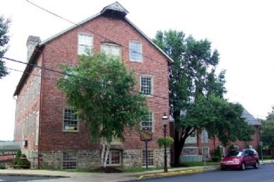
Photographed by William Fischer, Jr., July 2, 2009
2. Doylestown Agricultural Works Marker
Credits. This page was last revised on May 11, 2023. It was originally submitted on August 9, 2009, by William Fischer, Jr. of Reynoldsburg, Ohio. This page has been viewed 1,507 times since then and 62 times this year. Photos: 1, 2. submitted on August 9, 2009, by William Fischer, Jr. of Reynoldsburg, Ohio. • Kevin W. was the editor who published this page.
