Downtown in San Antonio in Bexar County, Texas — The American South (West South Central)
Historic Engineering on the Creek
Captions
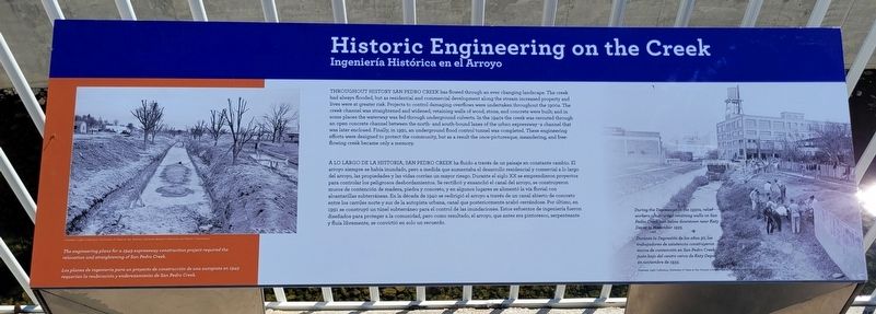
1: The engineering plans for a 1949 expressway construction project required the relocation and straightening of San Pedro Creek.
2: During the Depression in the 1930s, relief workers constructed retaining walls on San Pedro Creek just below downtown near Katy Depot in November 1933.
Courtesy: Light Collection. University of Texas at San Antonio Libraries Special Collections and Hearst Corporation.
[Spanish Text]
A Lo Largo De La Historia, San Pedro Creek ha fluido a través de un paisaje en constante cambio. El arroyo siempre se había inundado, pero a medida que aumentaba el desarrollo residencial y comercial a lo largo del arroyo, las propiedades y las vidas corrían un mayor riesgo. Durante el siglo XX se emprendieron proyectos para controlar los peligrosos desbordamientos. Se rectificó y ensanchó el canal del arroyo, se construyeron muros de contención de madera, piedra y concreto, y en algunos lugares se alimentó la via fluvial con alcantarillas subterráneas. En la década de 1940 se redirigió el arroyo a través de un canal abierto de concreto entre los carriles norte y sur de la autopista urbana, canal que posteriormente acabó cerrándose. Por último, en 1991 se construyó un túnel subterráneo para el control de las inundaciones. Estos esfuerzos de ingeniería fueron diseñados para proteger a la comunidad, pero como resultado, el arroyo, que antes era pintoresco, serpenteante y fluía libremente, se convirtió en solo un recuerdo.
Subtítulos
1:
Los planes de ingeniería para un proyecto de construcción de una autopista en 1949 requerian la reubicación y enderezamiento de San Pedro Creek.
2: Durante la Depresión de los años 30, los trabajadores de asistencia construyeron muros de contención en San Pedro Creek justo bajo del centro cerca de Katy Depot en noviembre de 1933.
Erected 2022 by San Pedro Creek Cultural Park.
Topics. This historical marker is listed in these topic lists: Industry & Commerce • Parks & Recreational Areas • Railroads & Streetcars • Roads & Vehicles. A significant historical month for this entry is November 1933.
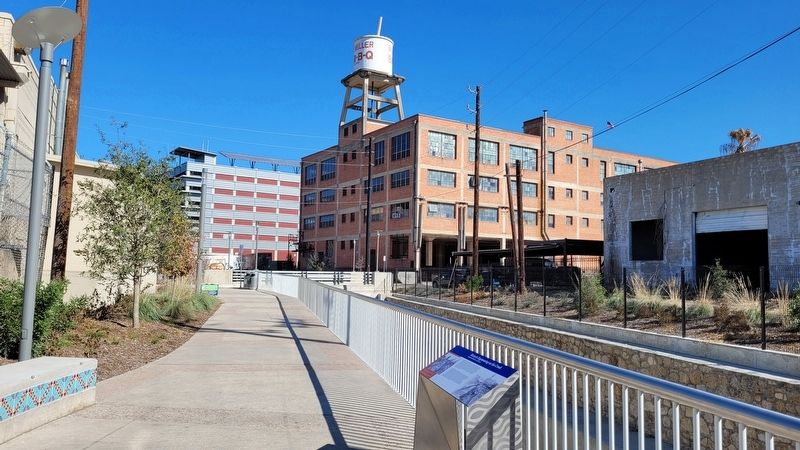
Location. 29° 25.256′ N, 98° 29.832′ W. Marker is in San Antonio, Texas, in Bexar County. It is in Downtown. Marker can be reached from West César E Chávez Boulevard, 0.1 miles west of South Flores Street. The marker is located north of the Cesar Chavez Bridge along the west side of the creek in the park. Touch for map. Marker is at or near this postal address: 201 West César E Chávez Blvd, San Antonio TX 78205, United States of America. Touch for directions.
Other nearby markers. At least 8 other markers are within walking distance of this marker. Late 19th and Early 20th Century Industry Along the Creek (within shouting distance of this marker); People of San Pedro Creek (about 300 feet away, measured in a direct line); Casa José Antonio Navarro (approx. 0.2 miles away); The Fight for an Independent Texas: From a Spanish Province to a Republic (approx. 0.2 miles away); Near Homesite of Erasmo Seguin (approx. ¼ mile away); Laredito and the Tale of Two San Antonios (approx. ¼ mile away); Urban Renewal and the Expansion of Government Buildings (approx. ¼ mile away); W.B. Teagarden House (approx. ¼ mile away). Touch for a list and map of all markers in San Antonio.
Also see . . . Where beauty meets purpose. San Pedro Creek Culture Park (Submitted on January 25, 2023, by James Hulse of Medina, Texas.)
Credits. This page was last revised on February 2, 2023. It was originally submitted on January 25, 2023, by James Hulse of Medina, Texas. This page has been viewed 63 times since then and 7 times this year. Photos: 1, 2. submitted on January 25, 2023, by James Hulse of Medina, Texas.

