
Near Linn in Gilmer County, West Virginia — The American South (Appalachia)
Stagecoach Stop
| — | Staunton-Parkersburg Turnpike | — |
Photographed by J. J. Prats, March 30, 2015
1. Stagecoach Stop Marker
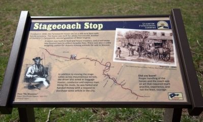
A tavern was built to feed and house travelers, and a toll house was located here to collect turnpike fees. There was also a cattle weighing Station for drovers moving animals for sale in Weston.
In addition to moving the stage safely across mountainous terrain, the driver also acted as baggage master, conductor and express man. Along the route, he was hailed and handed money with a request to purchase some article in the city.
Did you know? Proper handling of the horses and the coach was an art that required much practice, experiene, and not the least, courage.
Erected by America’s Byways.
Topics. This historical marker is listed in this topic list: Roads & Vehicles. A significant historical year for this entry is 1848.
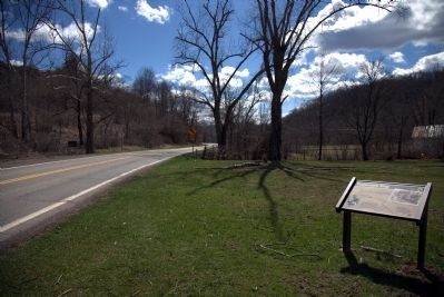
Location. 39° 1.898′ N, 80° 47.009′ W. Marker is near Linn, West Virginia, in Gilmer County. It is on West Virginia Route 47 west of U.S. 33, on the right when traveling east. Marker is on West Virginia
this page online

Regionally, this marker is in West Virginia’s Little Kanawha Valley. It is also in the American South, specifically in the Upper South, in Appalachia, and specifically in Southern Appalachia. Globally, it is in North America, the Western Hemisphere, the Western World, and the Anglosphere. Historically, it finds itself in what was once the territory of the Mississippian Culture.
Other nearby markers. At least 8 other markers are within 8 miles of this marker, measured as the crow flies: Raid on Troy (approx. 1.3 miles away); Gilmer County / Doddridge County (approx. 5.1 miles away); Gilmer County Poor Farm Infirmary (approx. 6 miles away); Samuel Lewis Hays (approx. 6½ miles away); J.H. Diss Debar (approx. 6.9 miles away); Fallen Post Oak (approx. 7.1 miles away); Fort Moore (approx. 7.1 miles away); Glenville State College Presidents (approx. 7.1 miles away).
Another marker is no longer nearby. Duck Run Cable Suspension Bridge (was approx. 7.1
Photographed by J. J. Prats, March 30, 2015
2. Stagecoach Stop Marker
More about this marker. A drawing captioned “Stagecoach - (1846)” is reproduced in the upper right of this interpretative panel. In the lower left is a drawing of a stagecoach driver published in Harper’s New Monthly Magazine in April 1972 captioned “From ‘The Mountains’.” The background image of the panel is a map of the Staunton-Parkersburg turnpike with the roadway highlighted in red.
Photographed by J. J. Prats, March 30, 2015
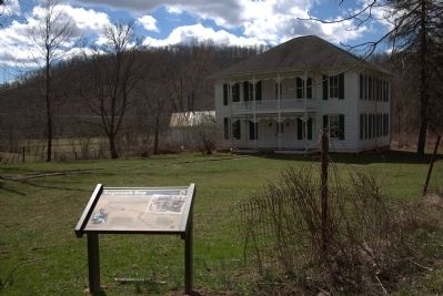
3. Farnsworth House and Marker
Photographed by J. J. Prats, March 30, 2015
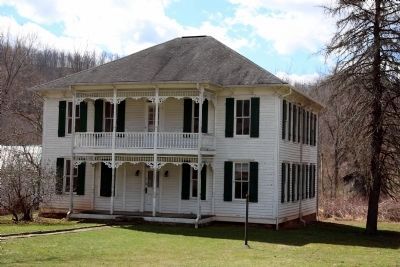
4. Farnsworth House
This is a private residence. Do not trespass on the property.
Credits. This page was last revised on January 26, 2023. It was originally submitted on April 1, 2015, by J. J. Prats of Powell, Ohio. This page has been viewed 1,730 times since then and 98 times this year. Last updated on January 25, 2023, by Rebecca Kirkpatrick-Oppe of Glenville, West Virginia. Photos: 1, 2, 3, 4. submitted on April 1, 2015, by J. J. Prats of Powell, Ohio. • Bill Pfingsten was the editor who published this page.
