Midtown in San Antonio in Bexar County, Texas — The American South (West South Central)
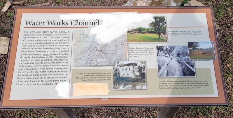
Water Works Channel
Captions
Upper Middle: This map illustrates the Brackenridge canal, pump house, and piping that delivered water from the San Antonio River to the reservoirs north of Fort Sam Houston.
Courtesy: San Antonio Municipal Archives, Office of the City Cleck.
Lower Middle: George Brackenridge expanded the water supply system to serve the growing population. This pump house, later used as a studio by sculptor Gutzon Borglum, was completed in 1885.
Courtesy: Hearst Corporation.
Upper Right: The rectangular stone-lined reservoir constructed by Jean B. LaCoste is now located within the San Antonio Botanical Gardens and is used as an amphitheater.
Photo: Maria Watson Pfeiffer, San Antonio.
Lower Right: This canal (above) delivered water from the San Antonio River to the lower pump house in the late 1800s. It was later incorporated into the Brackenridge Park Golf Course. National Youth Administration workers built this small bridge (upper right) over the canal in 1939.
Courtesy: University of Texas at San Antonio Libraries Special Collections.
Photo: David Haynes, San Antonio.
Topics. This historical marker is listed in these topic lists: Parks & Recreational Areas • Waterways & Vessels. A significant historical year for this entry is 1878.
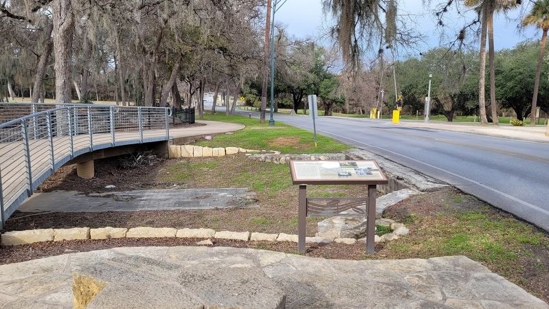
Location. 29° 27.35′ N, 98° 28.455′ W. Marker is in San Antonio, Texas, in Bexar County. It is in Midtown. Marker is at the intersection of East Mulberry Avenue and Red Oak Road, on the left when traveling west on East Mulberry Avenue. The marker is located on the south side of the highway along the walkway. Touch for map. Marker is at or near this postal address: 941 East Mulberry Avenue, San Antonio TX 78209, United States of America. Touch for directions.
Other nearby markers. At least 8 other markers are
within walking distance of this marker. Archaeology in Brackenridge Park (about 300 feet away, measured in a direct line); Polo Field (about 800 feet away); Acequia de Arriba (approx. ¼ mile away); Acequia Labor de Arriba (approx. 0.3 miles away); Upper Labor Acequia (approx. 0.3 miles away); The Mexican Village (approx. 0.4 miles away); Alamo Portland and Roman Cement Company (approx. 0.4 miles away); Flag Pole Memorial (approx. 0.4 miles away). Touch for a list and map of all markers in San Antonio.
Also see . . . History of the Park. Brackenridge Park Conservancy
The casual visitor to Brackenridge Park is totally unaware that the 349-acre park, with its picnic areas, ball fields, museum, zoo, and golf course, occupies some of the most historically rich land in the City of San Antonio. Traffic and pavement abound, urban congestion and noise intrude, and interpretation is virtually nil. Nothing tells the visitor that the park represents a long timeline reaching back at least 12,000 years. It is a rich tapestry of history linked by the San Antonio River that rises from springs above and in the park and flows through the park on its southerly course.(Submitted on January 26, 2023, by James Hulse of Medina, Texas.)
Credits. This page was last revised on February 2, 2023. It was originally submitted on January 26, 2023, by James Hulse of Medina, Texas. This page has been viewed 76 times since then and 8 times this year. Photos: 1, 2. submitted on January 27, 2023, by James Hulse of Medina, Texas.

