Near Balbec in Jay County, Indiana — The American Midwest (Great Lakes)
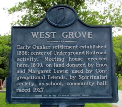
West Grove
Photographed by Duane Hall, May 20, 2013
1. West Grove Marker
Erected 1972 by Jay County Historical Society. (Marker Number 38.1972.1.)
Topics and series. This historical marker is listed in these topic lists: Abolition & Underground RR • Education • Religion & Religious Structures • Settlements & Settlers. In addition, it is included in the Indiana Historical Bureau Markers, and the Quakerism series lists. A significant historical year for this entry is 1836.
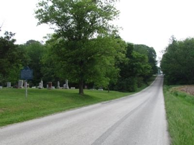
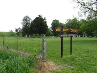
Location. 40° 31.892′ N, 85° 6.991′ W. Marker is near Balbec, Indiana, in Jay County. It is on W County Road 650N 0.4 miles east of N Country Road 750W, on the left when traveling east. Marker is located at the West Grove Cemetery. Touch for map. Marker is in this post office area: Pennville IN 47369, United States of America. Touch for directions.

Regionally, this marker is in Central Indiana. It is also in the American Midwest and in the Corn Belt.
this page online
Other nearby markers. At least 8 other markers are within 9 miles of this marker, measured as the crow flies: C.C. Paxson Donated-Cemetery (approx. 1.4 miles away); A Station on the Underground Railroad (approx. 1.7 miles away); Old Plank Road (approx. 3.3 miles away); Pennville Veterans Memorial (approx. 3.3 miles away); Godfroy Reserve (approx. 8.6 miles away); Montpelier Alumni Who Taught in Montpeliers Schools (approx. 8.6 miles away); Montpelier Carnegie Library (approx. 8.6 miles away); Forever Honoring The Pioneers (approx. 8.6 miles away). Touch for a list and map of all markers in Balbec.
Photographed by Duane Hall, May 20, 2013
2. West Grove Marker
Photographed by Duane Hall, May 20, 2013
3. West Grove Cemetery
Credits. This page was last revised on February 12, 2023. It was originally submitted on July 18, 2013, by Duane Hall of Abilene, Texas. This page has been viewed 1,179 times since then and 59 times this year. Last updated on January 29, 2023, by Craig Doda of Napoleon, Ohio. Photos: 1, 2, 3. submitted on July 18, 2013, by Duane Hall of Abilene, Texas. • J. Makali Bruton was the editor who published this page.
