Roxbury in Boston in Suffolk County, Massachusetts — The American Northeast (New England)
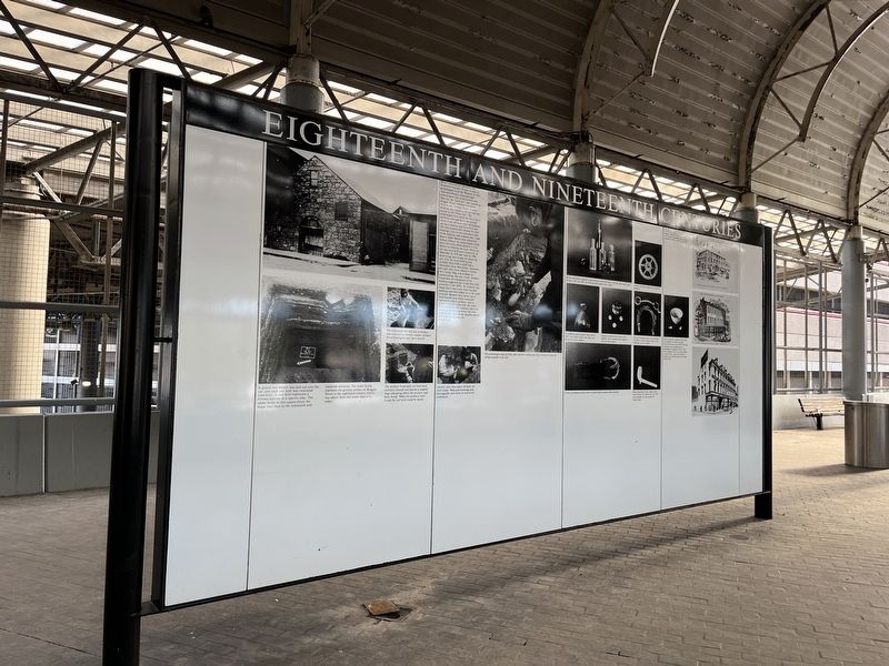
Eighteenth and Nineteenth Centuries

Photographed By Devry Becker Jones (CC0), January 27, 2023
1. Eighteenth and Nineteenth Centuries Marker
Before construction started for the Southwest Corridor Project, a team of archeologists from the Museum of Afro American History excavated eight archeological sites in the project area. One site, the "stone jail", was located on Ruggles Street, between Columbus Avenue and Tremont Street. A stone building once stood on the site and was known as the "Stone Jail" The archeologists first tested the site to see if anything remained below the ground which could tell them what the building had been used for and how old it was. the testing uncovered remains of other buildings, clues to the construction date of the building, and evidence that it had been a stable. Below these nineteenth century remains the archeologists found more soil levels which dated to a time before the building was built. When the site was excavated more extensively in December of 1979 and April of 1980 more things were found out about the site. First the stone building had probably been both a stable and a blacksmith shop. Horseshoes, harnesses, bits and other items related to horses were found. Slag, a by-product of blacksmithing, was also found. Artifacts found near the foundation of the building suggested that it had been built sometime in the 1830's. No evidence was found that it was a jail. Later wooden buildings had been added on to the stone structure. Beneath these layers was a thick burned layer which contained eighteenth century artifacts, which as pieces of pottery, glass and clay pipes. This evidence that someone had lived on this property long before the stone building was constructed, possibly before the American Revolution.
Beth Bower
[Captions:]
The excavated soil was put in buckets and screened to retrieve smaller artifacts the archeologists may have missed.
A grid of two meters was laid out over the site, and each soil level was excavated separately. A soil level represents a distinct activity at a specific time. The upper levels in this square (from the black line) date to the nineteenth and twentieth centuries. The lower levels represent the ground surface on Ruggles Street in the eighteenth century, which was about three feet lower than it is today.
The excavated soil was put in buckets and screened to retrieve smaller artifacts the archeologists may have missed.
The artifacts from each soil level were carefully cleaned and placed in labeled bags indicating where the artifacts had been found. When the artifacts were found the soil level could be dated.
Careful notes were taken on each soil level found. Measured drawings and photographs were done to record the excavation.
The archeologists dug carefully with
![Eighteenth and Nineteenth Centuries Marker [Reverse]. Click for full size. Eighteenth and Nineteenth Centuries Marker [Reverse] image. Click for full size.](Photos7/703/Photo703013.jpg?129202360300PM)
Photographed By Devry Becker Jones (CC0), January 27, 2023
2. Eighteenth and Nineteenth Centuries Marker [Reverse]
Bottles and bottle fragments representative of bottles found in the dig. They were made between 1857 and 1903, by blowing molten glass into a mold.
A brass clock gear which is 2˝ inches in diameter.
A freeblown glass inkwell made before 1857. It is aqua colored and there are traces of a cork inside it.
Agatware doorknob and three clay marbles. Early marbles were made of clay as well as glass.
An iron horseshoe and a cast iron horse bit. Both of these artifacts relate to the building's use as a stable.
A cast iron harness buckle with a stitched leather harness piece attached.
Many fragments of clay tobacco pipes were found at the "Stone Jail" site. This is an example of a late nineteenth century pipe.
The oldest dry goods store in Boston stood at the corner of Washington at Ruggles Streets. These three drawings were actually postcards of the store, as it appeared in 1814, in 1855, and in 1911.
In the earliest (the lowest) levels of the site, fragments of white salt glaze stoneware pottery were found. This type of pottery was manufactured in Staffordshire, England 1720 to 1780. These fragments are from vessel similar to the tea bowl, which was found at another site in Roxbury and was made around 1755.
Topics. This historical marker is listed in these topic lists: Animals • Anthropology & Archaeology • Industry & Commerce • Law Enforcement. A significant historical month for this entry is April 1980.
Location. 42° 20.175′ N, 71° 5.335′ W. Marker is in Boston, Massachusetts, in Suffolk County. It is in Roxbury. Marker can be reached from Ruggles Street north of Southwest Corridor Park, on the right when traveling north. The marker stands in the open-air section of Ruggles station. Touch for map. Marker is at or near this postal address: 1150 Tremont St, Roxbury Crossing MA 02120, United States of America. Touch for directions.
Other nearby markers. At least 8 other markers are within walking distance of this marker. Seventeenth and Eighteenth Centuries (here, next to this marker); Nineteenth and Twentieth Centuries (within shouting distance of this marker); Four Letters Home (within shouting distance of this marker); Roxbury (about 500 feet away, measured in a direct line); Sgt. William E. Carter Playground (approx. 0.2 miles away); Gen. Henry Knox Trail (approx. 0.4 miles away); Gardner Museum (approx. half a mile away); Titus Sparrow (approx. 0.7 miles away). Touch for a list and map of all markers in Boston.
Credits. This page was last revised on January 29, 2023. It was originally submitted on January 29, 2023, by Devry Becker Jones of Washington, District of Columbia. This page has been viewed 69 times since then and 31 times this year. Photos: 1, 2. submitted on January 29, 2023, by Devry Becker Jones of Washington, District of Columbia.