Exchange District in Winnipeg, Manitoba — Canada’s Prairie Region (North America)
The Exchange District
⎯⎯⎯
L'Arrondissement de la Bourse

Photographed by Cosmos Mariner, June 16, 2022
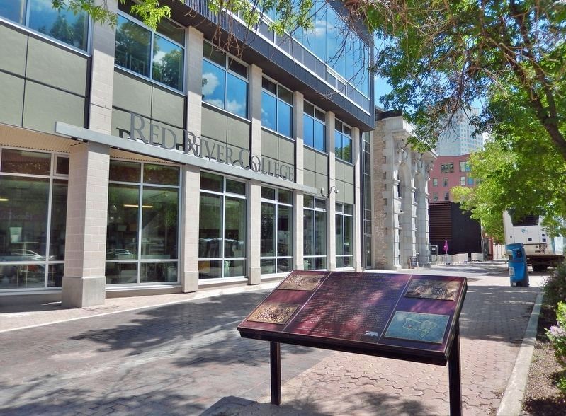
1. The Exchange District / L'Arrondissement de la Bourse Marker

This remarkable group of commercial buildings vividly illustrates Winnipeg’s transformation between 1878 and 1913 from a modest pioneer settlement to Western Canada’s largest metropolitan centre. The district’s banks, warehouses, and early skyscrapers recall the city’s dominance in the fields of finance, manufacturing, wholesale distribution and the international grain trade. Designed by a number of well known architects, these buildings reflect an approach to architecture that was innovative, stylish and functional. The First World War and the Great Depression contributed to the end of Winnipeg’s spectacular boom era. Through the efforts of dedicated citizens since the 1970’s, the Exchange District has been preserved as a distinctive legacy of a formative period in Canada’s economic development.
Ce remarquable ensemble d’édifices commerciaux illustre la transformation de Winnipeg, entre 1878 et 1913, d'un modeste établissement pionnière en métropole de l'Ouest canadien. Banques, entrepôts et premiers gratte-ciel de l‘arrondissement rappellent la prédominance de la ville dans les domaines de la
this page online
Erected by Historic Sites and Monuments Board of Canada/Commission des lieux et monuments historiques du Canada.
Topics and series. This historical marker is listed in these topic lists: Agriculture • Architecture • Industry & Commerce • Settlements & Settlers. In addition, it is included in the Canada, Historic Sites and Monuments Board series list. A significant historical year for this entry is 1878.
Location. 49° 53.945′ N, 97° 8.413′ W. Marker is in Winnipeg, Manitoba. It is in the Exchange District. It is on King Street (Manitoba Route 42) just south of William Avenue, on the right when traveling north.
Photographed by Cosmos Mariner, June 16, 2022
2. The Exchange District / L'Arrondissement de la Bourse Marker

Regionally, this marker is in Historic Winnipeg. It is also in the Prairies. Globally, it is in North America, the Western Hemisphere, the Western World, and the Anglosphere. Historically, it finds itself in what was once a British colony, the Viceroyalty of New France, and Rupert’s Land.
Other nearby markers. At least 8 other markers are within walking distance of this marker: First Headquarters • International Brotherhood of Magicians (within shouting distance of this marker); Union Bank Building (within shouting distance of this marker); Union Bank Building / L’édifice de la Union Bank (within shouting distance of this marker); Court House (within shouting distance of this marker); West Clements Block (Bijou Theatre) (within shouting distance of this marker); Old City Hall (about 90 meters away, measured in a direct line); Abraham Albert Heaps (about 90 meters away); First Salvation Army Meeting West of the Great Lakes

Provincial Archives of Manitoba
3. Marker detail: Exchange District Map
Regarding The Exchange District / L'Arrondissement de la Bourse. National Historic Site of Canada (1997/09/22).
Also see . . .
1. Exchange District National Historic Site of Canada.
The site consists of a densely built, turn-of -the-century warehousing and business centre of some 150 buildings covering 20 city blocks. Most of the district was constructed from about 1880 to 1913, using the most up-to-date construction methods and architectural styles. The intact nature of its densely built grid plan with its many compact masonry structures of limited height, the intensive occupation of the urban lots, and the use of relatively sophisticated turn-of-the-century architectural styles, gives this district a distinct identity within the surrounding city. Official recognition refers to the contributive buildings and landscape within the district boundaries.(Submitted on January 31, 2023, by Cosmos Mariner of Cape Canaveral, Florida.)
2. The Exchange District National Historic Site.
By 1905, Winnipeg was the fastest growing city of its(Submitted on January 31, 2023, by Cosmos Mariner of Cape Canaveral, Florida.)size in North America, gaining a new nickname – “Chicago of the North”. The City's Exchange District, named for the Winnipeg Grain and Produce Exchange founded in 1887, became Winnipeg's economic hub, generating huge fortunes for the businessmen of the day. In 1911, there were twenty-four rail lines converging on the City, establishing it as one of the largest rail centres in the world. As the city flourished, the Exchange became home to dozens of British and Eastern Canadian financial institutions, many of which established their Western Canadian headquarters in Winnipeg. By 1910, twenty such financial institutions claimed space on Main Street's “Bankers Row” creating unrivalled architectural showcases of prosperity and cosmopolitan status. The Exchange District, with its opulent theatres and cabarets, became the entertainment and vaudeville showcase for Western Canada, drawing such legends as Buster Keaton, Charlie Chaplin and the Marx Brothers.Provincial Archives of Manitoba4. Marker detail: Main Street

3. Exchange District.
As Winnipeg began to experience growth in the years following World War II,(Submitted on January 31, 2023, by Cosmos Mariner of Cape Canaveral, Florida.)much of Winnipeg’s downtown development shifted to the area of downtown south of Portage Avenue, particularly along Broadway and on towards Osborne Village. The lack of new development, mixed with the existing demand for inexpensive wholesaling and manufacturing space, left the Exchange District largely intact. As a result, Winnipeg today has one of the most historically intact early 20th century commercial districts in North America.Provincial Archives of Manitoba5. Marker detail: Arthur and Albert streets, ca.1905


Provincial Archives of Manitoba
6. Marker detail: Early Businessmen
Credits. This page was last revised on March 16, 2026. It was originally submitted on January 31, 2023, by Cosmos Mariner of Cape Canaveral, Florida. This page has been viewed 278 times since then and 78 times this year. Photos: 1, 2, 3, 4, 5, 6. submitted on January 31, 2023, by Cosmos Mariner of Cape Canaveral, Florida.
