Waterfront in Boston in Suffolk County, Massachusetts — The American Northeast (New England)
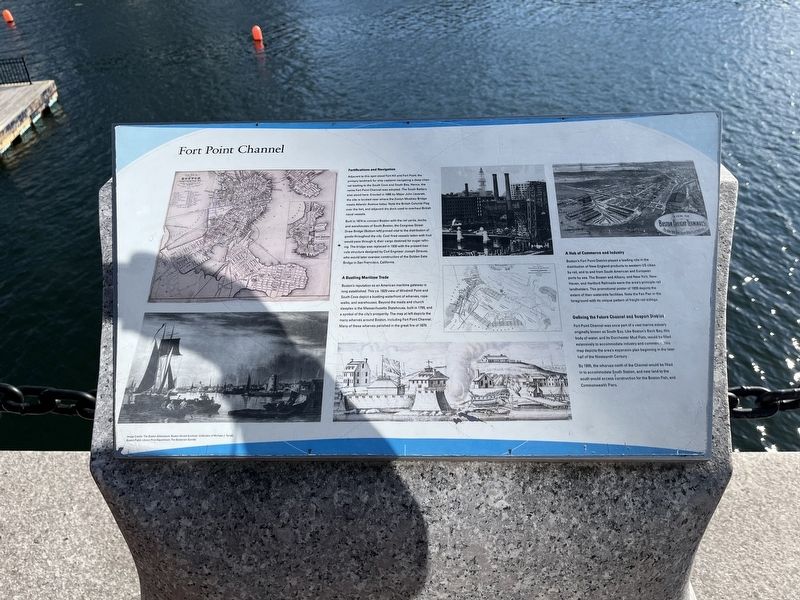
Four Point Channel
Fortifications and Navigation
Adjacent to this spot stood Fort Hill and Fort Point; the primary landmark for ship captains navigating a deep channel leading to the South Cove and South Bay. Hence, the name Fort Point Channel was adopted. The South Battery also stood here. Erected in 1656 by Major John Leverett, the site is located near where the Evelyn Moakley Bridge meets Atlantic Avenue today. Note the British Colonial Flag over the fort, and adjacent dry dock used to overhaul British naval vessels
Built in 1874 to connect Boston with the rial yards, docks, and warehouses of South Boston, the Congress Street Draw Bridge (Bottom left) proved vital to the distribution of goods throughout the city. Coal-fired vessels laden with fruit would pass through it; their cargo destined for sugar refining. The bridge was replaced in 1930 with the present bascule structure designed by Civil Engineer Joseph Strauss, who would later oversee construction of the Golden Gate Bridge in San Francisco, California.
A Bustling Maritime Trade
Boston's reputation as an American maritime gateway is long established. This ca. 1829 view of Windmill Point and South Cove depict a bustling waterfront of wharves, rope-walks, and warehouses. Beyond the masts and church steeples is the Massachusetts Statehouse, built in 1799, and a symbol of the city's prosperity. The map at left depicts the many wharves around Boston, including Four Point Channel Many of these wharves perished in the great fire of 1879.
A Hub of Commerce and Industry
Boston's Fort Point District played a leading role in the distribution of New England products to western US cities by rail, and to and from South American and European ports by sea. The Boston and Albany, and New York, New Haven, and Hartford Railroads were the area's principle rail landholders. This promotional poster of 1899 depicts the extent of their waterside facilities. Note the Fan Pier in the foreground with its unique pattern of freight rial sidings.
Defining the Future Channel and Seaport District
Four Point Channel was once part of a vast marine estuary originally known as South Bay. Like Boston's Back Bay, this body of water, and its Dorchester Mud Flats, would be filled extensively to accommodate industry and commerce. This map depicts the area's expansion plan beginning in the later half of the Nineteenth Century.
By 1895, the wharves north of the Channel would be filled in to accommodate South Station, and new land to the south would access construction for the Boston Fish, and Commonwealth Piers.
Topics. This historical marker is listed in these topic lists: Bridges & Viaducts
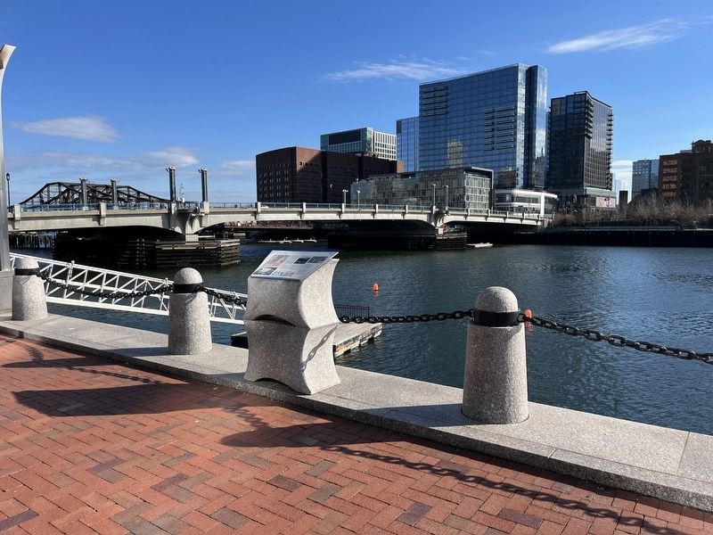
Location. 42° 21.214′ N, 71° 3.078′ W. Marker is in Boston, Massachusetts, in Suffolk County. It is in Waterfront. Marker is on Harborwalk north of Congress Street, on the right when traveling north. Touch for map. Marker is in this post office area: Boston MA 02210, United States of America. Touch for directions.
Other nearby markers. At least 8 other markers are within walking distance of this marker. InterContinental Boston Hotel (a few steps from this marker); The Boston Tea Party (within shouting distance of this marker); Sugar for Rope (about 300 feet away, measured in a direct line); The Great Fire (about 300 feet away); Entrepreneurial Spirit (about 400 feet away); Building Boom (about 400 feet away); Tufts Building (about 400 feet away); Graphic Arts Building (about 500 feet away). Touch for a list and map of all markers in Boston.
Credits. This page was last revised on February 2, 2023. It was originally submitted on February 2, 2023, by Devry Becker Jones of Washington, District of Columbia. This page has been viewed 115 times since then and 44 times this year. Photos: 1, 2. submitted on February 2, 2023, by Devry Becker Jones of Washington, District of Columbia.

