Waterfront in Boston in Suffolk County, Massachusetts — The American Northeast (New England)
The Central Artery / The Rose Kennedy Greenway
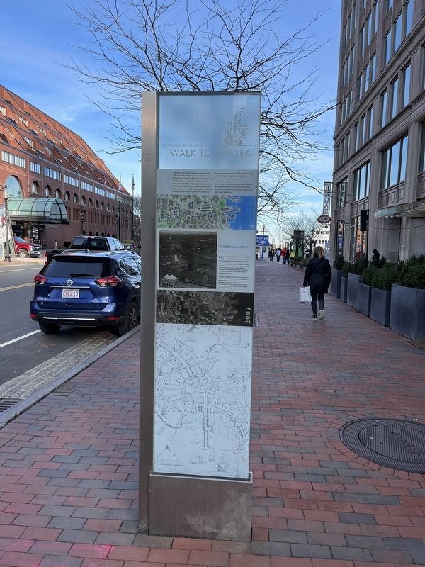
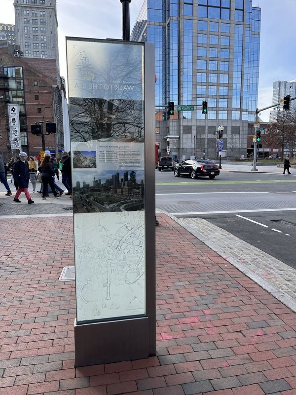
The Norman B. Leventhal Walk to the Sea
The Walk to the Sea encompasses four centuries of Boston history. Beginning at the State House on Beacon Hill, overlooking Boston's ancient Common, the Walk passes among historic landmarks and skyscrapers. The Walk crosses ground that, centuries earlier, was not ground at all but an active harbor. Boston's history is tied to the sea, whose smells and sounds once pervaded the town. the Walk from summit to sea, spanning one mile and descending a hundred feet, brings that history to life.
Mayor Thomas Menino dedicated the Norman B. Leventhal Walk to the Sea in 2008. For more information, explore The Norman B. Leventhal Map Center at the Boston Public Library (www.maps.bpl.org).
The Central Artery
Here stood Boston's "Highway to the Sky," so labeled in the 1950s by local media expressing the official hopes for a new elevated expressway.
Boston's leaders chose to raze hundreds of homes and commercial buildings for the progressive project. The Expressway was to decongest Boston's obsolete and crooked street network and "prune" away decayed portions of the city, inviting new investment downtown.
However, the highway and its supporting structure effectively cut off Boston's North End and waterfront from the rest of the city, and it came to be regarded as an eyesore. When traffic overwhelmed the expressway, Boston sought federal assistance to enlarge and bury the Central Artery, a project known as "The Big Dig."
The Rose Kennedy Greenway
The Rose Kennedy Greenway, completed in 2008, is a network of gardens and public spaces, named for the mother of long-serving, distinguished Massachusetts Senator Edward M. Kennedy and his brothers, President John F. Kennedy and New York Senator Robert F. Kennedy.
The mile-and-a-half Greenway extends from the Leonard P. Zakim Bunker Hill Bridge, past the North End and Wharf District, to Chinatown Gate. The Greenway serenely caps the massive traffic along the expressway buried beneath it.
The "Big Dig," a reconstruction of three-and-a-half miles of expressway, completed in 2007, became known as America's most expensive public works project. Today, traffic is routed underground, and now parks reconnect downtown Boston to the city's historic North End, wharves, and waterfront.
Erected 2008 by City of Boston.
Topics. This historical marker is listed in these topic lists: Industry & Commerce • Parks & Recreational Areas • Roads & Vehicles. A significant historical year for this entry is 2008.
Location. 42° 21.576′ N, 71° 3.096′ W. Marker is in Boston, Massachusetts, in Suffolk
Other nearby markers. At least 8 other markers are within walking distance of this marker. Pollinator Garden on the Greenway (within shouting distance of this marker); 255 State Street Sea Glass (within shouting distance of this marker); Rose Fitzgerald Kennedy Greenway (within shouting distance of this marker); Bumpkin Island (within shouting distance of this marker); Little Brewster Island (within shouting distance of this marker); Georges Island (within shouting distance of this marker); Peddocks Island (within shouting distance of this marker); Lovells Island (within shouting distance of this marker). Touch for a list and map of all markers in Boston.
Credits. This page was last revised on February 6, 2023. It was originally submitted on February 5, 2023, by Devry Becker Jones of Washington, District of Columbia. This page has been viewed 55 times since then and 11 times this year. Photos: 1, 2. submitted on February 5, 2023, by Devry Becker Jones of Washington, District of Columbia.
Editor’s want-list for this marker. A wide shot of the marker in context. • Can you help?

