East Boston in Suffolk County, Massachusetts — The American Northeast (New England)
Crossing the Harbor
East Boston
| — | Harborwalk Boston | — |
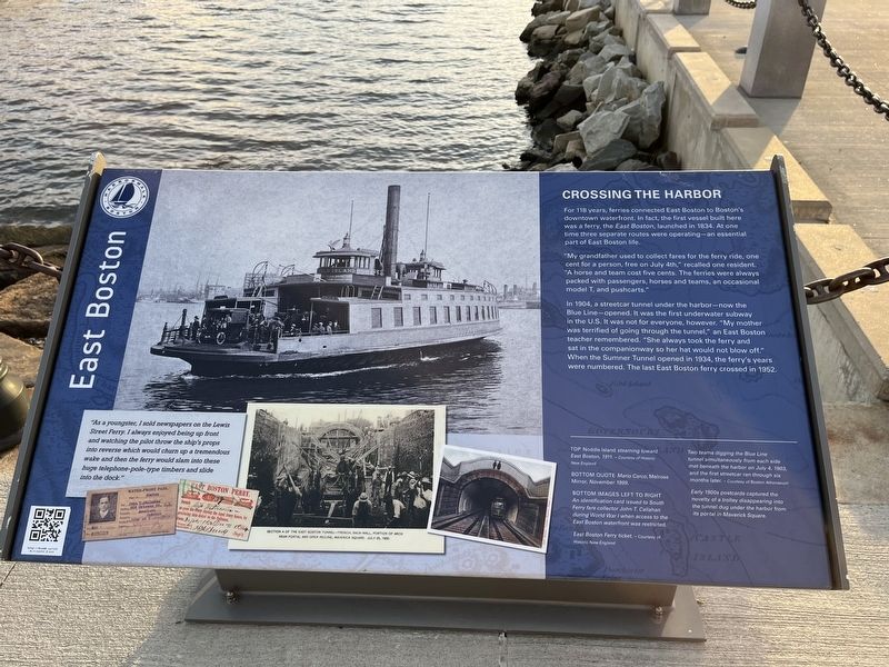
For 118 years, ferries connected East Boston to Boston's downtown waterfront. In fact, the first vessel built here was a ferry, the East Boston, launched in 1834. At one time three separate routes were operating—an essential part of East Boston life.
"My grandfather used to collect fares for the ferry ride, one cent for a person, free on July 4th," recalled one resident. "A horse and team cost five cents. The ferries were always packed with passengers, horses and teams, an occasional model T, and pushcarts."
In 1904, a streetcar tunnel under the harbor—now the Blue Line—opened. It was the first underwater subway in the U.S. It was not for everyone, however. "My mother was terrified of going through the tunnel," an East Boston teacher remembered. "She always took the ferry and sat in the companionway so her hat would not blow off." When the Sumner Tunnel opened in 1934, the ferry's years were numbered. The last East Boston ferry crossed in 1952.
"As a youngster, I sold newspapers on the Lewis Street Ferry. I always enjoyed being up front and watching the pilot throw the ship's props into reverse which would churn up a tremendous wake and then the ferry would slam into these huge telephone-pole-type timbers and slide into the dock."
[Captions:]
Top Noddle Island steaming toward East Boston, 1911.
Bottom Quote Mario Carco, Melrose Mirror, November 1999.
Bottom Images Left to Right
An identification card issued to South Ferry fare collector John T. Callahan during World War I when access to the East Boston waterfront was restricted.
East Boston Ferry ticket.
Two teams digging the Blue Line tunnel simultaneously from each side met beneath the harbor on July 4, 1903, and the first streetcar ran through six months later.
Early 1900s postcards captured the novelty of a trolley disappearing into the tunnel dug under the harbor from its portal in Maverick Square.
Erected by Harborwalk
this page online
Topics. This historical marker is listed in these topic lists: Industry & Commerce • Railroads & Streetcars • Waterways & Vessels. A significant historical date for this entry is July 4, 1834.
Location. 42° 21.982′ N, 71° 2.51′ W. Marker is in Boston, Massachusetts, in Suffolk County. It is in East Boston. It is at the intersection of Lewis Street and East Pier Drive, on the right when traveling south on Lewis Street. Touch for map. Marker is at or near this postal address: 65 Lewis St, East Boston MA 02128, United States of America. Touch for directions.

Regionally, this marker is in Historic Boston. It is also in the American Northeast, in New England, and on the Eastern Seaboard. Globally, it is in the North Atlantic Region, North America, the Western Hemisphere, the Western World, and the Anglosphere. Historically, it finds itself in what was once one of the original Thirteen Colonies.
Other nearby markers. At least 8 other markers are within walking distance of this marker: East Boston (here, next to this marker); "Extraordinary Passage of the Flying Cloud" (a few steps from this marker); View of Boston in 1848.

Credits. This page was last revised on February 6, 2023. It was originally submitted on February 6, 2023, by Devry Becker Jones of Washington, District of Columbia. This page has been viewed 520 times since then and 50 times this year. Photos: 1, 2. submitted on February 6, 2023, by Devry Becker Jones of Washington, District of Columbia.
