Bos en Lommer in Amsterdam, North Holland, Netherlands — Northwestern Europe
Fluwelen Ortelius
Photographed by Andrew Ruppenstein, November 1, 2022
1. Fluwelen Ortelius Marker

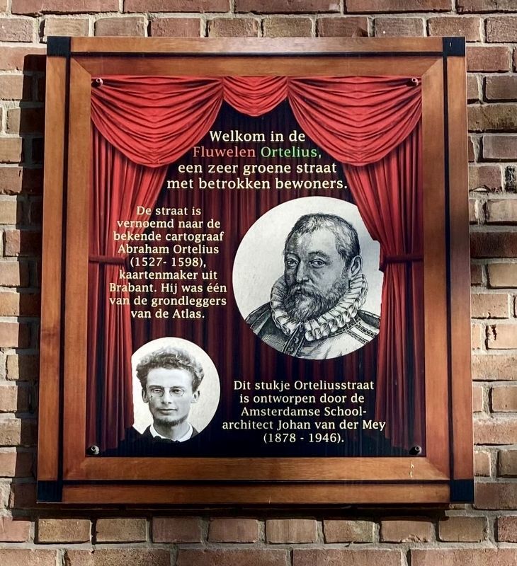
Welkom in de Fluwelen Ortelius, een zeer groene straat met betrokken bewoners.
De straat is vernoemd naar de bekende cartograaf Abraham Ortelius (1527-1598), kaartenmaker uit Brabant. Hij was één van de grondleggers van de Atlas.
Dit stukje Orteliusstraat is ontworpen door de Amsterdamse School- architect Johan van der Mey (1878 - 1946).
Welcome to the Fluwelen Ortelius, a very green street with involved residents.
The street is named after the famous cartographer Abraham Ortelius (1527-1598), mapmaker from Brabant. He was one of the creators of the Atlas.
This stretch of Orteliusstraat was designed by the Amsterdam School architect Johan van der Mey (1878 - 1946).
Topics. This historical marker is listed in these topic lists: Architecture • Science & Medicine.
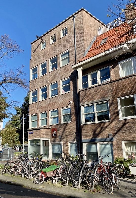
Location. 52° 22.502′ N, 4° 50.806′ E. Marker is in Amsterdam, Noord-Holland (North Holland). It is in Bos en Lommer. It is at the intersection of Orteliusstraat and Erasmusgracht, on the left when traveling south on Orteliusstraat. Touch for map.
this page online

Regionally, it is in Europe, the European Union, Atlantic Europe, the Benelux Low Countries, the Schengen Area, Western Europe, and the Western World. Historically, it finds itself in what was once the Holy Roman Empire.
Other nearby markers. At least 8 other markers are within walking distance of this marker: Erasmus (about 210 meters away, measured in a direct line); James Clark Ross (about 210 meters away); Roald Amundsen (approx. 0.2 kilometers away); Mariken van Nieumeghen (approx. 0.2 kilometers away); Lanseloet / Lancelot (approx. 0.3 kilometers away); Hendrik Conscience: De Leeuw van Vlaanderen / The Lion of Flanders (approx. 0.3 kilometers away); Ernest Henry Shackleton (approx. 0.4 kilometers away); Fanny Blankers-Koen (approx. 0.4 kilometers away). Touch for a list and map of all markers in Amsterdam.
Also see . . . Abraham Ortelius (Wikipedia).
Overview: Abraham Ortelius (also Ortels, Orthellius, Wortels; 4 or 14 April 1527 – 28 June 1598) was a Brabantian cartographer,(Submitted on February 7, 2023.)geographer, and cosmographer. He is recognized as the creator of the first modern atlas, the Theatrum Orbis Terrarum (Theatre of the World). Along with Gemma Frisius and Gerardus Mercator, Ortelius is generally considered one of the founders of the Netherlandish school of cartography and geography. He was a notable figure of this school in its golden age (approximately 1570s–1670s) and an important geographer of Spain during the age of discovery. The publication of his atlas in 1570 is often considered as the official beginning of the Golden Age of Netherlandish cartography. He was the first person proposing that the continents were joined before drifting to their present positions.Photographed by Andrew Ruppenstein, November 1, 20222. Fluwelen Ortelius Marker - wide view
Additional keywords. Cartography
Credits. This page was last revised on December 31, 2023. It was originally submitted on February 7, 2023, by Andrew Ruppenstein of Lamorinda, California. This page has been viewed 253 times since then and 18 times this year. Photos: 1, 2. submitted on February 7, 2023, by Andrew Ruppenstein of Lamorinda, California.
