
San Diego in Cartagena de Indias in Municipio de Cartagena, Bolívar, Colombia — Northwestern South America
Vaults Barracks

Photographed by James Hulse, February 4, 2023
1. Vaults Barracks Marker

Forma parte del recinto amurallado del Centro Histórico de Cartagena. Este inmueble está incorporado a la cortina de muralla que conecta el baluarte de Santa Catalina con el de Santa Clara. Edificación colonial (1798) de corte renacentista conformada por 24 bóvedas a prueba de bombas y 44 arcos de medio punto que actúan como un pórtico galería que corre a lo largo de toda la fachada principal y obedece a un diseño simétrico. Engalana y jerarquiza su fachada con un frontón central que alberga en su tímpano un blasón tallado en piedra. Fueron construidas por el Ing. Antonio de Arévalo, dada la necesidad de alojamientos para la crecida guarnición, aprovechando el lienzo de muralla entre los baluartes de Santa Catalina y Santa Clara.
Cuartel de las Bóvedas
Fotografía: Harvin Lewis
Patrimonio Mundial - UNESCO-1984
English:
El barrio de San Diego, denominado antiguamente "Barrio de los Jagüeyes" porque casi todas las casas poseían jagüeyes o aljibes de donde se proveían de agua residentes y vecinos, constituye una parte fundamental del Centro Histórico de Cartagena de Indias.
El centro historico de Cartagena, «La Ciudad Amurallada», fue declarada Patrimonio Nacional de Colombia en el año 1959, mientras que en 1984, el Comité del Patrimonio de la Humanidad de la UNESCO la incluyó en la lista del patrimonio mundial como «Puerto, Fortaleza y Conjunto Monumental de Cartagena de Indias».
English:
The historic center of Cartagena, «The Walled City», was declared a National Heritage of Colombia in 1959, while in 1984, the Committee of World Heritage of UNESCO included it on the World Heritage List as «Port, Monumental Complex and Fortress of Cartagena de Indias».
Erected 1984
this page online
Topics. This historical marker is listed in these topic lists: Architecture • Colonial Era • Forts and Castles. A significant historical year for this entry is 1959.
Location. 10° 25.805′ N, 75° 32.765′ W. Marker is in Cartagena de Indias, Bolívar, in Municipio de Cartagena. It is in San Diego. It is at the intersection of Carrera 2 and Calle del Jardin, in the median on Carrera 2. The marker is located along the median of the Plaza de las Bóvedas (Former dungeon housing souvenir shops). Touch for map. Marker is at or near this postal address: Cra 2 39182, Cartagena de Indias, Bolívar 130001, Colombia. Touch for directions.

Regionally, it is on the Caribbean Sea, in South America, in a Andean South America country, in the Pacific Rim, and in the Western Hemisphere. Historically, it finds itself in what was once a Spanish colony.
Other nearby markers. At least 8 other markers are within walking distance of this marker: San Juan Bosco (within shouting distance of this marker); Adolfo Mejia Theater (approx. 0.7 kilometers away); Mercy Square (approx. 0.7

Photographed by James Hulse, February 4, 2023
2. Reverse Side - Vaults Barracks Marker
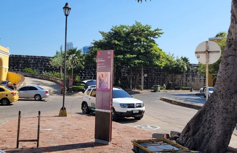
Photographed by James Hulse, February 4, 2023
3. The view of the front side of the Marker from the median
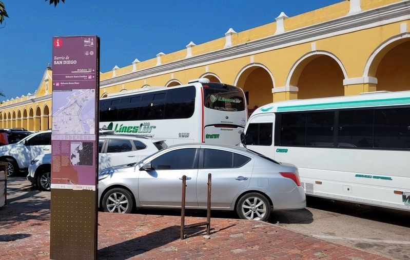
Photographed by James Hulse, February 4, 2023
4. The reverse side of the Marker with Las Bóvedas in the background
Credits. This page was last revised on February 11, 2023. It was originally submitted on February 10, 2023, by James Hulse of Medina, Texas. This page has been viewed 134 times since then and 5 times this year. Photos: 1, 2, 3, 4. submitted on February 10, 2023, by James Hulse of Medina, Texas.
