North Bay in Nipissing District, Ontario — Central Canada (North America)
Golf Street / Lee Park
North Bay Heritage Site
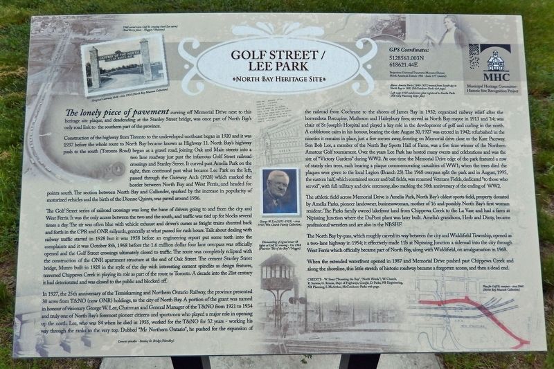
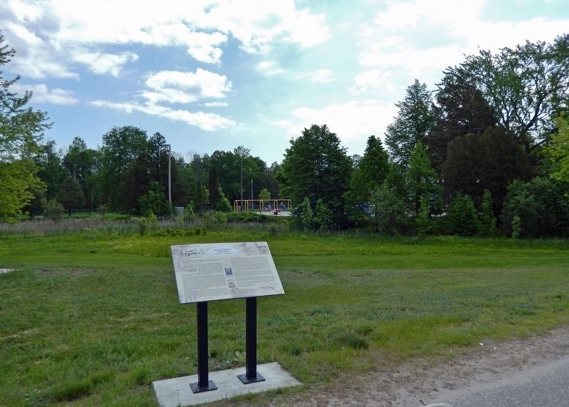
The lonely piece of pavement curving off Memorial Drive next to this heritage site plaque, and deadending at the Stanley Street bridge, was once part of North Bay's only road link to the southern part of the province.
Construction of the highway from Toronto to the undeveloped northeast began in 1920 and it was 1937 before the whole route to North Bay became known as Highway 11. North Bay's highway push to the south (Toronto Road) began as a gravel road, joining Oak and Main streets into a two lane roadway just past the infamous Golf Street railroad crossings and Stanley Street. It curved past Amelia Park on the right, then continued past what became Lee Park on the left, passed through the Gateway Arch (1928) which marked the border between North Bay and West Ferris, and headed for points south. The section between North Bay and Callander, sparked by the increase in popularity of motorized vehicles and the birth of the Dionne Quints, was paved around 1936.
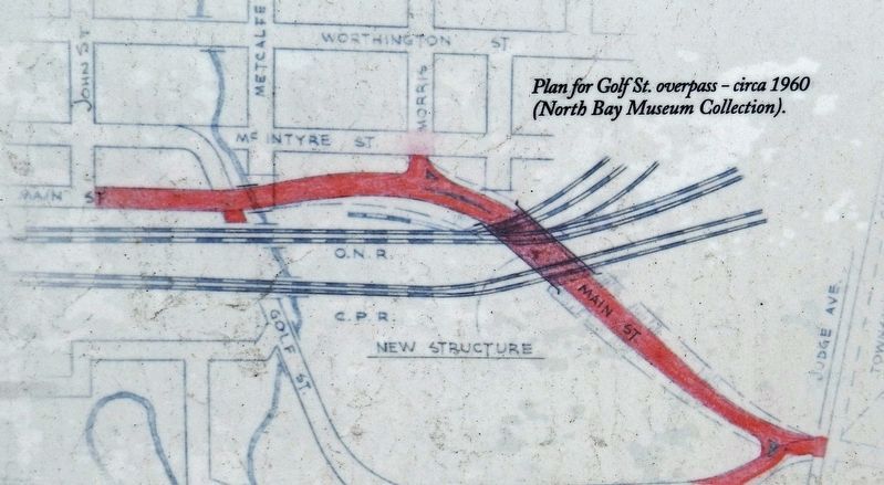
The Golf Street series of railroad crossings was long the bane of drivers going to and from the city and West Ferris. It was the only access between the two and the south, and traffic was tied up for blocks several times a day. The air was often blue with vehicle exhaust and driver's curses as freight trains shunted back and forth in the CPR and ONR railyards, generally at what passed for rush hours. Talk about dealing with railway traffic started in 1928 but it was 1958 before an engineering report put some teeth into the complaints and it was October 8th, 1968 before the 1.6 million dollar four lane overpass was officially opened and the Golf Street crossings ultimately closed to traffic. The route was completely eclipsed with the construction of the ONR apartment structure at the end of Oak Street. The cement Stanley Street bridge, Munro built in 1928 in the style of the day with interesting cement spindles as design features, traversed Chippewa Creek in playing its role as part of the route to Toronto. A decade into the 21st century it had deteriorated and was closed to the public and blocked off.
In 1927, the 25th anniversary of the Temiskaming and Northern Ontario Railway, the province presented 30 acres from T&NO (now ONR) holdings, to the city of North Bay. A portion of the grant was named in honour of visionary George W Lee, Chairman and General Manager of the T&NO from 1921 to 1934 and truly one of North Bay's foremost pioneer citizens and sportsmen who played a major role in opening up the north. Lee, who was 84 when he died in 1955, worked for the T&NO for 32 years working his way through the ranks to the very top. Dubbed "Mr Northern Ontario", he pushed for the expansion of the railroad from Cochrane to the shores of James Bay in 1932; organized railway relief after the horrendous Porcupine, Matheson and Haileybury fires; served as North Bay mayor in 1913 and '14; was chair of St Joseph's Hospital and played a key role in the development of golf and curling in the north. A cobblestone cairn in his honour, bearing the date August 30, 1927 was erected in 1942; refurbished in the nineties it remains in place, just a few metres away, fronting on Memorial drive close to the Kate Paceway. Son Bob Lee, a member of the North Bay Sports Hall of Fame, was a five time winner of the Northern Amateur Golf tournament. Over the years Lee Park has hosted many events and celebrations and was the site of "Victory Gardens" during WW2. At one time the Memorial Drive edge of the park featured a row of stately elm trees, each bearing a plaque commemorating casualties of WW1; when the trees died the plaques were given to the local Legion (Branch 23). The 1968 overpass split the park and in August, 1995, the eastern half; which contained soccer and ball fields, was renamed Veterans Fields, dedicated "to those who served", with full military and civic ceremony, also marking the 50th anniversary of the ending of WW2.
The athletic field across Memorial Drive is Amelia Park, North Bay's oldest sports field, property donated by Amelia Parks, pioneer landowner, businesswoman, mother of 16 and possibly
North Bay's first woman resident. The Parks family owned lakefront land from Chippewa Creek to the La Vase and had a farm at Nipissing Junction where the DuPont plant was later built. Amelia's grandsons, Herb and Dinty, became professional wrestlers and are also in the NBSHF.
The North Bay by-pass, which roughly carved its way between the city and Widdifield Township, opened as a two-lane highway in 1954; it effectively made 11b at Nipissing Junction a sideroad into the city through West Ferris which officially became part of North Bay, along with Widdifield, on amalgamation in 1968.
When the extended waterfront opened in 1987 and Memorial Drive pushed past Chippewa Creek and along the shoreline, this little stretch of historic roadway became a forgotten access, and then a dead end.
CREDITS - W. Steer ("Boosting the Bay", "North Words"), W. Church, R. Surtees, G. Rennie, Dept of Highways, Google, D. Parks, NB Engineering, NB Planning, S. McArthur, McCutcheon-Parks web page.
[photo captions]
1968 aerial view Golf Street crossing (note Lee cairn).
Original Gateway Arch, circa 1930.
George W. Lee (1871-1955), circa 1950.
Dismantling of signal tower & lights at Golf Street crossing Oct 1968.
Cement spindles Stanley Street Bridge.
Amelia Parks (1840-1927) moved from Sundridge to North Bay in 1882.
1910 subdivision plan registered to Amelia Parks.
Plan for Golf St. overpass, circa 1960.
Erected by Municipal Heritage Committee Historic Site Recognition Project.
Topics. This historical marker is listed in these topic lists: Parks & Recreational Areas • Railroads & Streetcars • Roads & Vehicles • Sports. A significant historical year for this entry is 1920.
Location. 46° 18.012′ N, 79° 27.579′ W. Marker is in North Bay, Ontario, in Nipissing District. Marker is at the intersection of Memorial Drive and Stanley Street, on the right when traveling north on Memorial Drive. Marker is located beside the sidewalk, near the northwest corner of Lee Park. Touch for map. Marker is at or near this postal address: 800 Memorial Drive, North Bay ON P1A 1T6, Canada. Touch for directions.
Other nearby markers. At least 8 other markers are within walking distance of this marker. Jean Nicolet (approx. 0.3 kilometers away); Gateway of the North Arch (approx. 0.3 kilometers away); The CF100 Canuck (approx. 0.4 kilometers away); The Bomarc Missile (approx. 0.4 kilometers away); New Ontario Brewing Co. Ltd. (approx. 0.4 kilometers away); Veterans Fields (approx. half a kilometer away); The Ontario Northland Railway (approx. half a kilometer away); Carnegie Library (approx. one kilometer away). Touch for a list and map of all markers in North Bay.
Related markers. Click here for a list of markers that are related to this marker. North Bay Heritage Sites
Also see . . . The History of Highway 11.
The formative years of this development were so precarious that the young highway required visitors to sign in, register their vehicles, and receive a permit to travel northwards. A toll booth was located just north of Thibeault Hill in North Bay, near Cooks Mill Rd., just past the psychiatric hospital, and was open for the summer season only. You took your chances driving northwards. The birth of the Dionne Quintuplets on May 28, 1934, and the increasing popularity of vacations spawned the early beginnings of Northeastern Ontario tourism using Highway 11 North. It was the very beginnings of hunting and fishing and family vacations.(Submitted on February 13, 2023, by Cosmos Mariner of Cape Canaveral, Florida.)
Credits. This page was last revised on February 14, 2023. It was originally submitted on February 11, 2023, by Cosmos Mariner of Cape Canaveral, Florida. This page has been viewed 140 times since then and 39 times this year. Photos: 1, 2, 3. submitted on February 13, 2023, by Cosmos Mariner of Cape Canaveral, Florida.


