Near Ekalaka in Carter County, Montana — The American West (Mountains)
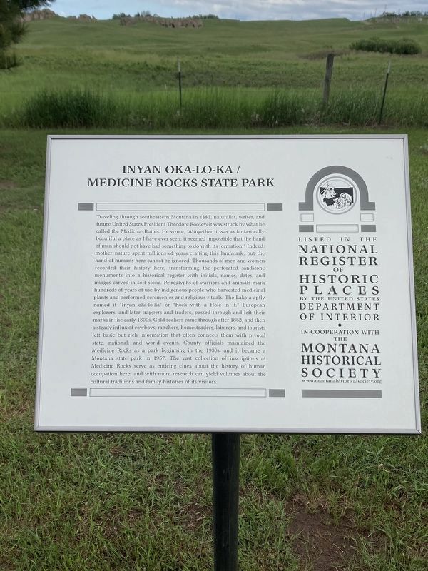
Inyan Oka-lo-ka / Medicine Rocks State Park
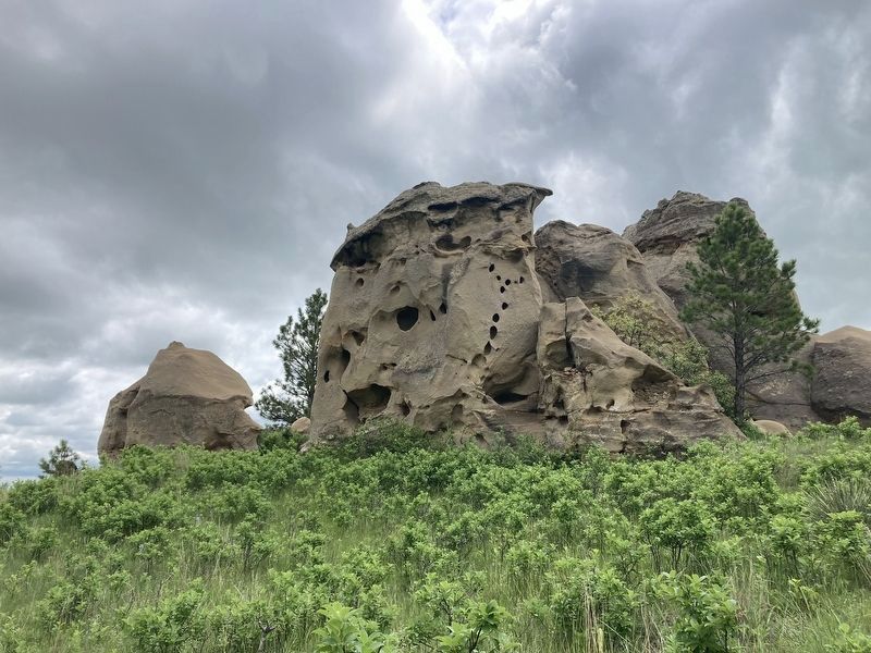
Traveling through southeastern Montana in 1883, naturalist, writer, and future United States President Theodore Roosevelt was struck by what he called the Medicine Buttes. He wrote, "Altogether it was as fantastically beautiful a place as I have ever seen: it seemed impossible that the hand of man should not have had something to do with its formation." Indeed, mother nature spent millions of years crafting this landmark, but the hand of humans here cannot be ignored. Thousands of men and women recorded their history here, transforming the perforated sandstone monuments into a historical register with initials, names, dates, and images carved in soft stone. Petroglyphs of warriors and animals mark hundreds of years of use by indigenous people who harvested medicinal plants and performed ceremonies and religious rituals. The Lakota aptly named it "Inyan oka-lo-ka" or "Rock with a Hole in it." European explorers, and later trappers and traders, passed through and left their marks in the early 1800s. Gold seekers came through after 1862, and then a steady influx of cowboys, ranchers, homesteaders, laborers, and tourists left basic but rich information that often connects them with pivotal state, national, and world events. County officials maintained the Medicine Rocks as a park beginning in the 1930s, and it became a Montana state park in 1957. The vast collection of inscriptions at Medicine Rocks serve as enticing clues about the history of human occupation here, and with more research can yield volumes about the cultural traditions and family histories of its visitors.
Erected by Montana Historical Society.
Topics. This historical marker is listed in these topic lists: Environment • Paleontology • Parks & Recreational Areas. A significant historical year for this entry is 1883.
Location. 46° 2.74′ N, 104° 27.508′ W. Marker is near Ekalaka, Montana, in Carter County. Marker is on Montana Route 7, on the right when traveling south. Touch for map. Marker is at or near this postal address: 1141 MT-7, Ekalaka MT 59324, United States of America. Touch for directions.
Other nearby markers. At least 7 other markers are within 12 miles of this marker, measured as the crow flies. A Fantastically Beautiful Place: The Medicine Rocks (a few steps from this marker); Home on the Range (approx. half a mile away); A River Ran Through It (approx. half a mile away); Prairie Island (approx. 0.8 miles away); Inyan-oka-la-ka (approx. one mile away); Ekalaka (approx. 10˝ miles away); First National Bank of Ekalaka / Rickard Hardware Building (approx. 11.6 miles away).
Credits. This page was last revised on February 24, 2023. It was originally submitted on February 11, 2023, by Connor Olson of Kewaskum, Wisconsin. This page has been viewed 78 times since then and 23 times this year. Photos: 1, 2. submitted on February 11, 2023, by Connor Olson of Kewaskum, Wisconsin. • J. Makali Bruton was the editor who published this page.

