Deanburg near Henderson in Chester County, Tennessee — The American South (East South Central)
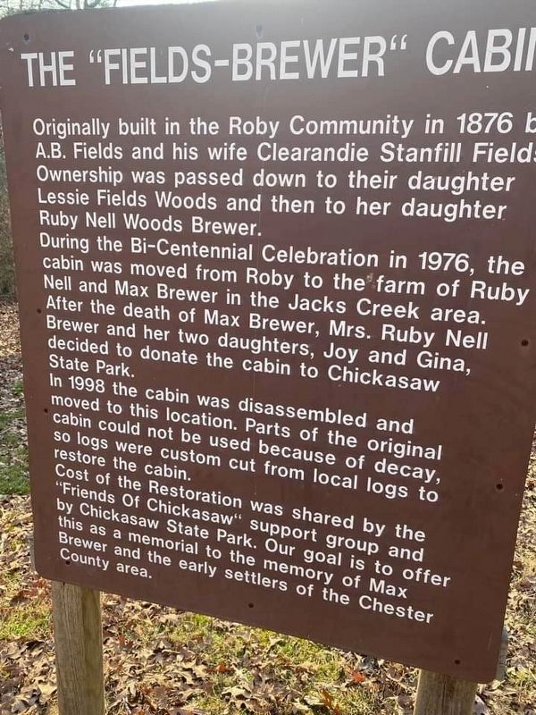
The "Fields-Brewer" Cabin
Photographed by David Austin
1. The "Fields-Brewer" Cabin Marker
During the Bi-Centennial Celebration in 1976, the cabin was moved from Roby to the farm of Ruby Nell and Max Brewer in the Jacks Creek area. After the death of Max Brewer, Mrs. Ruby Nell Brewer and her two daughters, Joy and Gina, decided to donate the cabin to Chickasaw State Park.
In 1998 the cabin was disassembled and moved to this location. Parts of the original cabin could not be used because of decay, so logs were custom cut from local logs to restore the cabin.
Cost of the Restoration was shared by the "Friends of Chickasaw" support group and by Chickasaw State Park. Our goal is to offer this as a memorial to the memory of Max Brewer and the early settlers of the Chester County area.
Erected by Chickasaw State Park.
Topics. This historical marker is listed in these topic lists: Agriculture • Architecture • Settlements & Settlers. A significant historical year for this entry is 1876.
Location. 35° 23.582′ N,
this page online

Regionally, this marker is in West Tennessee. It is also in the American South and specifically in the Upper South. Globally, it is in North America, the Western Hemisphere, the Western World, and the Anglosphere. Historically, it finds itself in what was once the territory of the Mississippian Culture, one of the Confederate States of America, and the Antebellum South.
Other nearby markers. At least 8 other markers are within 9 miles of this marker, measured as the crow flies: Chickasaw State Park (approx. ¼ mile away); Armstrong's Raid (approx. 6.9 miles away); Pinson Mounds (approx. 7.4 miles away); Mark Perrin Lowrey (approx. 8.1 miles away); Henderson at War (approx. 8.1 miles away); Historic Front Street (approx. 8.1 miles away); Eddy Arnold (approx. 8.2 miles away); Tornado of 1952 (approx. 8.2 miles away). Touch for a list and map
Photographed by David Austin, February 9, 2023
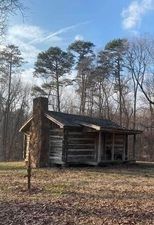
2. The "Fields-Brewer" Cabin Marker
Fields-Brewer Cabin
Photographed by David Austin, February 9, 2023
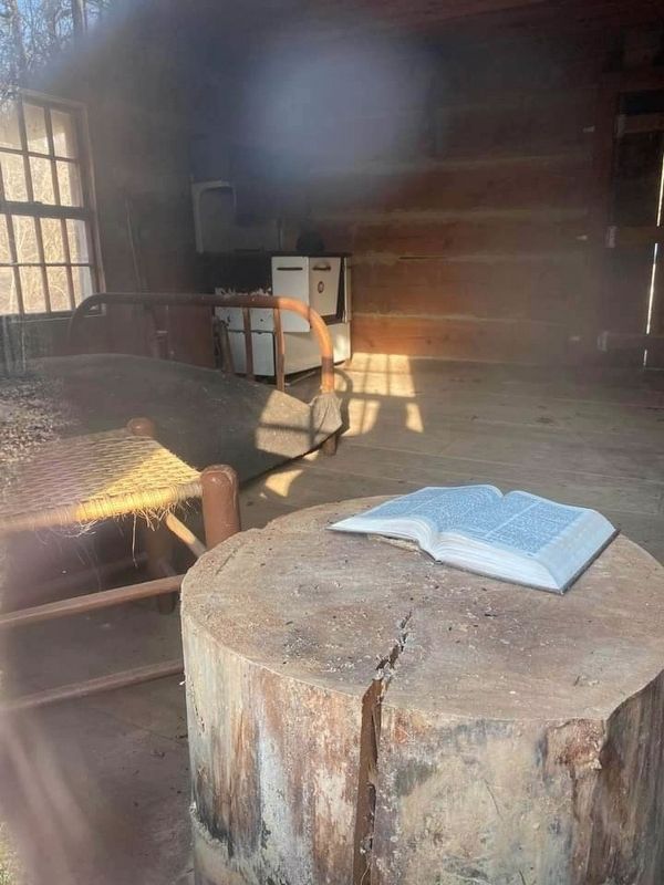
3. The "Fields-Brewer" Cabin Marker
Interior of Fields-Brewer Cabin
Credits. This page was last revised on February 20, 2023. It was originally submitted on February 11, 2023, by David Austin of Scotts Hill, Tennessee. This page has been viewed 388 times since then and 49 times this year. Photos: 1, 2, 3. submitted on February 11, 2023, by David Austin of Scotts Hill, Tennessee. • Bill Pfingsten was the editor who published this page.
