El Centro in Cartagena de Indias in Municipio de Cartagena, Bolívar, Colombia — Northwestern South America
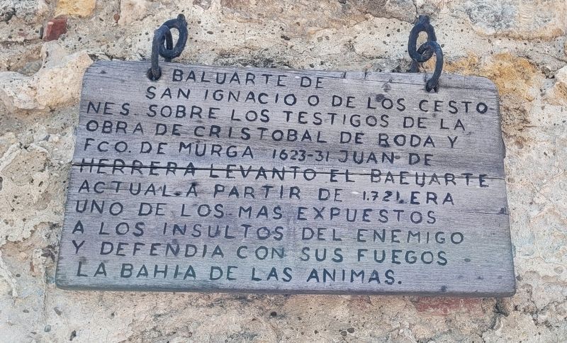
Bastion of San Ignacio or the Baskets
Photographed by James Hulse, February 4, 2023
1. Bastion of San Ignacio or the Baskets Marker

English translation:
Topics. This historical marker is listed in these topic lists: Colonial Era • Forts and Castles. A significant historical year for this entry is 1721.
Location. 10° 25.272′ N, 75° 33.052′ W. Marker is in Cartagena de Indias, Bolívar, in Municipio de Cartagena. It is in El Centro. It is at the intersection of Carrera 4 and Calle San Pedro Claver, on the left when traveling west on Carrera 4. The marker is located along the fort wall about 100 feet south of the San Pedro Claver Church. Touch for map. Marker is at or near this postal
this page online

Regionally, it is on the Caribbean Sea, in South America, in a Andean South America country, on the Pacific Rim, and in the Western Hemisphere. Historically, it finds itself in what was once a Spanish colony.
Other nearby markers. At least 8 other markers are within walking distance of this marker: San Ignacio de Loyola Bastion (here, next to this marker); San Pedro Claver Sanctuary Museum (within shouting distance of this marker); San Pedro Claver Square (within shouting distance of this marker); San Pedro Claver Parish and Sanctuary (within shouting distance of this marker); Admiral Jose Padilla (about 120 meters away, measured in a direct line); Admiral Lino de Clemente y Palacios (about 120 meters away); Juan Pablo Duarte y Diez (about 120 meters away); Colombia a Sus Valiosos Hombres de Mar (Colombia to Her Brave Seamen) (about 120 meters away). Touch for a list and map of all markers in Cartagena de Indias.
Photographed by James Hulse, February 4, 2023
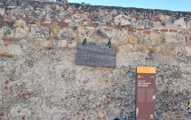
2. The Bastion of San Ignacio or the Baskets Marker is on the left top
Credits. This page was last revised on February 14, 2023. It was originally submitted on February 14, 2023, by James Hulse of Medina, Texas. This page has been viewed 190 times since then and 24 times this year. Photos: 1, 2. submitted on February 14, 2023, by James Hulse of Medina, Texas.
