Glacier to Gorge
An Incredible Diversion
— Pine Creek Rail Trail —
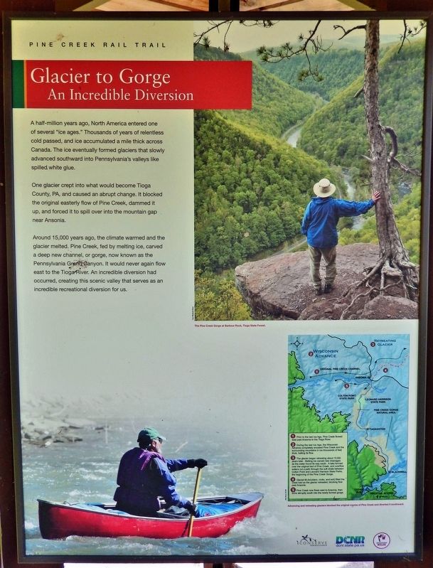
A half-million years ago, North America entered one of several "ice ages." Thousands of years of relentless cold passed, and ice accumulated a mile thick across Canada. The ice eventually formed glaciers that slowly advanced southward into Pennsylvania's valleys like spilled white glue.
One glacier crept into what would become Tioga County, PA, and caused an abrupt change. It blocked the original easterly flow of Pine Creek, dammed it up, and forced it to spill over into the mountain gap near Ansonia.
Around 15,000 years ago, the climate warmed and the glacier melted. Pine Creek, fed by melting ice, carved a deep new channel, or gorge, now known as the Pennsylvania Grand Canyon. It would never again flow east to the Tioga River. An incredible diversion had occurred, creating this scenic valley that serves as an incredible recreational diversion for us.
Erected by Pennsylvania Department of Conservation and Natural Resources.
Topics and series. This historical marker is listed in these topic lists: Parks & Recreational Areas • Waterways & Vessels. In addition, it is included in the National Natural Landmarks series list.
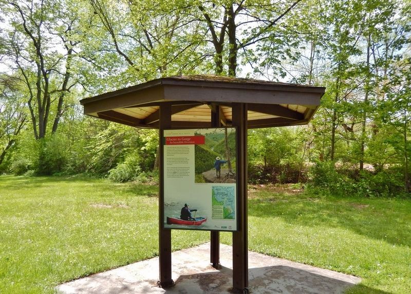
Location. 41° 13.27′ N, 77° 19.168′ W. Marker is near Jersey Shore, Pennsylvania, in Lycoming County. It is in Watson Township. Marker can be reached from Pennsylvania Route 44, 0.1 miles north of Furnace Run Road, on the left when traveling north. Marker is mounted on an interpretive kiosk on the southeast side of the Pine Creek Rail Trail Whitetail Trailhead parking lot. Touch for map. Marker is in this post office area: Jersey Shore PA 17740, United States of America. Touch for directions.
Other nearby markers. At least 8 other markers are within 4 miles of this marker, measured as the crow flies. Pine Creek's Path Through History (here, next to this marker); Tiadaghton Elm (approx. 2.1 miles away); Pine Creek Presbyterian Church (approx. 3 miles away); Jersey Shore Cemetery War Memorial (approx. 3.2 miles away); a different marker also named Pine Creek Presbyterian Church (approx. 3˝ miles away); a different marker also named Tiadaghton Elm (approx. 3.6 miles away); War Memorial (approx. 3.6 miles away); Spanish-American War Memorial (approx. 3.6 miles away). Touch for a list and map of all markers in Jersey Shore.
Regarding Glacier to Gorge. Pine Creek Gorge, National Natural Landmark (1968). Pine Creek Gorge contains superlative scenery, geological and ecological value, and is one of the finest examples of a deep gorge in the eastern United States.
Also see . . . Pine Creek Gorge.
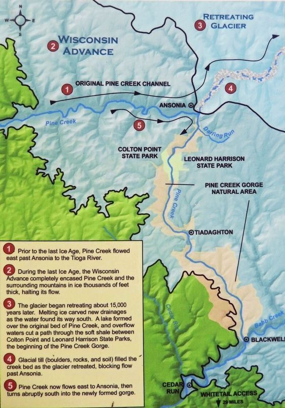
Pine Creek Gorge, sometimes called The Grand Canyon(Submitted on February 16, 2023, by Cosmos Mariner of Cape Canaveral, Florida.)of Pennsylvania, is a 47-mile gorge carved into the Allegheny Plateau by Pine Creek in north-central Pennsylvania. Pine Creek had flowed northeasterly until about 20,000 years ago, when the receding Laurentide Continental Glacier dammed it with rocks, soil, and other debris. Glacial meltwater formed a lake near the present town of Ansonia, and when it overflowed the debris dam, the creek flooded to the south. Ultimately, it carved a deep channel on its way south to the West Branch Susquehanna River.Courtesy Matt Reed, DCNR2. Marker detail: Pine Creek DiversionAdvancing and retreating glaciers blocked the original course of Pine Creek and diverted it southward.1 • Prior to the last Ice Age, Pine Creek flowed east past Ansonia to the Tioga River.
2 • During the last Ice Age, the Wisconsin Advance completely encased Pine Creek and the surrounding mountains in ice thousands of feet thick, halting its flow.
3 • The glacier began retreating about 15,000 years later. Melting ice carved new drainages as the water found its way south. A lake formed over the original bed of Pine Creek, and overflow waters cut a path through the soft shale between Colton Point and Leonard Harrison State Parks, the beginning of the Pine Creek Gorge.
4 • Glacial till (boulders, rocks, and soil) filled the creek bed as the glacier retreated, blocking flow past Ansonia.
5 • Pine Creek now flows east to Ansonia, then turns abruptly south into the newly formed gorge.
Credits. This page was last revised on February 16, 2023. It was originally submitted on February 15, 2023, by Cosmos Mariner of Cape Canaveral, Florida. This page has been viewed 129 times since then and 23 times this year. Photos: 1, 2, 3. submitted on February 16, 2023, by Cosmos Mariner of Cape Canaveral, Florida.


