Thelka in San Antonio in Bexar County, Texas — The American South (West South Central)
Concepción Park
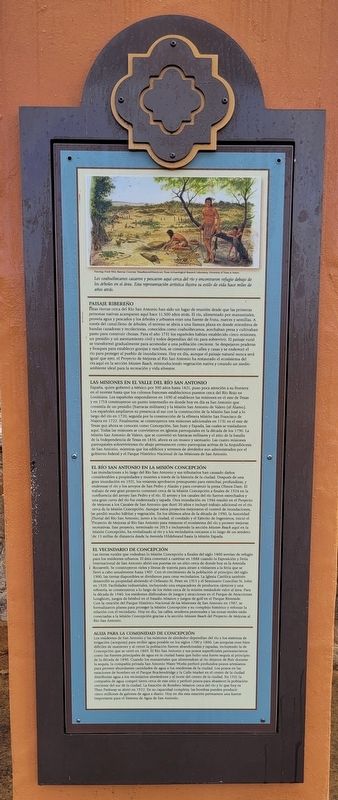
Estas tierras cerca del Rio San Antonio han sido un lugar de reunión desde que las primeras personas nativas acamparan aquí hace 11.500 años atrás. El río, alimentado por manantiales, provela agua y pescados y los árboles y arbustos eran una fuente de fruta, nueces y semillas. A través del canal lleno de árboles, el terreno se abría a una llanura plana en donde miembros de bandas cazadoras y recolectoras, conocidos como coahuiltecanos, acechaban presa y cultivaban pasto para construir chozas. Para el año 1731 los españoles hablan establecido cinco misiones, un presidio y un asentamiento civil y todos dependían del río para sobrevivir. El paisaje rural se transformó gradualmente para acomodar a una población creciente. Se despejaron praderas y bosques para establecer granjas y ranchos, se construyeron calles y casas y se enderezó el rio para proteger al pueblo de inundaciones. Hoy en día, aunque el paisaje natural nunca será igual que ayer, el Proyecto de Mejoras al Río San Antonio ha restaurado el ecosistema del rio aquí en la sección Mission Reach, reintroduciendo vegetación nativa y creando un medio ambiente ideal para la recreación y vida silvestre.
Las Misiones en El Valle Del Río San Antonio
España, quien gobernó a México por 300 años hasta 1821, puso poca atención a su frontera en el noreste hasta que los colonos franceses establecieron puestos cerca del Rio Rojo en Louisiana. Los españoles respondieron en 1690 al establecer las misiones en el este de Texas y en 1718 construyeron un punto intermedio en donde hoy en día es San Antonio que consistía de un presidio (barracas militares) y la Misión San Antonio de Valero (el Álamo). Los españoles ampliaron su presencia al sur con la construcción de la Misión San José a lo largo del río en 1720, seguida por la construcción de la effmera Misión San Francisco de Najera en 1722. Finalmente, se construyeron tres misiones adicionales en 1731 en el este de Texas que ahora se conocen como Concepción, San Juan y Espada, las cuales se trasladaron aquí. Todas las misiones se convirtieron en iglesias parroquiales en la década de los 1790. La Misión San Antonio de Valero, que se convirtió en barracas militares y el sitio de la batalla de la Independencia de Texas en 1836, ahora es un museo y santuario. Las cuatro misiones parroquiales sobrevivientes to abajo permanecen como parroquias activas de la Arquidiócesis de San Antonio, mientras que los edificios y terrenos de alrededor son administrados por el gobierno
federal y el Parque Histórico Nacional de las Misiones de San Antonio.
El Río San Antonio en La Misión Concepción
Las inundaciones a lo largo del Río San Antonio y sus tributarios han causado daños considerables a propiedades y muertes a través de la historia de la ciudad. Después de una gran inundación en 1921, los votantes aprobaron presupuesto para estrechar, profundizar, y enderezar el río y los arroyos de San Pedro y Alazán y para construir la presa Olmos Dam. El trabajo de este gran proyecto comenzó cerca de la Misión Concepción a finales de 1924 en la confluencia del arroyo San Pedro y el río. El arroyo y los canales del río fueron estrechados y una gran curva del río fue enderezada y tapada. Oura inundación en 1946 resultó en el Proyecto de Mejoras a los Canales de San Antonio que duro 20 años e incluyó trabajo adicional en el río cerca de la Misión Concepción. Aunque estos proyectos mejoraron el control de inundaciones, se perdió mucho hábitat y vegetación. En los últimos años de la década de 1990, la Autoridad Fluvial del Rio San Antonio, junto a la ciudad, el condado y el Ejército de Ingenieros, inició el Proyecto de Mejoras al Rio San Antonio para restaurar el ecosistema del río y proveer mejoras recreativas. Este proyecto, terminado en 2013 e incluyendo la sección Mission Reach aquí en la Misión Concepción, ha revitalizado al río y a los vecindarios cercanos a lo largo de un sendero de 13 millas de distancia desde la Avenida Hildebrand hasta la Misión Espada.
El Vecindario de Concepción
Las tierras rurales que rodeaban la Misión Concepción a finales del siglo 1800 servian de refugio para los residentes urbanos. El área comenzó a cambiar en 1888 cuando la Exposición y Feria Internacional de San Antonio abrió sus puertas en un sitio cerca de donde hoy es la Avenida Roosevelt. Se construyeron rieles y lineas de tranvía para atraer a visitantes a la feria que se llevó a cabo anualmente hasta 1907. Con el crecimiento de la población al principio del siglo 1900, las tierras disponibles se dividieron para crear vecindarios. La Iglesia Católica también desarrolló su propiedad abriendo el Orfanato St. Peter en 1913 y el Seminario Conciliar St. John en 1920. Facilidades industriales, incluyendo una empacadora de productos cárnicos y una refinería, se construyeron a lo largo de los rieles cerca de la misión restándole valor al área. Para la década de 1940, los residentes disfrutaban de juegos y atracciones en el Parque de Atracciones Longhom, juegos de béisbol en el Estadio Mission y juegos de golf en el Parque Riverside Con la creación del Parque Histórico Nacional de las Misiones de San Antonio en 1987, se formalizaron planes para proteger la Misión Concepción y su complejo histórico y reforzar la relación con el vecindario. Hoy en día, las calles, senderos peatonales y las zonas verdes están conectadas a la Misión Concepción gracias a la sección Mission Reach del Proyecto de Mejoras al Rio San Antonio.
Agua Para la Comunidad de Concepción
Los residentes de San Antonio y las misiones de alrededor dependían del río y los sistemas de Irrigación (acequias) para recibir agua potable en los siglos 1700 y 1800. Las acequias eran bien dificiles de mantener y al crecer la población fueron abandonadas y tapadas, incluyendo la de Concepción que se cerró en 1869. El Rio San Antonio y sus pozos superficiales permanecieron como las fuentes principales de agua en la ciudad hasta que hubo una fuerte sequía al principio de la década de 1890. Cuando los manantiales que alimentaban al rio dejaron de fluir durante la sequía, la compañía privada San Antonio Water Works perford profundos pozos artesianos para proveer abundantes cantidades de agua a los residentes de la ciudad. Los pozos en las estaciones de bombeo en el Parque Brackendridge y la Calle Market en el centro de la ciudad distribuian agua a los vecindarios alrededores y al norte del centro de la ciudad. En 1921 la compañía de agua compró tierra cerca de este sitio y perforé pozos para abastecer la población creciente del sur de la ciudad. La Estación de Bombeo Mission cerca del río y lo que hoy e Theo Parkway se abrió en 1922. En su capacidad completa, las bombas pueden producir cinco millones de galones de agua a diario. Hoy en día esta estación permanece una fuente importante para el Sistema de Agua de San Antonio.
Subtítulos
Los coahuiltecanos cazaron y pescaron aquí cerca del río y encontraron refugio debajo de los árboles en el drea. Esta representación artística ilustra su estilo de vida hace miles de años atrás.
English translation:
This land near the San Antonio River has been a human gathering place ever since native people first camped here 11,500 years ago. The spring-fed river provided water and fish, and nearby trees and shrubs were a source of fruit, nuts, and seeds. Beyond the tree-lined waterway, the land opened onto a flat plain where members of hunting and gathering bands, known collectively as Coahuiltecans, stalked game and harvested grasses to build huts. By 1731 the Spanish had established five missions, a presidio, and a civilian settlement, all of which relied on the river for survival. The rural landscape was gradually transformed to meet the needs of the growing population. Grasslands and woods were cleared for farms and ranches, streets and houses were built, and the river was straightened to protect the town from flooding. Today, though the natural landscape is forever changed, the San Antonio River Improvements Project has restored the river's ecosystem here in the Mission Reach, reintroducing native vegetation and creating an environment suitable for both recreation and wildlife.
Missions in the San Antonio River Valley
Spain, which ruled Mexico for the 300 years ending in 1821, paid little attention to its northeastern frontier until French settlers established outposts near the Red River in Louisiana. The Spanish responded in the 1690s by founding missions in East Texas, and in 1718 they built a way station at today's San Antonio that consisted of a presidio (military barracks) and Mission San Antonio de Valero (the Alamo). The Spanish expanded their presence when Mission San José was built along the river to the south in 1720, followed by the short-lived Mission San Francisco Xavier de Nájera in 1722. Finally, in 1731, three of the East Texas missions, now known as Concepción, San Juan, and Espada, were moved here. The missions thrived until the 1790s when they were converted from religious to civil communities. Mission San Antonio de Valero, which became a military barracks and the site of a famous battle for Texas independence in 1836, is now a museum and shrine. The surviving four downriver mission churches remain active parishes of the Archdiocese of San Antonio, while the surrounding buildings and grounds are administered by the Federal government as the San Antonio Missions National Historical Park.
The San Antonio River at Mission Concepción
Flooding along the San Antonio River and its tributaries has caused extensive property damage and loss of life throughout the city's history. After a major flood in 1921, voters approved funding to widen, deepen, and straighten the river and San Pedro and Alazan creeks and build Olmos Dam. The first work on this massive project took place near Mission Concepción, beginning in late 1924 at the confluence of San Pedro Creek and the river. Both the creek and river channels were widened and a large river bend was straightened and filled. Another flood in 1946 resulted in the twenty-year San Antonio Channel Improvement Project, which included additional work on the river near Mission Concepción. While these projects improved flood control, they removed habitat and vegetation. In the late 1990s the San Antonio River Authority, working with the city, county, and U.S. Army Corps of Engineers, initiated the San Antonio River Improvements Project to restore the river's ecosystem and provide recreational opportunities. Completed in 2013, this project, including the Mission Reach here at Concepción, has revitalized the river and surrounding neighborhoods along a thirteen-mile-long path from Hildebrand Avenue to Mission Espada.
The Concepción Neighborhood
Rural land surrounded Mission Concepción in the late 1800s providing a quiet retreat for city dwellers. The area began to change in 1888 when the San Antonio International Fair and Exposition opened at a nearby site along today's Roosevelt Avenue. Rail and streetcar lines were built to bring visitors to the fair that was held annually until 1907. As the city grew in the early 1900s, the open land was divided for residential neighborhoods. The Catholic Church also developed its property, opening St. Peter's Orphanage in 1913 and St. John's Seminary in 1920. Detracting from the area were industrial facilities, including a meatpacking plant and a refinery, built along rail lines close to the mission. By the 1940s residents enjoyed games and rides at Longhorn Amusement Park, baseball at Mission Stadium, and golf at Riverside Park. With the authorization of the San Antonio Missions National Historical Park in 1978, plans were made to protect Mission Concepción and its historic compound and strengthen its relationship to the surrounding neighborhood. Today streets, pedestrian paths, and parkland all link Mission Concepción to the Mission Reach of the San Antonio River Improvements Project.
Water for the Concepción Community
Residents of San Antonio and its surrounding missions relied on the river and irrigation ditches (acequias) for their water in the 1700s and 1800s. The acequias were difficult to maintain, and as the city grew most were abandoned and filled, including the Concepción ditch that closed in 1869. The San Antonio River and shallow wells remained the city's main sources of water until a prolonged drought in the early 1890s. When springs feeding the river stopped flowing during the drought, the privately owned San Antonio Water Works drilled deep artesian wells to provide abundant, pure water to city residents. Wells at pumping stations in Brackenridge Park and downtown on Market Street distributed water to neighborhoods surrounding and north of the city center. In 1921 the water company purchased land near this site and drilled wells to supply the city's growing south side. The Mission Pump Station near the river and today's Theo Parkway opened in 1922. At full capacity the pumps could produce five million gallons of water daily. Today this station remains an important source for the San Antonio Water System.
Captions
Coahuiltecans hunted and fished here along the river and found shelter under the area's trees. This artist's depiction illustrates their lifestyle thousands of years ago.
Painting: Frank Weir, Bastrop, Courtesy: TexasBeyondHistory.net, Texas Archaeological Research Laboratory, University of Texas at Austin
Topics. This historical marker is listed in these topic lists: Churches & Religion • Colonial Era • Forts and Castles • Native Americans. A significant historical year for this entry is 1731.
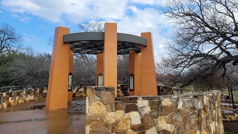
Location. 29° 23.306′ N, 98° 29.876′ W. Marker is in San Antonio, Texas, in Bexar County. It is in Thelka. Marker is on East Theo Avenue, 0.4 miles west of Mission Road, on the right when traveling west. The marker is located in the western section of the Concepción Park near the River Walk. Touch for map. Marker is in this post office area: San Antonio TX 78210, United States of America. Touch for directions.
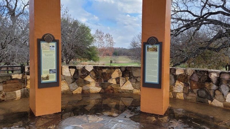
Other nearby markers. At least 8 other markers are within walking distance of this marker. The Concepción Neighborhood (here, next to this marker); Missions in the San Antonio River Valley (here, next to this marker); Water for the Concepción Community (here, next to this marker); The San Antonio River at Mission Concepción (here, next to this marker); The River Landscape (here, next to this marker); The San Antonio Missions World Heritage Site (within shouting distance of this marker); Mission Nuestra Señora de la Purísima Concepción (within shouting distance of this marker); San Antonio River Tributaries (within shouting distance of this marker). Touch for a list and map of all markers in San Antonio.
More about this marker. The English translation were taken from the other five markers at the location.
Credits. This page was last revised on February 18, 2023. It was originally submitted on February 16, 2023, by James Hulse of Medina, Texas. This page has been viewed 84 times since then and 23 times this year. Photos: 1, 2, 3. submitted on February 18, 2023, by James Hulse of Medina, Texas.


