Manchester in Richmond, Virginia — The American South (Mid-Atlantic)
The First Baptist Church of South Richmond
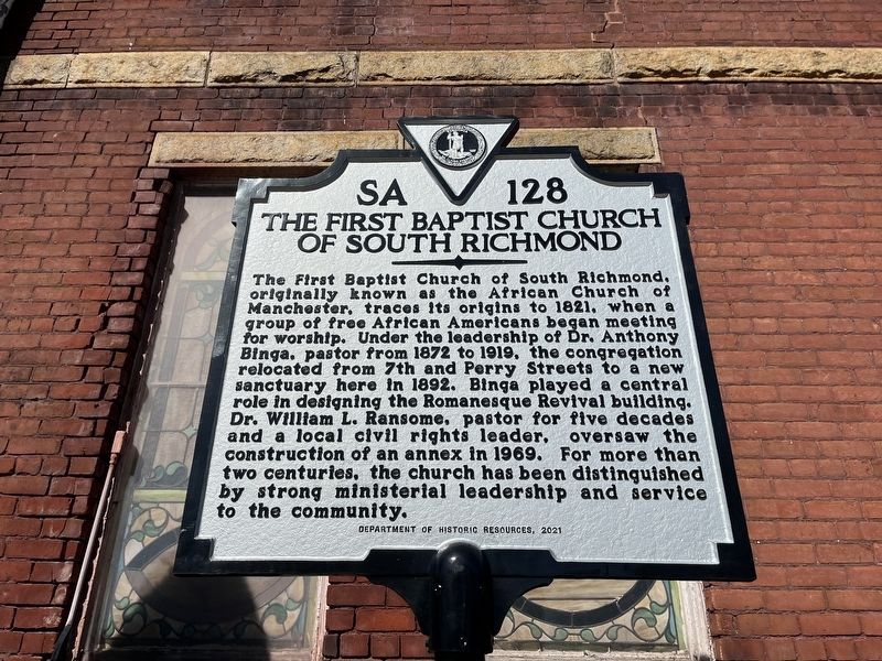
Photographed by Devry Becker Jones (CC0), February 18, 2023
1. The First Baptist Church of South Richmond Marker
Erected 2021 by Department of Historic Resources. (Marker Number SA-128.)
Topics and series. This historical marker is listed in these topic lists: African Americans • Architecture • Religion & Religious Structures. In addition, it is included in the Virginia Department of Historic Resources (DHR) series list. A significant historical year for this entry is 1821.
Location. 37° 31.101′ N, 77° 26.768′ W. Marker is in Richmond, Virginia. It is in
this page online

Regionally, this marker is in Central Virginia. It is also in the American South and specifically in the Upper South. Globally, it is in North America, the Western Hemisphere, the Western World, and the Anglosphere. Historically, it finds itself in what was once the territory of the Mississippian Culture, one of the original Thirteen Colonies, one of the Confederate States of America, and the Antebellum South.
Other nearby markers. At least 8 other markers are within walking distance of this marker: Dr. Dorothy Irene Height (about 400 feet away, measured in a direct line); Dorothy Height (about 500 feet away); Colonel Thomas Stegge, Jr. (approx. 0.3 miles away); Here Rest More Than One Hundred (approx. half a mile away); The African Church of Manchester (approx. 0.6 miles away); Manchester Lodge No. 14 (approx. 0.6 miles away); Richmond and Petersburg Railroad Bridge
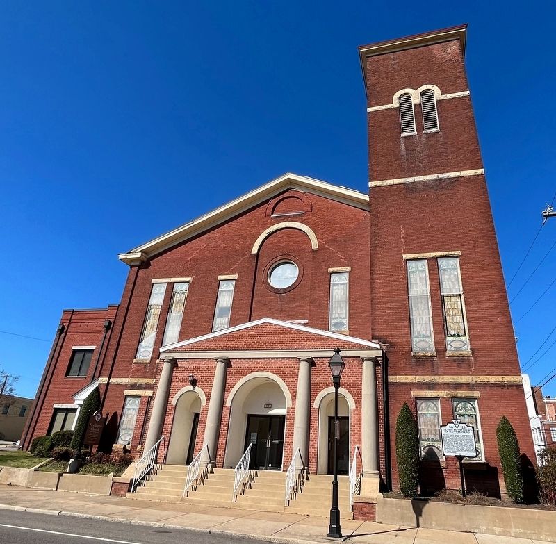
Photographed by Devry Becker Jones (CC0), February 18, 2023
2. The First Baptist Church of South Richmond
Other markers no longer nearby. Manchester Elliott Grays (was approx. 0.3 miles away but has been permanently removed); Belle Isle Rolling Milling and Slitting Manufactory (was approx. 0.8 miles away but has been replaced with another marker now near it).
Credits. This page was last revised on February 19, 2023. It was originally submitted on February 19, 2023, by Devry Becker Jones of Washington, District of Columbia. This page has been viewed 1,324 times since then and 233 times this year. Photos: 1, 2. submitted on February 19, 2023, by Devry Becker Jones of Washington, District of Columbia.
