South Downtown in Atlanta in Fulton County, Georgia — The American South (South Atlantic)
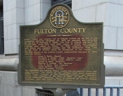
Fulton County
Photographed by Judith Barber, September 16, 2012
1. Fulton County Marker
Jonas S. Smith, Sheriff
Benjamin F. Bomar, Clerk, Superior Court
Columbus M. Payne, Clerk, Inferior Court
Joseph H. Mead, Ordinary
Madison S. Yoakum, Tax Receiver
John M. Smith, Tax Collector
James Bartlett, Surveyor
John K. Landers, Coroner
The legislative act creating Fulton County did not specify whom the name honored. The names of two persons have been suggested: Robert Fulton, inventor of the steamboat Clermont, and Hamilton Fulton, Chief Engineer of the State in 1826. In 1954 the Fulton County Centennial Commission, based on research by several Atlanta historians, gave that
this page online
Erected 1966 by Georgia Historical Commission. (Marker Number 060-195.)
Topics and series. This historical marker is listed in this topic list: Government & Politics. In addition, it is included in the Georgia Historical Society series list. A significant historical month for this entry is February 1847.
Location. 33° 45.077′ N, 84° 23.456′ W. Marker is in Atlanta, Georgia, in Fulton County. It is in South Downtown. It is at the intersection of Pryor Street Southwest and Martian Luther King, Jr Drive Southwest, on the right when traveling north on Pryor Street Southwest. Touch for map. Marker is at or near this postal address: 147 Pryor Street, Atlanta GA 30303, United States of America. Touch for directions.

Regionally, this marker is in the Piedmont. It is also in the American South and specifically in the Deep South. Globally, it is in North America, the Western Hemisphere, the Western World, and the Anglosphere. Historically, it finds itself in what was once the territory of the Mississippian Culture, one of the original Thirteen Colonies, one of the Confederate States of America, and the Antebellum
Photographed by Judith Barber, September 16, 2012
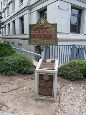
2. Fulton County Marker
Below the Fulton County marker is a small stone and metal plate monument describing the Fulton County Superior Court building located behind the marker.
Other nearby markers. At least 8 other markers are within walking distance of this marker: Immaculate Conception Church (about 400 feet away, measured in a direct line); The Eternal Flame Of The Confederacy (about 500 feet away); Georgia Railroad Freight Depot (about 600 feet away); a different marker also named Georgia Railroad Freight Depot (about 700 feet away); The Burning and Destruction of Atlanta (about 700 feet away); Desegregation of Municipal Facilities (1961) (about 700 feet away); Zero Mile Post (approx. 0.2 miles away); Central Presbyterian Church (approx. 0.2 miles away). Touch for a list and map of all markers in Atlanta.

Photographed by Judith Barber, September 16, 2012
3. Fulton County Marker
Marker is in front of the Fulton County Superior court building.

Photographed by Judith Barber, September 16, 2012
4. Fulton County Marker
Marker is in front of the Fulton County Superior Court building.
Photographed by Judith Barber, September 16, 2012
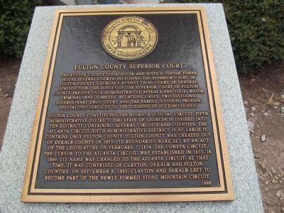
5. Fulton County Marker
A close up photo of the top metal plate on the small stone monument. The plate describes the Fulton County Superior Court building located behind the Fulton County marker.
Photographed by Judith Barber, September 16, 2012
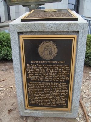
6. Fulton County Marker
A close up photo of the metal plate on the front of the small stone and plate monument. The plate describes the Fulton County Superior court building located behind the marker.
Credits. This page was last revised on February 21, 2023. It was originally submitted on September 16, 2012, by Judith Barber of Marietta, Georgia. This page has been viewed 992 times since then and 47 times this year. Last updated on February 21, 2023, by Amanda Zimmer of Atlanta, Georgia. Photos: 1, 2, 3, 4, 5, 6. submitted on September 16, 2012, by Judith Barber of Marietta, Georgia. • Bernard Fisher was the editor who published this page.
