
McHenry in Garrett County, Maryland — The American Northeast (Mid-Atlantic)
Gettysburg Campaign
Invasion & Retreat
Photographed by J. J. Prats, August 25, 2007
1. Gettysburg Campaign Marker
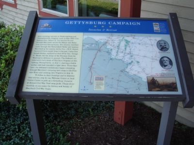
After stunning victories at Fredericksburg and Chancellorsville, Virginia, early in May 1863, Confederate Gen. Robert E. Lee carried the war through Maryland, across the Mason and Dixon Line and into Pennsylvania. His infantry marched north through the Shenandoah Valley and western Maryland as his cavalry, led by Gen. J.E.B. Stuart, harassed Union supply lines to the east. Union Gen. Joseph Hooker, replaced on June 28 by Gen. George G. Meade, led the Army of the Potomac from the Washington defenses in pursuit. The Federals collided with Lee’s Army of Northern Virginia at Gettysburg, Pennsylvania, on July 1, starting a battle neither side had intended to fight there. Three days later, the defeated Confederates began retreating through Maryland, retracing their steps to the Potomac River and crossing into Virginia on July 14.
To follow their footsteps and to discover their stories, stop by any Welcome Center or local Visitor Center to pick up a Gettysburg: Invasion & Retreat Civil War Trail map-guide. Please drive carefully as you enjoy the history and beauty of Maryland Civil War Trails.
Topics and series. This
this page online
Location. This marker has been replaced by another marker nearby. It was located near 39° 33.704′ N, 79° 21.513′ W. Marker was in McHenry, Maryland, in Garrett County. It could be reached from Visitors Center Drive just west of Garrett Highway (U.S. 219), on the left when traveling west. It is at the entrance to the Garrett County Chamber of Commerce Visitors Center. Touch for map. Marker was at or near this postal address: 15 Visitors Center Dr, Mc Henry MD 21541, United States of America. Touch for directions.

Regionally, this marker was in Western Maryland. It was also in the American Mid-Atlantic, in Appalachia, and specifically in Northern Appalachia. Globally, it was in North America, the Western Hemisphere, the Western World, and the Anglosphere. Historically, it found itself in what was once one of the original Thirteen Colonies.
Other nearby markers. At least 8 other markers are within walking distance of this location: Western Maryland

Photographed by J. J. Prats, August 25, 2007
2. Entrance to Garrett County Visitors Center
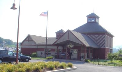
Two markers at the Visitors Center in the Deep Creek Lake Recreation Area of the county, this one is on the left.
Another marker is no longer nearby. The National Road (was a few steps from this marker but has been replaced with another marker now near it).
Related marker. Click here for another marker that is related to this marker. This marker has been replaced with the linked marker.
Photographed by J. J. Prats, August 25, 2007
3. The Garrett County Visitors Center
Credits. This page was last revised on October 27, 2023. It was originally submitted on August 26, 2007, by J. J. Prats of Powell, Ohio. This page has been viewed 1,964 times since then and 25 times this year. Photos: 1, 2, 3. submitted on August 26, 2007, by J. J. Prats of Powell, Ohio.
