Sunset Hill in Kansas City in Jackson County, Missouri — The American Midwest (Upper Plains)
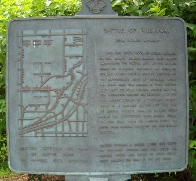
Battle of Westport
Union Flanking Movement
Here just before noon on Sunday, October 23, 1864, Major General Samuel Ryan Curtis, commanding the Federal Army of the Border, began his flanking movement of Brigadier General Joseph Orville Shelby's Division of the Confederate Army of Missouri. While the Union army was engaged in heavy fighting just east of here, General Curtis led the 9th Wisconsin Battery and Company G of the 11th Kansas Cavalry up a twisting, wooded defile to a position on the left and rear of General Shelby's lines, the battery, firing down the Confederate lines, caused Shelby to pull back from the heights south of Brush Creek, severely weakening the Confederate position.
George Thoman, a farmer living just south of Westport pointed out the defile to General Curtis and served as guide. Sunset Drive follows the wall of the old defile.
Erected 1964 by Native Sons of Kansas City, Missouri. (Marker Number 3.)
Topics and series. This historical marker is listed in this topic list: War, US Civil. In addition, it is included in the Kansas City - Native Sons and Daughters of Greater Kansas City, and the Missouri – Battle of Westport series lists. A significant historical date for this entry is October 23, 1871.
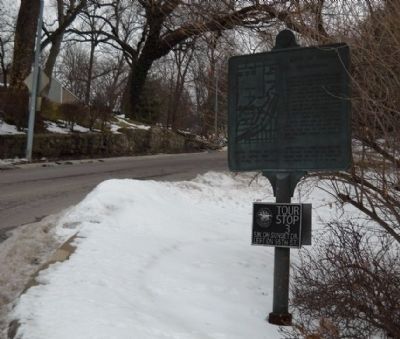
Location. 39° 2.175′ N, 94° 35.881′ W. Marker is in Kansas City , Missouri, in Jackson County. It is in Sunset Hill. Marker is at the intersection of Sunset Drive and 51st Street, in the median on Sunset Drive. This marker is on the east side of the median island made at the intersection of 51st Street and Sunset Drive. Touch for map. Marker is in this post office area: Kansas City MO 64112, United States of America. Touch for directions.
Other nearby markers. At least 8 other markers are within walking distance of this marker. Confederate Position (approx. 0.2 miles away); Carolyne Farwell Fuller (approx. ¼ mile away); Union Position (approx. ¼ mile away); Centennial Anniversary of Japan's Gift of Cherry Trees (approx. ¼ mile away); First Home of the Kansas City Country Club (approx. 0.3 miles away); Union Artillery (approx. 0.3 miles away); The French and the Osage (approx. 0.4 miles away); Landing At Westport (approx. half a mile away). Touch for a list and map of all markers in Kansas City.
Also see . . . Battle of Westport. Link from the Civil War Muse with further information on this tour stop. (Submitted on August 16, 2009, by Thomas Onions of Olathe, Kansas.)
Credits. This page was last revised on February 10, 2023. It was originally submitted on August 16, 2009, by Thomas Onions of Olathe, Kansas. This page has been viewed 1,807 times since then and 16 times this year. Photos: 1. submitted on August 16, 2009, by Thomas Onions of Olathe, Kansas. 2. submitted on February 28, 2010, by Thomas Onions of Olathe, Kansas. • Craig Swain was the editor who published this page.

