Cayce in Lexington County, South Carolina — The American South (South Atlantic)
Congaree Fort
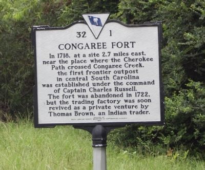
Photographed by Mike Stroud, 2009
1. Congaree Fort Marker
Erected 1958 by South Carolina Department of Archives and History, sponsored by South Carolina Society Daughters of the American Colonists. (Marker Number 32-1.)
Topics and series. This historical marker is listed in these topic lists: Colonial Era • Forts and Castles • Settlements & Settlers. In addition, it is included in the Daughters of the American Colonists, and the South Carolina Historical Markers series lists. A significant historical year for this entry is 1718.
Location. 33° 56.226′ N, 81° 4.632′ W. Marker is in Cayce, South Carolina, in Lexington County. It is on Charleston Highway (U.S. 176/321) near Between Dixiana Road and Old Dunbar Road, on the right when traveling north. Located north of I-26 Exit 116, near Congaree Creek. Touch for map. Marker is in this
this page online

Regionally, this marker is in the Midlands and in the Greater Columbia Area. It is also in the American South and specifically in the Deep South. Globally, it is in North America, the Western Hemisphere, the Western World, and the Anglosphere. Historically, it finds itself in what was once the territory of the Mississippian Culture, one of the original Thirteen Colonies, one of the Confederate States of America, and the Antebellum South.
Other nearby markers. At least 8 other markers are within 3 miles of this marker, measured as the crow flies: Wil Lou Gray Opportunity School (approx. 2.2 miles away); Camp Moore (approx. 2.3 miles away); Emily Geiger (approx. 2.3 miles away); The Post at the Congarees (approx. 2.3 miles away); Cayce Colored School / Cayce Negro Elementary School (approx. 2.3 miles away); Congaree Creek Earthworks (approx. 2.4 miles away); Springdale (approx. 2.4 miles away); Battle of Congaree Creek (approx. 2.8 miles away). Touch for a list and map of all markers in Cayce.
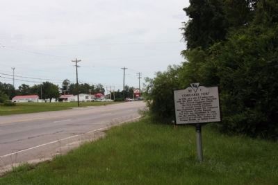
Photographed by Mike Stroud, August 16, 2009
2. Congaree Fort Marker, looking northbound along Charleston Hwy (US 176, US 321, US 21)
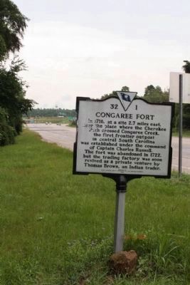
Photographed by Mike Stroud, August 16, 2009
3. Congaree Fort Marker Looking southbound along Charleston Hwy
I-26, Interchange 116 seen in background
Credits. This page was last revised on January 25, 2026. It was originally submitted on August 16, 2009, by Mike Stroud of Bluffton, South Carolina. This page has been viewed 4,263 times since then and 227 times this year. Photos: 1, 2, 3. submitted on August 16, 2009, by Mike Stroud of Bluffton, South Carolina. • Craig Swain was the editor who published this page.
