Naarden in Gooise Meren, North Holland, Netherlands — Northwestern Europe
Naarden; Erfgooiersroute
Photographed by Andrew Ruppenstein, July 22, 2022
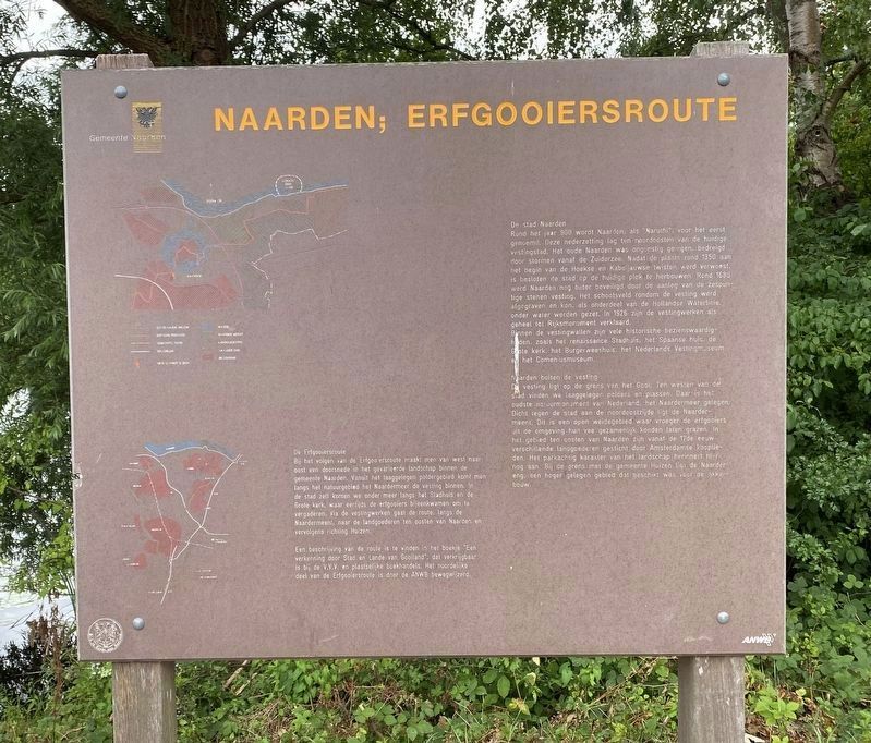
1. Naarden; Erfgooiersroute Marker

De Erfgooiersroute
Bij het volgen van de Erfgooiersroute maakt men van west naar oost een doorsnede in het gevarieerde landschap binnen de gemeente Naarden. Vanuit het laaggelegen poldergebied komt men langs het natuurgebied het Naardermeer de vesting binnen. In de stad zelf komen we onder meer langs het Stadhuis en de Grote kerk, waar eertijds de erfgooiers bijeenkwamen om te vergaderen. Via de vestingwerken gaat de route, langs de Naardermeent naar de landgoederen ten oosten van Naarden en vervolgens richting Huizen.
Een beschrijving van de route is te vinden in het boekje "Een verkenning door Stad en Lande van Gooiland", dat verkrijgbaar is bij de V.V.V. en plaatselijke boekhandels. Het noordelijke deel van de Erfgooiersroute is door de ANWB bewegwijzerd.
De stad Naarden
Rond het jaar 900 wordt Naarden, als "Naruthi", voor het eerst genoemd. Deze nederzetting lag ten noordoosten van de huidige vestingstad. Het oude Naarden was ongunstig gelegen, bedreigd door stormen vanaf de Zuiderzee. Nadat de plaats rond 1350 aan het begin van de Hoekse en Kabeljauwse twisten werd verwoest, is besloten
this page online
Naarden buiten de vesting
De vesting ligt op de grens van het Gooi. Ten westen van de stad vinden we laaggelegen polders en plassen. Daar is het oudste natuurmonument van Nederland, het Naardermeer gelegen. Dicht tegen de stad aan de noordoostzijde ligt de Naardermeent. Dit is een open weidegebied waar vroeger de erfgooiers uit de omgeving hun vee gezamenlijk konden laten grazen. In het gebied ten oosten van Naarden zijn vanaf de 17de eeuw verschillende landgoederen gesticht door Amsterdamse kooplieden. Het parkachtig karakter van het landschap herinnert hier nog aan. Bij de grens met de gemeente
Photographed by Andrew Ruppenstein, July 22, 2022
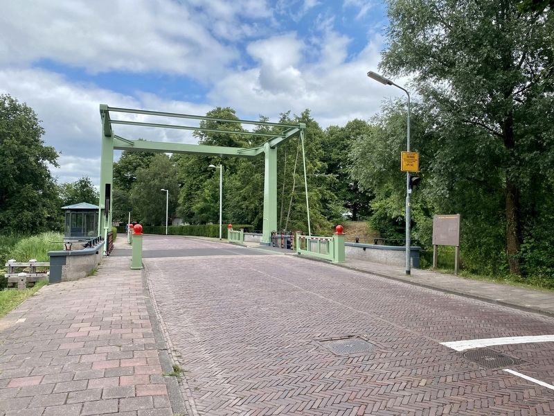
2. Naarden; Erfgooiersroute Marker - wide view
The Erfgooiers route
When following the Erfgooiersroute, one crosses from west to east through the varied landscape within the municipality of Naarden. From the low-lying polder area, you enter the fortress via the Naardermeer nature reserve. In the city itself, we pass the Town Hall and the Grote Kerk (“Great Church”) where the Erfgooiers used to gather to hold meetings. The route goes through the fortifications, along the Naardermeent to the estates east of Naarden and then towards Huizen.
A description of the route can be found in the booklet "An exploration through the City and Lands of Gooiland", which is available at the V.V.V. and local bookstores. The northern part of the Erfgooiersroute is signposted by the ANWB.
The city of Naarden
Around the year 900 Naarden, as "Naruthi", is mentioned for the first time. This settlement was located northeast of the current fortified city. Old Naarden was unfavorably located, threatened by storms from the Zuiderzee. After the place was destroyed around 1350 at the start of the Hoekse and Kabeljauwse quarrels, it was decided to rebuild the city on its current site. Around 1680, Naarden was even better protected by the construction of a six-pointed stone fortress. A field of fire around the fortress was excavated and, as part of the Dutch Waterline, could be flooded. In 1926, the fortifications as a whole were declared a national monument. Within the ramparts are many historical sights, such as the Renaissance Town Hall, the Spanish House, the Grote Kerk (“Great Church”), the (civic orphanage), the Dutch Fortress Museum and the Comenius Museum.
Outside of the fortress
The fortress is located on the border of the Gooi. West of the city we find low-lying polders and lakes. The oldest natural monument in the Netherlands, the Naardermeer, is located there. Close to the city on the northeast side is the Naardermeent. This is an open meadow area where Erfgooiers from the area used to graze their cattle together. In the area east of Naarden, since the 17th century, Amsterdam merchants have located their estates there. The park-like character of the landscape is still a reminder of this. At the border with the municipality of Huizen is the Naardereng, a higher area that was suitable for arable farming.
Erected by The ANWB.
Topics. This historical marker is listed in these topic lists: Forts and Castles • Roads & Vehicles • Settlements & Settlers. A significant historical year for this entry is 1350.
Location. 52° 17.492′ N, 5° 9.465′ E. Marker is in Naarden, Noord-Holland (North Holland), in Gooise Meren. It is on Burgemeester M.P. van Wettumweg, on the right when traveling north. Touch for map. Marker is in this post office area: Naarden, Noord-Holland 1411, Netherlands. Touch for directions.

Regionally, it is in Europe, the European Union, Atlantic Europe, the Benelux Low Countries, the Schengen Area, Western Europe, and the Western World. Historically, it finds itself in what was once the Holy Roman Empire.
Other nearby markers. At least 8 other markers are within walking distance of this marker: Lange Bedekte Weg Naarden (about 180 meters away, measured in a direct line); Bastion Turfpoort (approx. 0.3 kilometers away); Het Spaanse Huis / The Spanish House (approx. half a kilometer away); De Promerskazerne / Promers Barracks (approx. 0.6 kilometers away); Oude Stadehuis / Old City Hall - Marktstraat 22 Naarden (approx. 0.6 kilometers away); Stadhuis / City Hall (approx. 0.6 kilometers away); Replica van Stadspomp / City Water Pump Replica (approx. 0.6 kilometers away); Kogel / Cannonball (approx. 0.6 kilometers away). Touch for a list and map of all markers in Naarden.
Credits. This page was last revised on December 31, 2023. It was originally submitted on February 27, 2023, by Andrew Ruppenstein of Lamorinda, California. This page has been viewed 108 times since then and 13 times this year. Photos: 1, 2. submitted on February 27, 2023, by Andrew Ruppenstein of Lamorinda, California.
