Lewisburg in Greenbrier County, West Virginia — The American South (Appalachia)
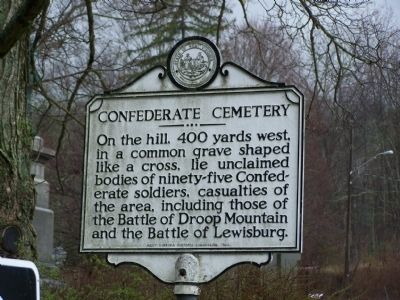
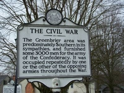
Confederate Cemetery / The Civil War
Side A
On the hill, 400 yards west, in a common grave shaped like a cross, lie unclaimed bodies of ninety-five Confederate soldiers, casualties of the area, including those of the Battle of Droop Mountain and the Battle of Lewisburg.
Side B
The Greenbrier area was predominately Southern in its sympathies, and furnished some 3000 men for the army of the Confederacy. It was occupied repeatedly by one or the other of the opposing armies throughout the War.
Erected 1963 by West Virginia Historic Commission.
Topics and series. This historical marker is listed in these topic lists: Cemeteries & Burial Sites • War, US Civil. In addition, it is included in the West Virginia Archives and History series list.
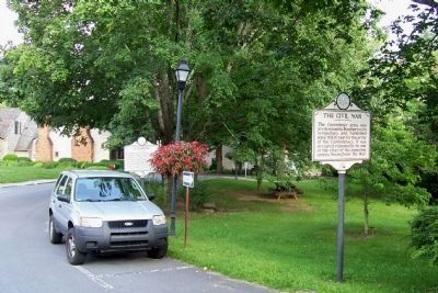
Location. 37° 48.223′ N, 80° 26.894′ W. Marker is in Lewisburg, West Virginia, in Greenbrier County. Marker is on Courtney Drive east of Washington Street (U.S. 60). Touch for map. Marker is in this post office area: Lewisburg WV 24901, United States of America. Touch for directions.
Other nearby markers. At least 8 other markers are within walking distance of this marker. Lewisburg (a few steps from this marker); William Cammack Campbell (within shouting distance of this marker); Confederate Cemetery (within shouting distance of this marker); a different marker also named Lewisburg (about 300 feet away, measured in a direct line); Shuck Memorial Baptist Church (about 300 feet away); The Lewisburg Foundation (about 400 feet away); Battle of Lewisburg (about 400 feet away); Greenbrier College / Greenbrier Hall (about 500 feet away). Touch for a list and map of all markers in Lewisburg.
Credits. This page was last revised on October 7, 2019. It was originally submitted on August 17, 2009, by Bill Pfingsten of Bel Air, Maryland. This page has been viewed 2,096 times since then and 29 times this year. Photos: 1, 2. submitted on August 17, 2009, by Bill Pfingsten of Bel Air, Maryland. 3. submitted on November 28, 2012, by Forest McDermott of Masontown, Pennsylvania.


