Fredericksburg, Virginia — The American South (Mid-Atlantic)
The Lewis Store
1749
| — | Historic Fredericksburg Foundation, Inc. • Restoration in 2002 and 2019 | — |
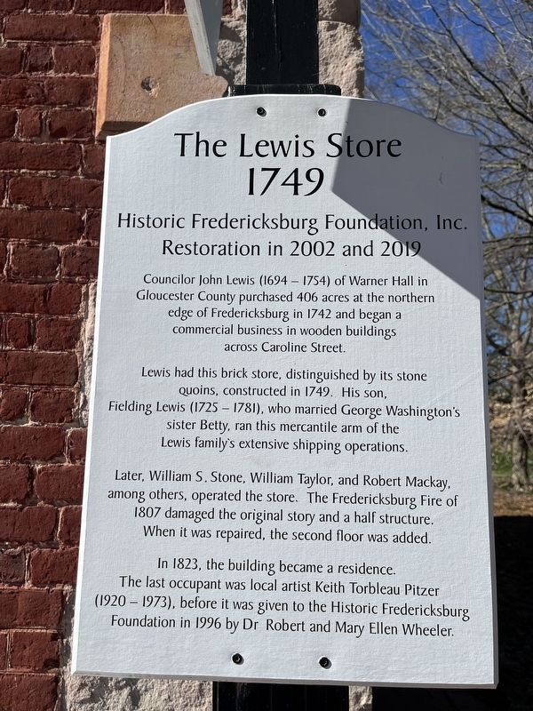
Councilor John Lewis (1694 - 1754) of Warner Hall in Gloucester County purchased 406 acres at the northern edge of Fredericksburg in 1742 and began a commercial business in wooden buildings across Caroline Street.
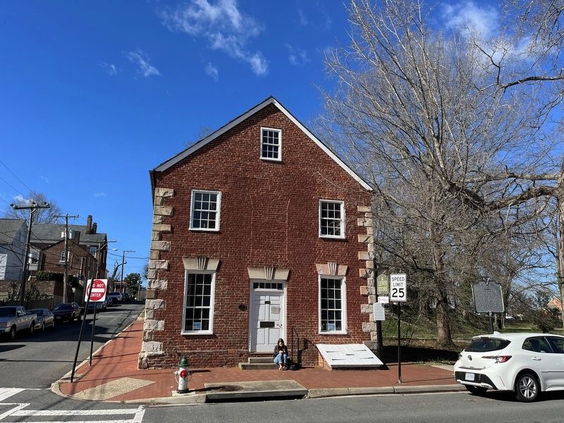
Lewis had this brick store, distinguished by its stone Quoins, constructed in 1749. His son, Fielding Lewis (1725-1781), who married George Washington's sister Betty, ran this mercantile arm of the Lewis family's extensive shipping operations.
Later, William S. Stone, William Taylor, and Robert Mackay, among others, operated the store. The Fredericksburg Fire of 1807 damaged the original story and a half structure. When it was repaired, the second floor was added.
In 1823, the building became a residence. The last occupant was local artist Keith Torbleau Pitzer (1920-1973), before it was given to the Historic Fredericksburg Foundation in 1996 by Dr Robert and Mary Ellen Wheeler.
Erected by Historic Fredericksburg Foundation, Inc.
Topics. This historical marker is listed in these topic lists: Colonial Era • Industry & Commerce. A significant historical year for this entry is 1742.
Location. 38° 18.345′ N, 77° 27.663′ W.
this page online

Regionally, this marker is in the Washington Metropolitan Area and in Northern Virginia. It is also in the American South and specifically in the Upper South. Globally, it is in North America, the Western Hemisphere, the Western World, and the Anglosphere. Historically, it finds itself in what was once the territory of the Mississippian Culture, one of the original Thirteen Colonies, one of the Confederate States of America, and the Antebellum South.
Other nearby markers. At least 8 other markers are within walking distance of this marker: Kenmore (a few steps from this marker); 1908 (within shouting distance of this marker); Fire on Caroline Street (within shouting distance of this marker); Reformed Baptist Church (within shouting distance of this marker); 1854 (about 300 feet away, measured in a direct line); Rising Sun Tavern
Other markers no longer nearby. The Lewis Store (was a few steps from this marker but has been replaced with another marker now near it); Fredericksburg Campaign, December 1862 (was within shouting distance of this marker but has been replaced with another marker now near it).
Related marker. Click here for another marker that is related to this marker. This marker has replaced the linked marker.
Credits. This page was last revised on March 4, 2023. It was originally submitted on March 4, 2023, by Devry Becker Jones of Washington, District of Columbia. This page has been viewed 394 times since then and 33 times this year. Photos: 1, 2. submitted on March 4, 2023, by Devry Becker Jones of Washington, District of Columbia.
