Southside in San Antonio in Bexar County, Texas — The American South (West South Central)
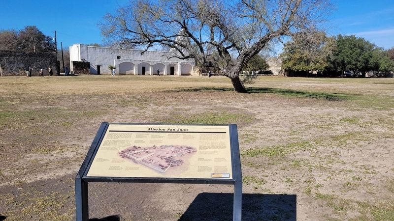
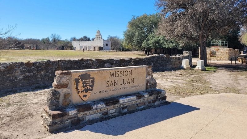
Mission San Juan
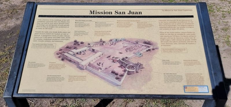
Outside the walls were fertile fields where one quart of seed yielded six bushels of corn at harvest. A prosperous ranch 25 miles distant raised over 3,500 sheep and 3,000 cattle. Inside the mission, workshops produced cured hides, cloth, wooden articles, and ironwares.
The convento
The Franciscans brothers lived in sparse cells behind a graceful arcade to your left. They cooked and ate in the rooms behind you.
The first masonry church
Priests celebrated Mass in an open thatched-roof shed in the early years. This stone structure was San Juan's church between 1756 and 1786.
1700s Food storehouse
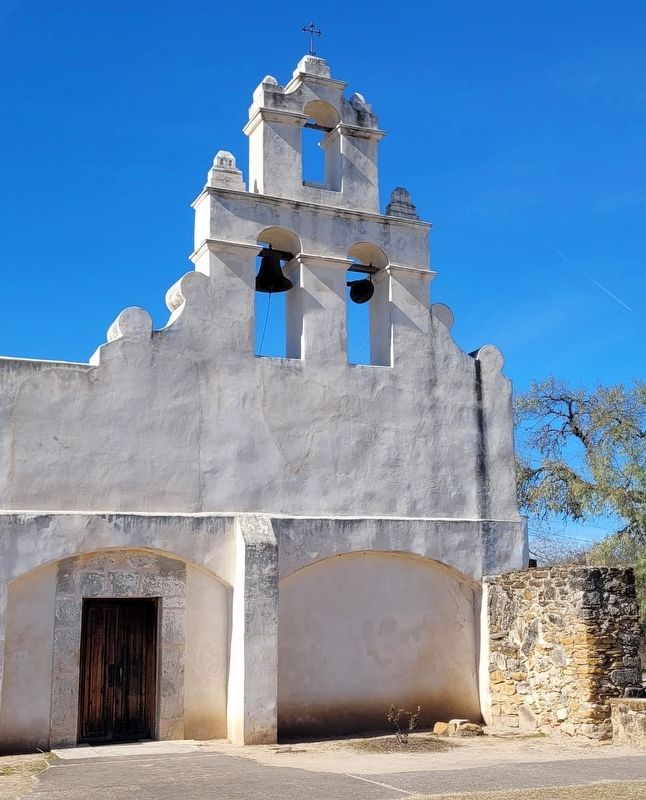
Today's mission church was built over part of the foundation of an earlier granary - as a temporary sanctuary - in 1786.
Since the mission era ended
1. Priest's quarters
Built in 1968 using stones recycled from earlier mission walls, this is still an active parsonage. It is not open to the public.
2. Post-colonial house
Built in 1856 atop old Spanish foundation, this residence was occasionally used to store parish school supplies in the 20th century.
Indian homes
Thatched-roof "jacales" like these were replaced by apartments built into the outer wall as the mission grew.
San Juan's third church
These half-finished walls belong to a 10-year effort to build a much grander new church and sacristy for San Juan. Dwindling numbers of Indian workers brought construction to a halt in the late 1780s, leaving this building as you see it now.
Spanish:
Solamente una fracción de las estructuras de lo que fue la comunidad autosuficiente de San Juan Capistrano aún se puede ver actualmente. Proveen la arqueologia y los antiguos registros españoles indicios que nos ayudan a imaginar este poblado de hasta 200 almas.
Fuera de los muros habían campos fértiles en donde un solo litro de semillas de maíz rendía una cosecha de 210 litros. Un rancho próspero situado a 40 km de distancia criaba más de 3,500 ovejas y 3,000 cabezas de ganado. Dentro del recinto, los talleres producían artículos de cuero ahumado, telas, articulos de madera y de ferretería.
El convento
Los hermanos franciscanos vivían en celdas austeras tras una galería elegante que purden ver su izquierda. En los cuartos detrás de ustedes se ven la cocina y el refectoria.
Primera iglesia de mampostería
Al principio, se celebraba la Misa en jacales crudos. Entre los años 1756 y 1786, esta estructura fue la iglesia de San Juan.
Almacén de víveres del siglo XVIII
Se construyó la iglesia actual de la misión en 1786 como un sanctuario temporal sobre parte de los cimlentos de un granero antiguo.
Desde el fin de la época de las misiones
1. Residencia del sacerdote
Construida en 1968 utilizando pieras de los antiguos muros de la misión, esta es aún una parroquia activa. No esta abierto al público.
2. Casa post-colonial
Construida en 1850 sobre antiguos cimientos españoles, esta vivienda se usaba de vez en cuando en el siglo XX para almacenar sumlalstros de la escuela parroquial.
Habitaciones de indígenas
A medida que crecía la población, fueron reemplazados jacales como éstos por apartamentos construidos en el muro exterior.
La tercera iglesia de San Juan
Estos muros a medio terminar representen un esfuerzo de 10 años por construir una iglesia y sacristía más grande y nueva para San Juan. Debido a la escasez de trabajadores indigenas se suspendió la construcción a fines de 1780, dejando esta estructura en el estado en que se ve.
Erected by San Antonio Missions National Historical Park.
Topics. This historical marker is listed in these topic lists: Anthropology & Archaeology • Churches & Religion • Colonial Era • Forts and Castles. A significant historical year for this entry is 1786.
Location. 29° 19.924′ N, 98° 27.288′ W. Marker is in San Antonio, Texas, in Bexar County. It is in Southside. Marker can be reached from the intersection of Graf Road and Mission Road. The marker is located at the southeastern section of the Mission San Juan grounds. Touch for map. Marker is at or near this postal address: 9101 Graf Road, San Antonio TX 78223, United States of America. Touch for directions.
Other nearby markers. At least 8 other markers are within walking distance of this marker. A Sacred Place (within shouting distance of this marker); Hub of Commerce (within shouting distance of this marker); Permission to Enter (within shouting distance of this marker); San Antonio Missions (about 400 feet away, measured in a direct line); Mission San Juan Capistrano (approx. 0.2 miles away); Bergs Mill Veterans Memorial Bridge (approx. 0.2 miles away); a different marker also named Mission San Juan Capistrano (approx. 0.2 miles away); The San Antonio Missions World Heritage Site (approx. 0.2 miles away). Touch for a list and map of all markers in San Antonio.
Also see . . . Mission San Juan. San Antonio Missions - World Heritage
Mission San Juan Capistrano moved to the San Antonio River from East Texas on March 5, 1731. The unfinished church was utilized as a cemetery and some of the original mission residents were buried there. Today, many of the parishioners are descendants of the original inhabitants of the mission. The Yanaguana Trail along the San Antonio River at the mission is a shaded, paved walkway among trees and vegetation that show you what the riverbank was like 300 years ago. The San Juan Acequia has been restored to use for watering the Spanish Colonial Demonstration Farm.(Submitted on March 6, 2023, by James Hulse of Medina, Texas.)
Credits. This page was last revised on March 6, 2023. It was originally submitted on March 4, 2023, by James Hulse of Medina, Texas. This page has been viewed 67 times since then and 13 times this year. Photos: 1, 2, 3, 4. submitted on March 6, 2023, by James Hulse of Medina, Texas.


