
Pelham in Navarro County, Texas — The American South (West South Central)
Pelham Cemetery
Photographed by James Hulse, March 5, 2023
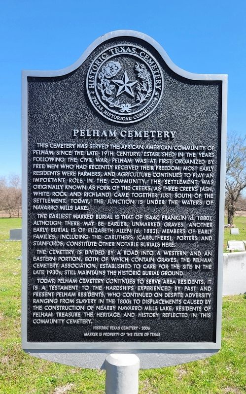
1. Pelham Cemetery Marker
The earliest marked burial is that of Isaac Franklin (d. 1880), although there may be earlier, unmarked graves. Another early burial is of Elizabeth Allen (d. 1882), members of early families including the Caruthers (Carruthers), Porters and Stanfords constitute other notable burials here.
The cemetery is divided by a road into a western and an eastern portion, both of which contain graves. The Pelham Cemetery Association, established to care for the site in the late 1930s, still maintains the historic burial ground.
Today, Pelham Cemetery continues to serve area residents. It is a testament to the hardships experienced by past and present Pelham residents, who continued on despite adversity ranging from slavery in the 1800s to displacements caused by the construction of nearby Navarro Mills Lake, residents of Pelham treasure the heritage and history reflected in this community cemetery.
Erected 2006 by Texas Historical Commission. (Marker Number 13903.)
Topics. This historical marker is listed in these topic lists: African Americans • Cemeteries & Burial Sites. A significant historical year for this entry is 2006.
Location. 31° 57.134′ N, 96° 48.053′ W. Marker is in Pelham, Texas, in Navarro County. It is on County Highway
this page online

Regionally, this marker is in the Prairies & Lakes Region. It is also in the American South. Globally, it is in North America, a Gulf of Mexico state, the Western Hemisphere, the Western World, and the Anglosphere. Historically, it finds itself in what was once New Spain, the Republic of Texas, and one of the Confederate States of America.
Other nearby markers. At least 8 other markers are within 4 miles of this marker, measured as the crow flies: Wesley Chapel Methodist Church (approx. 0.6 miles away); Ash Creek (Pelham) School (approx. 0.6 miles away); Pelham Community (approx. 0.7 miles away); The Savage Schools (approx. 3 miles away); Salem Cemetery (approx. 3.1 miles away); Nathaniel Addison (approx. 3.1 miles away); George Washington Savage (approx. 3.2 miles away); Brushie Prairie Methodist Church (approx. 3.8 miles away). Touch for a list and map
Photographed by James Hulse, March 5, 2023
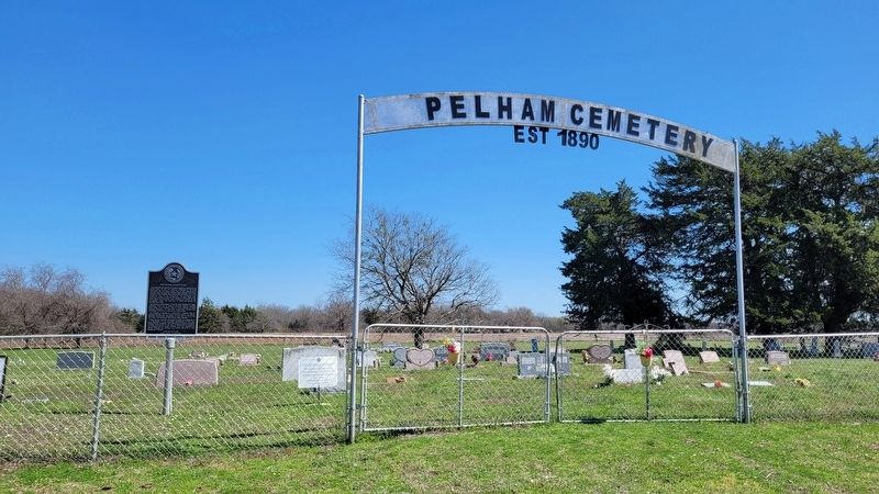
2. The entrance to the Pelham Cemetery and Marker
Credits. This page was last revised on March 5, 2023. It was originally submitted on March 5, 2023, by James Hulse of Medina, Texas. This page has been viewed 658 times since then and 65 times this year. Photos: 1, 2. submitted on March 5, 2023, by James Hulse of Medina, Texas.
