Southside in San Antonio in Bexar County, Texas — The American South (West South Central)
Permission to Enter
Photographed by James Hulse, December 27, 2022
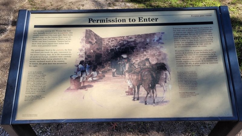
1. Permission to Enter Marker
 All travelers coming into Mission San Juan were formally received here by a portero, who closely monitored this main gate. Pack trains hauled cargo on the Camino Real, some 15- days north from Coahuila in Mexico, or two weeks east from Louisiana. Traders had to show their travel papers here before their mules were permitted inside.
The gatekeeper lived in the portería, the first cell found just inside the gate, convenient to his never ceasing duty. As in the monasteries of medieval Europe, outsiders were carefully scrutinized before being admitted to the secure, enclosed world of the mission. At sunset, the great door was secured for the night.
I order by the present Decree that no Person of whatever status or condition may remain outside of this Presidio or Village at Night, without my Permission, nor fail to present themselves upon Return....The Penalty for those who disobey will be Six pesos fine for the Public Funds, and three Days in Jail for the first offense, the Same (fine) for a second, and as I see fit if they backslide again.
Don Juan Maria Ripperdá
Governor and Commanding General
Province of Texas and Coahuila
March 15, 1772
Spanish:
Todos
this page online
El portero vivía en la primera celda justo adentro de la puerta, lo que facilitaba su tarea continua. Tal como en los monasterios de la Europa medieval, los extraños eran cuidadosamente escudriñados antes de ser admitidos al mundo seguro y encerrado de la misión. Con el puesto del sol, el gran portal se mantenía cerrado durante la noche.
Mando por el press. Auto que ninguna Persona de qualesquien estado, y confiz que sea pueda quedarse de Noche fuera de este Presidio o Villa, sin mi Lizmazia, ni dexar de presentarse a su Regresa....Pena al que contrabiniere (sic) de Seis P. de multa p. Gastos Públicos, y tres Dias de Carzel por la primera vez, Duplicados por la segunda, y advitraria (sic) si reinsidere...
Don Juan Maria Ripperdá
Gobernador y Comandante General
Provincia de Texas y Coahuila
15 de marzo de 1772
Erected by San
Photographed by James Hulse, December 27, 2022
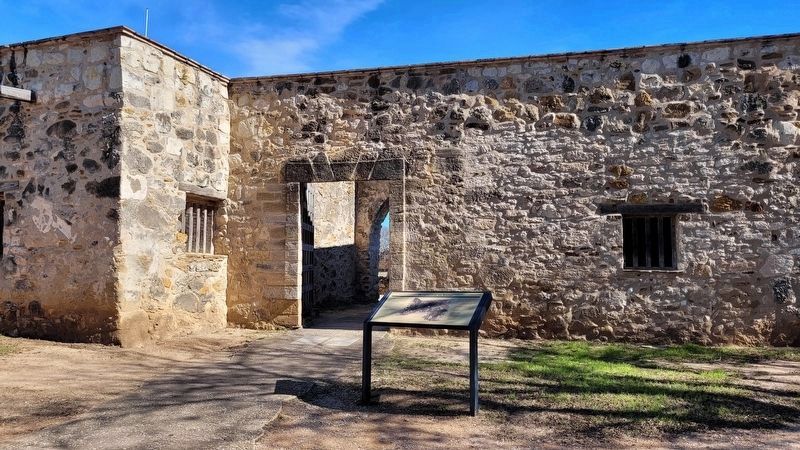
2. The view of the Permission to Enter Marker at the main gate
Topics. This historical marker is listed in these topic lists: Colonial Era • Forts and Castles • Religion & Religious Structures. A significant historical date for this entry is March 15, 1772.
Location. 29° 19.917′ N, 98° 27.327′ W. Marker is in San Antonio, Texas, in Bexar County. It is in Southside. It can be reached from the intersection of Graf Road and Mission Road. The marker is located in the southwest corner of the Mission San Juan grounds. Touch for map. Marker is at or near this postal address: 9101 Graf Road, San Antonio TX 78223, United States of America. Touch for directions.

Regionally, this marker is in South Texas. It is also in the American South. Globally, it is in North America, a Gulf of Mexico state, the Western Hemisphere, the Western World, and the Anglosphere. Historically, it finds itself in what was once New Spain, the Republic of Texas, and one of the Confederate States of America.
Other nearby markers. At least 8 other markers are within walking distance of this marker: Mission San Juan (within shouting distance of this marker); A Sacred Place (about
Photographed by James Hulse, December 27, 2022
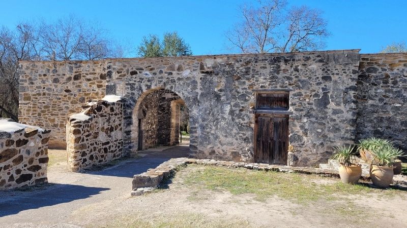
3. Inside view of the main gate
Also see . . . Mission San Juan. San Antonio Missions - World Heritage
Mission San Juan Capistrano moved to the San Antonio River from East Texas on March 5, 1731. The unfinished church was utilized as a cemetery and some of the original mission residents were buried there. Today, many of the parishioners are descendants of the original inhabitants of the mission. The Yanaguana Trail along the San Antonio River at the mission is a shaded, paved walkway among trees and vegetation that show you what the riverbank was like 300 years ago. The San Juan Acequia has been restored to use for watering the Spanish Colonial Demonstration Farm.(Submitted on March 6, 2023, by James Hulse of Medina, Texas.)
Credits. This page was last revised on March 6, 2023. It was originally submitted on March 6, 2023, by James Hulse of Medina, Texas. This page has been viewed 163 times since then and 15 times this year. Photos: 1, 2, 3. submitted on March 6, 2023, by James Hulse of Medina, Texas.
