Anniston in Calhoun County, Alabama — The American South (East South Central)
Surrounding Development
Exploring the History of Block No. 148 - The Site of Anniston's Federal Courthouse
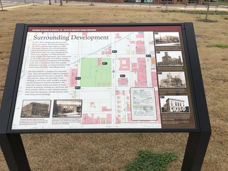
The map pictured is a Sanborn Fire Insurance Map. These were produced to help fire insurance agents determine the fire risk of a property. They show the size, shape, and materials of each building, as well as fire walls, sprinkler systems, and the locations of windows and doors. The maps also indicate widths and names of streets, property boundaries, building use, and house and block numbers. While not their intended purpose, these maps have become a valuable resource when researching historic buildings.
[Captions (clockwise from top right)]
• No. 1 – The Chero-Cola Bottling Company building at 110-112 West 12th Street was built on Block 148 around 1910. Chero-Cola was a cherry-flavored cola that launched Royal Crown Cola International.
• No. 2 –Anniston City Hall and Fire Station was built on the block north of Block 148 about 1900. This building functioned as city hall until it was moved to the former USO building after World War II.
• No. 3 – The Calhoun County Courthouse to the east of Block 148 was built in 1900 when the county seat moved from Jacksonville to Anniston. Here it is shown with its original cupola, lost in the fire of January 1931.
• No. 4 – The U.S. Courthouse and Post Office was built two blocks east on Noble Street in 1904. The design of the new Federal Courthouse on Block 148 was based on the facade of the historic Beaux Arts building, whic still stands.
• No. 6 – The Armour and Company building was erected adjacent to the Mercantile at 1104-1106 Moore Ave. between 1900 and 1905. In this ca. 1915 photograph, you can see the streetcar rails running in front of the building.
• No. 5 – The Anniston Mercantile Company was built at the northwest corner of 11th and Moore streets in 1887. Both this building and the Armour and Company Building next door were destroyed by fire in 1998.
1917 Sanborn Fire Insurance Map of Anniston, Alabama, Courtesy of the Library of Congress; Photographs courtesy of the Public Library of Anniston-Calhoun County and the Russell Brothers Collection.
Topics. This historical marker is listed in this topic list: Industry & Commerce
. A significant historical month for this entry is January 1931.
Location. 33° 39.529′ N, 85° 49.894′ W. Marker is in Anniston, Alabama, in Calhoun County. Marker is on Gurnee Avenue south of 12th Street, on the right when traveling south. Marker is at the 'new' federal courthouse. Touch for map. Marker is at or near this postal address: 1100 Gurnee Ave, Anniston AL 36201, United States of America. Touch for directions.
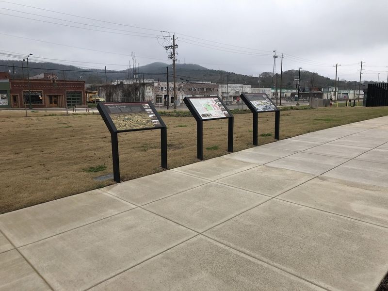
Other nearby markers. At least 8 other markers are within walking distance of this marker. Humble Beginnings (here, next to this marker); Civic Purpose (here, next to this marker); The Murder of Willie Brewster (within shouting distance of this marker); The Human Relations Council (within shouting distance of this marker); 1030 Gurnee Avenue (within shouting distance of this marker); 1031 Gurnee Avenue (about 300 feet away, measured in a direct line); Greyhound Bus Station Protest, May 14, 1961 (about 300 feet away); 50 Years Later (about 300 feet away). Touch for a list and map of all markers in Anniston.
Related markers. Click here for a list of markers that are related to this marker.
Also see . . . Anniston Federal Courthouse: A Fresh Take on the Model City. Anniston originated as an industrial town during the Reconstruction Era and played a pivotal role in major historical events of the twentieth century. Block 148, the location of the new federal courthouse, was central to some of the most important moments in Anniston history. (New South Associates, Inc., posted March 14, 2022) (Submitted on March 6, 2023, by Duane and Tracy Marsteller of Murfreesboro, Tennessee.)
Credits. This page was last revised on March 6, 2023. It was originally submitted on March 6, 2023, by Duane and Tracy Marsteller of Murfreesboro, Tennessee. This page has been viewed 176 times since then and 28 times this year. Photos: 1, 2. submitted on March 6, 2023, by Duane and Tracy Marsteller of Murfreesboro, Tennessee.

