Old Washington in Maysville in Mason County, Kentucky — The American South (East South Central)
Tollhouses
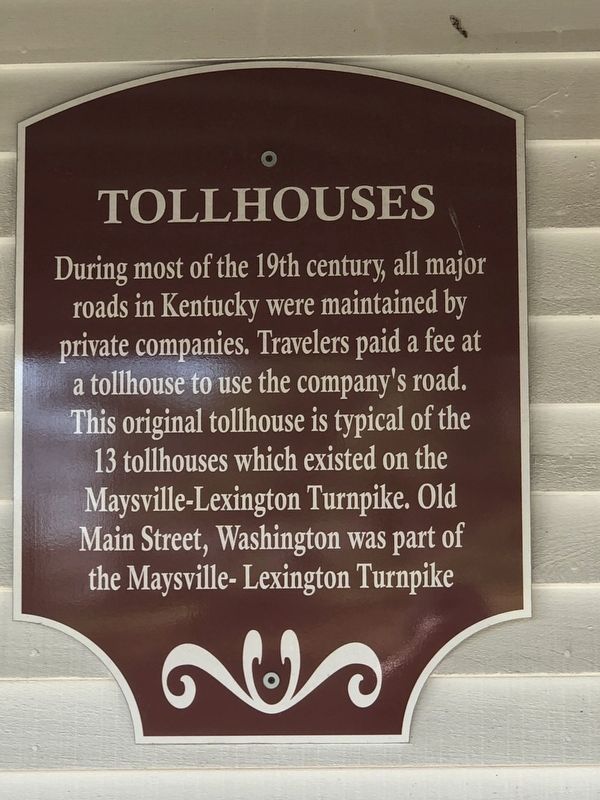
Photographed by Duane and Tracy Marsteller, March 4, 2023
1. Tollhouses Marker
Toll Schedule
One Person 2¢ • One Mule, Horse 4¢ • 10 cows 6¼¢ • 20 Sheep, Hogs 6¼¢ • Two Wheel Cart 8¢ • Four Wheel Carriage 16¢ • Stage Coach 25¢ • Work Wagon 25¢ • Funerals No Charge • Church Goers No Charge
Topics. This historical marker is listed in these topic lists: Industry & Commerce • Roads & Vehicles.
Location. 38° 36.968′ N, 83° 48.466′ W. Marker is in Maysville, Kentucky, in Mason County. It is in Old Washington. It is on Paxton Street west of Green Street, on the right when traveling west. Touch for map. Marker is at or near this postal address: 1810 Paxton St, Maysville KY 41056, United States of America. Touch for directions.

Regionally, this marker is in the Outer Bluegrass. It is also in the American
this page online
Other nearby markers. At least 8 other markers are within walking distance of this marker: Paxton Inn (within shouting distance of this marker); a different marker also named Paxton Inn (within shouting distance of this marker); Taylor's Corner (within shouting distance of this marker); Gen. Albert Sidney Johnston (within shouting distance of this marker); "Albert Sidney Johnston House" (within shouting distance of this marker); Pillsbury Boy's School (within shouting distance of this marker); "Washington Courthouse Site" (about 300 feet away, measured in a direct line); Old Church Museum (about 300 feet away). Touch for a list and map of all markers in Maysville.
Also see . . . Maysville-Lexington Turnpike. The road between Maysville and Lexington dates to prehistoric times and has been an important transportation link. It

Photographed by Duane and Tracy Marsteller, March 4, 2023
2. Toll Schedule
Marker is on the side of the building.

Photographed by Duane and Tracy Marsteller, March 4, 2023
3. Tollhouses Marker
Credits. This page was last revised on March 11, 2023. It was originally submitted on March 11, 2023, by Duane and Tracy Marsteller of Murfreesboro, Tennessee. This page has been viewed 249 times since then and 27 times this year. Photos: 1, 2, 3. submitted on March 11, 2023, by Duane and Tracy Marsteller of Murfreesboro, Tennessee.
