
Tzintzuntzan, Michoacán, Mexico — The Pacific Coast (and Central Highlands)
Substructure
Photographed by J. Makali Bruton, December 2, 2022
1. Substructure Marker

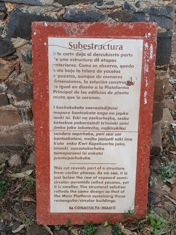
Este corte deja al descubierto parte de una estructura dè etapas anteriores. Como se observa, queda justo bajo la hilera de yácatas expuestas, aunque de menores dimensiones, la solución construct es igual en diseño a la Plataforma Principal de los edificios de planta mixta, que la coronan.
I kachukukata exerasïndijtsïni mapura kantsakata enga na japka ionki isï. Eski na exekorhejka, sesku ketsekua pakarasïndi ts'ïminki siriri jimbo jaka iakatecha, najkirukiksi sanderu sapirhaka, pari sési uni kantsakatani, majku jasïvati eski ima k'uta enka K'eri Kopekuarhu jaka, imanki uaxastakorheka tsimapurueni isï enkatsi juantsiparhukuka.
Substructure
This cut reveals part of a structure from earlier phases. As we see, it is just below the row of exposed semi- circular pyramids called yácatas, yet it is smaller. The structural solution reflects the same design as that of the Main Platform sustaining these rectangular/circular buildings.
Erected by Instituto Nacional de Antropología e Historia (INAH).
Topics. This historical marker is listed in these topic lists: Anthropology & Archaeology
this page online
Location. 19° 37.519′ N, 101° 34.357′ W. Marker is in Tzintzuntzan, Michoacán. It can be reached from Avenida Las Yácatas, on the right when traveling east. The marker is on the grounds of the Tzintzuntzan Archeological Site. Touch for map. Marker is in this post office area: Tzintzuntzan MIC 58440, Mexico. Touch for directions.

Regionally, this marker is in Western Mexico, in the Bajío, and on the Pacific Coast. Globally, it is in North America, specifically in Mesoamerica, on the Ring of Fire, in the Pacific Rim, and in the Western Hemisphere. Historically, it finds itself in what was once New Spain, a Spanish colony, and the Aztec Empire.
Other nearby markers. At least 8 other markers are within walking distance of this marker: Tzintzuntzan Archeological Zone (a few steps from this marker); Terraces and the Great Platform (within shouting distance of this marker); Petroglyphs: Messages in the Rock (within shouting distance of this marker); Las Yácatas (within shouting distance of this marker); Architecture of Farmers and Petroglyphs of Hunters (about 90

Photographed by J. Makali Bruton, December 2, 2022
2. Substructure Marker
The marker has been moved from its original location and its context lost.
Credits. This page was last revised on April 4, 2025. It was originally submitted on March 19, 2023, by J. Makali Bruton of Washington, District of Columbia. This page has been viewed 101 times since then and 7 times this year. Photos: 1, 2. submitted on March 19, 2023, by J. Makali Bruton of Washington, District of Columbia.
