Fort Davis in Jeff Davis County, Texas — The American South (West South Central)
Fort Davis
1854-1862
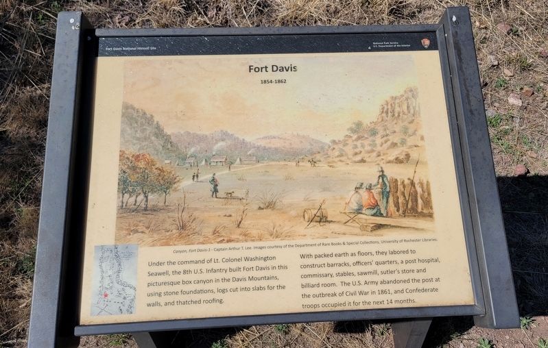
With packed earth as floors, they labored to construct barracks, officers' quarters, a post hospital, commissary, stables, sawmill, sutler's store and billiard room. The U.S. Army abandoned the post at the outbreak of Civil War in 1861, and Confederate troops occupied it for the next 14 months.
Caption
Center: Canyon, Fort Davis-1 - Captain Arthur T. Lee. Images courtesy of the Department of Rare Books & Special Collections, University of Rochester Libraries.
Erected by National Park Service - U.S. Department of the Interior.
Topics. This historical marker is listed in these topic lists: Forts and Castles • War, US Civil • Wars, US Indian. A significant historical year for this entry is 1861.
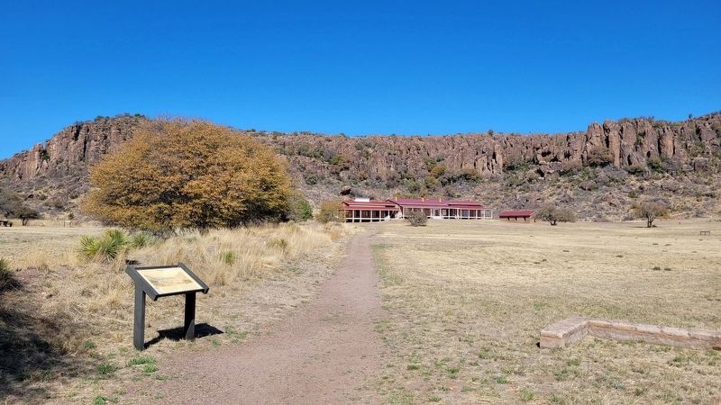
Location. 30° 35.857′ N, 103° 53.644′ W. Marker is in Fort Davis, Texas, in Jeff Davis County. Marker can be reached from the intersection of Lt. Henry Flipper Drive and State Street (State Highway 17). The marker is located in the western section of the historic Fort Davis. Touch for map. Marker is at or near this postal address: 101 Lt Henry Flipper Drive, Fort Davis TX 79734, United States of America. Touch for directions.
Other nearby markers. At least 8 other markers are within walking distance of this marker. A different marker also named Fort Davis (a few steps from this marker); Sick Call (within shouting distance of this marker); The First Fort Davis (within shouting distance of this marker); a different marker also named Fort Davis (about 300 feet away, measured in a direct line); a different marker also named Fort Davis (about 400 feet away); Commanding Officer's Quarters (about 500 feet away); a different marker also named Fort Davis (about 700 feet away); Legend - Fort Davis (approx. 0.2 miles away). Touch for a list and map of all markers in Fort Davis.
More about this marker. The fort and markers are located on the grounds of the Fort Davis National Historic Site which requires a small entrance fee to access.
Also see . . . Fort Davis: Frontier Post. National Park Service
A key post in the defense system of western Texas, Fort Davis played a major role in the history of the Southwest. From 1854 until 1891, troops stationed at the post protected emigrants, freighters, mail coaches, and travelers on the San Antonio-El Paso Road hoping to reach the gold fields of California. Today, Fort Davis is considered one of the best remaining examples of a frontier military post in the American Southwest. It is a vivid reminder of the significant role played by the military in the settlement and development of the western frontier. Named for Secretary of War Jefferson Davis, the fort was first garrisoned by Lieutenant Colonel Washington Seawell and six companies of the Eighth U.S. Infantry. The post was located in a box canyon near Limpia Creek on the eastern side of the Davis Mountains--where wood, water, and grass were plentiful. From 1854 to 1861, troops of the Eighth Infantry spent much of their time in the field pursuing Comanches, Kiowas, and Apaches.(Submitted on March 20, 2023, by James Hulse of Medina, Texas.)
Credits. This page was last revised on March 20, 2023. It was originally submitted on March 20, 2023, by James Hulse of Medina, Texas. This page has been viewed 72 times since then and 13 times this year. Photos: 1, 2. submitted on March 20, 2023, by James Hulse of Medina, Texas.

