Near Currie in Pender County, North Carolina — The American South (South Atlantic)
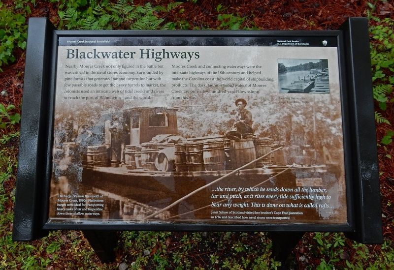
Blackwater Highways
— Moores Creek National Battlefield —
Moores Creek and connecting waterways were the interstate highways of the 18th century and helped make the Carolina coast the world capital of shipbuilding products. The dark, tannin-stained waters of Moores Creek are only a few hundred yards downslope from this site.
…the river, by which he sends down all the lumber, tar and pitch, as it rises every tide sufficiently high to bear any weight. This is done on what is called rafts… – Janet Schaw of Scotland visited her brother's Cape Fear plantation in 1776 and described bow naval stores were transported.
[Captions]
Background: The barge Bee near the mouth of Moores Creek, 1890s. Flatbottom barges were ideal for transporting heavy casks of tar and turpentine down these shallow waterways.
Inset: Loading flats on the Cape Fear River, 1800s
Erected by National Park Service.
Topics. This historical marker is listed in these topic lists: Colonial Era • Horticulture & Forestry • Industry & Commerce • Waterways & Vessels. A significant historical year for this entry is 1890.
Location. 34° 27.417′ N, 78° 6.55′ W. Marker is near Currie, North Carolina, in Pender County. Marker can be reached from Moores Creek Drive, ¼ mile west of North Carolina Route 210. Marker is on the Tarheel Trail in Moores Creek National Battlefield. Touch for map. Marker is in this post office area: Currie NC 28435, United States of America. Touch for directions.
Other nearby markers. At least 8 other markers are within walking distance of this marker. Trees for a Navy (within shouting distance of this marker); Boxing the Pines (within shouting distance of this marker); Tarheel Trail (within shouting distance of this marker); Women's Monument (about 300 feet away, measured in a direct line); We Women Have...To Let Our Voices Be Heard (about 300 feet away); Vanishing Longleafs (about 300 feet away); Tar Kiln (about 400 feet away); Moores Creek National Battlefield (about 400 feet away). Touch for a list and map of all markers in Currie.
Credits. This page was last revised on June 19, 2023. It was originally submitted on March 21, 2023, by Duane and Tracy Marsteller of Murfreesboro, Tennessee. This page has been viewed 67 times since then and 5 times this year. Photos: 1. submitted on March 21, 2023, by Duane and Tracy Marsteller of Murfreesboro, Tennessee. 2. submitted on June 19, 2023, by Dave W of Co, Colorado.

