Fort Davis in Jeff Davis County, Texas — The American South (West South Central)
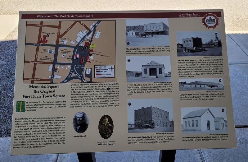
Memorial Square
The Original Fort Davis Town Square
— Welcome to The Fort Davis Town Square —
Daniel Murphy was an Irish immigrant who saw service in Mexico during the Mexican War. He lived in San Antonio before coming to Fort Davis in 1855. After the Civil War Murphy built a combined residence, hotel, and general store due south of the fort, where Dirks-Anderson Elementary School is now located. In 1878 Murphy donated a tract of land east of his store to the Catholic Diocese of San Antonio as the site for a church. He hoped that the town would grow around a plaza between the church and his store, in the manner of San Antonio and other Spanish-Mexican towns in the Southwest, and that his store would be in the center of town.
Whittaker Keesey was an Ohioan who came here with the army in 1869. Shortly after his arrival he built a store a half-mile south of Murphy's. That building A is now the Jeff Davis County Library. In 1880, Keesey donated an acre west of his store for a courthouse for newly-organized Presidio County, gambling that the town would grow around the courthouse following the Midwestern model. Keesey's bet paid off. Fort Davis grew around the courthouse rather than the Catholic church, and Keesey's store occupied the most prominent site in town, right on the square.
Captions
Daniel Murphy
Whittaker Keesey
Photos from the Mildred Bloys Nored Photo Archives
1. The Limpia Hotel was constructed east of the courthouse in 1912 to accommodate Fort Davis's increasing number of automobile tourists.
2. In 1909 Harold L. King and E.H. Carlton erected a stamped metal building on the square to serve as Fort Davis's first auto garage and dealership. Keesey Miller bought the building in 1924 and added the concrete façade.
3. The Fort Davis State Bank was built in 1913 in conjunction with the International Order of Odd Fellows Lodge No. 329, which occupied the second floor.
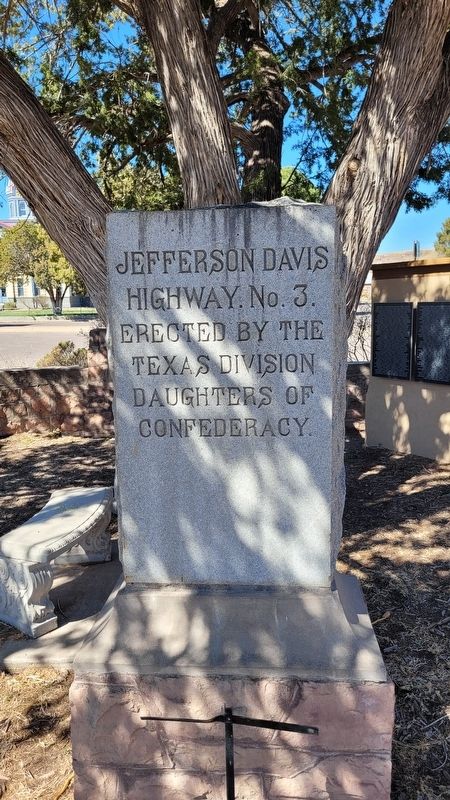
4. Park in Town Square In 1931 a granite marker for the Jefferson Davis Highway was placed in a small park in the center of the square by the United Daughters of the Confederacy, even though Fort Davis was not on the route of the Jefferson Davis Highway (present day U.S. 90). Several generations of Fort Davis children have grown up believing that Jefferson Davis is buried there, rather than in Richmond, Virginia.
5. Lempert Hotel William S. Lempert built a hotel northwest of the courthouse in 1883 and laid out a residential subdivision north of it that same year.
6. The Methodist Church was built south of the courthouse in 1884 on land donated by Whittaker Keesey.
Photos from the Mildred Bloys Nored Photo Archives
Erected by The Jeff Davis County Historical Commission.
Topics. This historical marker is listed in these topic lists: Churches & Religion • Forts and Castles • Hispanic Americans • Industry & Commerce. A significant historical year for this entry is 1855.
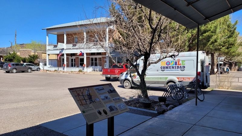
Location. 30° 35.323′ N, 103° 53.625′ W. Marker is in Fort Davis, Texas, in Jeff Davis County. Marker is at the intersection of Limpia Street and Court Avenue on Limpia Street. The marker is located at the entrance to the Jeff Davis County Library. Touch for map. Marker is at or near this postal address: 100 Memorial Square, Fort Davis TX 79734, United States of America. Touch for directions.
Other nearby markers. At least 8 other markers are within walking distance of this marker. Jeff Davis County Library (here, next to this marker); Union Mercantile (a few steps from this marker); Hotel Limpia (within shouting distance of this marker); Hometown Heroes (within shouting distance of this marker); Old Fort Davis CSA (about 300 feet away, measured in a direct line); T/SGT. Manuel S. Gonzales (about 300 feet away); Confederate President Jefferson Davis (about 400 feet away); Jeff Davis County Courthouse (about 500 feet away). Touch for a list and map of all markers in Fort Davis.
Credits. This page was last revised on March 22, 2023. It was originally submitted on March 22, 2023, by James Hulse of Medina, Texas. This page has been viewed 104 times since then and 32 times this year. Photos: 1, 2, 3. submitted on March 22, 2023, by James Hulse of Medina, Texas.


