Dover in Stewart County, Tennessee — The American South (East South Central)
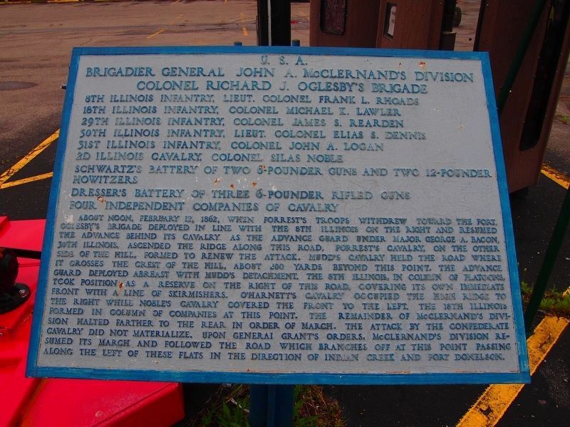
Brigadier General John A. McClernand’s Division
Photographed by Darryl R Smith
1. Brigadier General John A. McClernand’s Division Marker
U. S. A.
Brigadier General John A. McClernand’s Division
Colonel Richard J. Oglesby’s Brigade
8th Illinois Infantry, lieut. Colonel Frank L. Rhoads
18th Illinois Infantry, Colonel Michael K. Lawler
29th Illinois Infantry, Colonel James S. Rearden
30th Illinois Infantry, Lieut. Colonel Elias S. Dennis
31st Illinois Infantry, Colonel John A. Logan
2d Illinois Cavalry, Colonel Silas Noble
Schwartz’s Battery of two 6-pounder and two 12-pounder howitzers
Dresser’s Battery of three 6-pounder rifled guns
Four independent companies of cavalry
About Noon, February 12, 1862, when Forrest’s troops withdrew toward the fort, Oglesby’s Brigade deployed in line with the 8th Illinois on the right and resumed the advance behind the cavalry. As the advanced guard under Major George A. Bacon, 30th Illinois, ascended the ridge along this road, Forrest’s cavalry, on the other side of the hill, formed to renew the attack. Mudd’s cavalry held the road where it crosses the crest of the hill, about 200 yards beyond this point. The advance guard deployed abreast with Mudd’s detachment. The 8th Illinois, in column of platoons, took
this page online
Topics. This historical marker is listed in this topic list: War, US Civil. A significant historical date for this entry is February 12, 1862.
Location. 36° 28.863′ N, 87° 52.998′ W. Marker is in Dover, Tennessee, in Stewart County. It is on Donelson Parkway (Tennessee Route 76) 0.3 miles east of The Trace Road ( Route 49), on the right when traveling east. Touch for map. Marker is at or near this postal address: 1322 Donelson Pkwy, Dover TN 37058, United States of America. Touch for directions.

Regionally, this marker

Photographed by Darryl R Smith, 2018
2. Brigadier General John A. McClernand’s Division Marker
Other nearby markers. At least 8 other markers are within 2 miles of this marker, measured as the crow flies: U.S.A. Headquarters of Brigadier General U.S. Grant (approx. 0.3 miles away); Brigadier General Charles F. Smith’s Division (approx. 0.9 miles away); The Stewart County Iron Industry (approx. 0.9 miles away); Lauman's Brigade (approx. 1.1 miles away); Union Camp (approx. 1.1 miles away); Porter's Battery (approx. 1.1 miles away); 6-pounder Gun (approx. 1.1 miles away); Seizing the Initiative (approx. 1.1 miles away). Touch for a list and map of all markers in Dover.
Other markers no longer nearby. Forrest's Attack (was approx. 0.9 miles away but has been permanently removed); Holding The Line (was approx. 0.9 miles away but has been permanently removed); Morrison's Attack (was approx. 0.9 miles away but has been permanently removed); Battle of Dover (was approx. 0.9 miles away but has been permanently removed); Forrest's Escape (was approx. 0.9 miles away but has been permanently removed).
Credits. This page was last revised on March 26, 2023. It was originally submitted on March 26, 2023, by Darryl R Smith of Cincinnati, Ohio. This page has been viewed 235 times since then and 37 times this year. Photos: 1, 2. submitted on March 26, 2023, by Darryl R Smith of Cincinnati, Ohio. • Bernard Fisher was the editor who published this page.
