Near Stafford in Stafford County, Virginia — The American South (Mid-Atlantic)
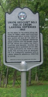
Union Redoubt No. 3
Aquia Creek Landing Defenses, 1863
On the ridge to the north stood the third of three large fortifications or redoubts built during February and March of 1863 by the Army of the Potomac. This redoubt protected Aquia Landing and the nearby camps of the Union 12th Corps. The fortification was square-shaped and designed for a garrison of 100 men. It was supported by four 3-inch guns. The actual site of redoubt No. 3 is currently marked with a large granite memorial erected in 2005.
Erected 2006 by FSCWS, SYG Associates Inc.
Topics. This historical marker is listed in these topic lists: Military • War, US Civil. A significant historical month for this entry is March 1863.
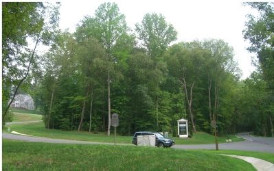
Location. 38° 22.423′ N, 77° 20.227′ W. Marker is near Stafford, Virginia, in Stafford County. Marker is at the intersection of Brooke Road (County Route 608) and Sentinel Ridge Road, on the left when traveling east on Brooke Road. Touch for map. Marker is at or near this postal address: 23 Sentinel Ridge Ln, Stafford VA 22554, United States of America. Touch for directions.
Other nearby markers. At least 8 other markers are within one mile of this marker, measured as the crow flies. Union Redoubt # 3 (approx. ¼ mile away); John Smith Explores the Chesapeake (approx. 0.3 miles away); Crow's Nest Natural Area Preserve / Virginia’s State Natural Area Preserves (approx. 0.3 miles away); Crow's Nest (approx. 0.4 miles away); Union XIIth Corps Winter Camp (approx. 0.9 miles away); Redoubt # 2 (approx. one mile away); Mason's Homestead (approx. 1.1 miles away); Aquia Landing (approx. 1.1 miles away). Touch for a list and map of all markers in Stafford.
Also see . . . Union Redoubt # 3. Link takes you to the marker for the actual site of redoubt No. 3. (Submitted on August 31, 2007, by Kevin W. of Stafford, Virginia.)
Credits. This page was last revised on April 21, 2024. It was originally submitted on August 28, 2007, by Kevin W. of Stafford, Virginia. This page has been viewed 1,656 times since then and 19 times this year. Photos: 1, 2. submitted on August 28, 2007, by Kevin W. of Stafford, Virginia. • J. J. Prats was the editor who published this page.

