Big Bend National Park in Brewster County, Texas — The American South (West South Central)
Grand Canyon Farms
Big Bend National Park
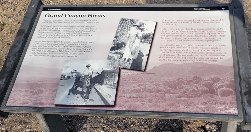
Sublett is recognized for introducing mechanized farming into the Big Bend. In 1914 the Subletts moved into the Alvino house in Castolon, cleared much of the land, and installed the area's first irrigation system supplied by a water wheel. Sublett hired Mexican laborers to plant the new fields with sorghum, corn, alfalfa, and other livestock feed crops.
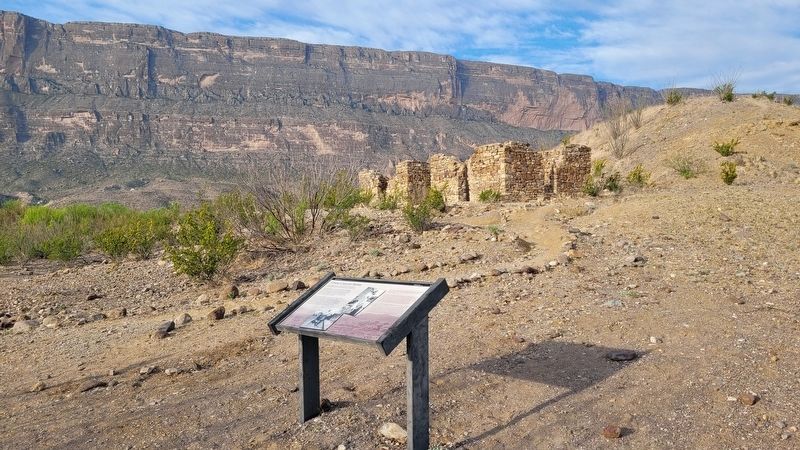
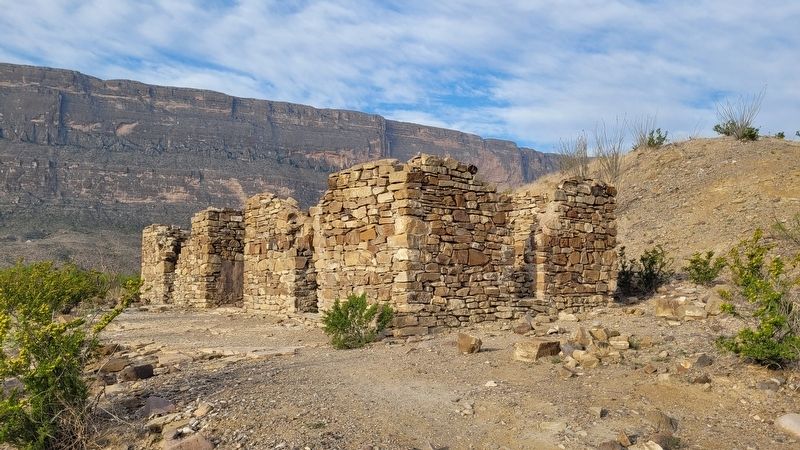
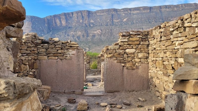
By 1918, with a growing farm business in place, Sublett purchased 2,560 acres in this area and called it Grand Canyon Farms. He built a large adobe house on top of the hill to the southeast, and a smaller house below, known today as La Casita (follow the trail to see these other ruins). While little remains of the Subletts' adobe house, their stone farmhouse and La Casita survive, and have received historic preservation treatments.
Captions
Belle Sublett after a good day of fishing along the Rio Grande
James L. Sublett in Alpine, Texas
Spanish:
Se le reconoce para introducir la agricultura mecanizada en Big Bend. En 1914, los Sublett se mudaron dentro de la casa Alvino en Castolón, desmontaron el terreno e instalaron el primer sistema de riego suministrado por una rueda hidráulica. Sublett contrató labradores mexicanos para sembrar los terrenos nuevos con sorgo, maíz, alfafa y otros cultivos alimenticios para ganado.
En 1918, Sublett compró 1,036 hectáreas en esta área y las llamó el Grand Canyon Farms. Sublett construyó una casa grande de adobe sobre la colina al sudeste, y abajo, una casa pequeña conocida actualmente como La Casita (sigue el sendero para ver las otras ruinas). Mientras queda muy poco de la casa de adobe de los Sublett, su casa de piedra y La Casita permanecen y han recibido los tratamientos para su preservación histórica.
Subtítulos
Belle Sublett después de un buen día de pescar en el río Bravo
James L. Sublett en Alpine, Texas
Erected by National Park Service - U.S. Department of the Interior.
Topics. This historical marker is listed in these topic lists: Animals • Hispanic Americans • Settlements & Settlers. A significant historical year for this entry is 1913.
Location.
29° 9.271′ N, 103° 34.789′ W. Marker is in Big Bend National Park, Texas, in Brewster County. Marker is on Santa Elena Canyon Road, 2.3 miles east of Santa Elena Canyon Overlook Drive, on the right when traveling west. The marker is located at the start of the Dorgan-Sublett Trail which is just north of the road pullout. Touch for map. Marker is in this post office area: Big Bend National Park TX 79834, United States of America. Touch for directions.
Other nearby markers. At least 8 other markers are within 5 miles of this marker, measured as the crow flies. Into the Canyon! (approx. 2.1 miles away); Terlingua Abaja (approx. 3.3 miles away); La Harmonia Store (approx. 3½ miles away); Floodplain Panorama (approx. 4.2 miles away); Cavalry Post to Trading Post (approx. 4.2 miles away); Garlick House (approx. 4.2 miles away); Cotton Boom in Castolon (approx. 4.2 miles away); Magdalena's House (approx. 4.2 miles away). Touch for a list and map of all markers in Big Bend National Park.
More about this marker. The marker is located on the grounds of the Big Bend National Park which requires an entrance fee to access.
Also see . . . History of the Castolon Area. National Park Service
In the early 1900s, people began to live and farm along the banks of the Rio Grande, downstream from Santa Elena Canyon. The fields were fertile and the community grew. Farmers in the area raised corn, beans, wheat, squash, tomatoes, and melons. In 1901, Cipriano Hernandez started the first store in the area and sold goods to his neighbors and to the mining community in Terlingua. He operated the store out of his home, which is today known as the Alvino House (named for Alvino Ybarra who lived there with his family from 1918 to 1957).(Submitted on March 29, 2023, by James Hulse of Medina, Texas.)
Credits. This page was last revised on March 29, 2023. It was originally submitted on March 28, 2023, by James Hulse of Medina, Texas. This page has been viewed 84 times since then and 16 times this year. Photos: 1, 2, 3, 4. submitted on March 29, 2023, by James Hulse of Medina, Texas.


